Information
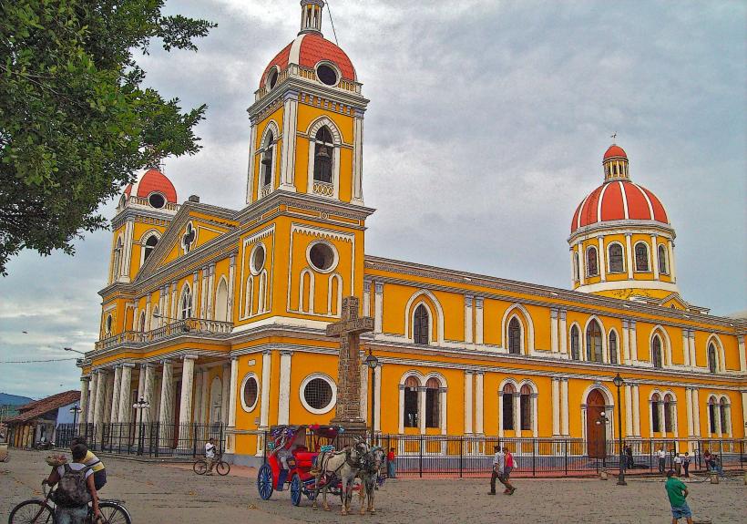
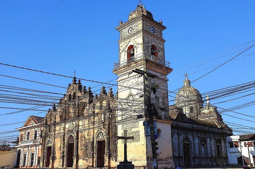
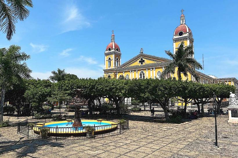
Landmark: Mombacho VolcanoCity: Granada City
Country: Nicaragua
Continent: North America
Mombacho Volcano, Granada City, Nicaragua, North America
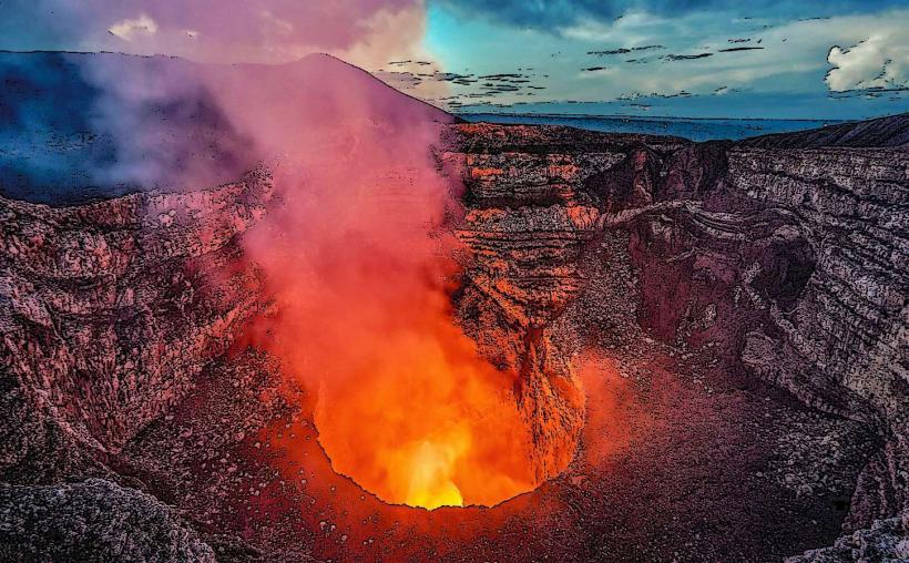
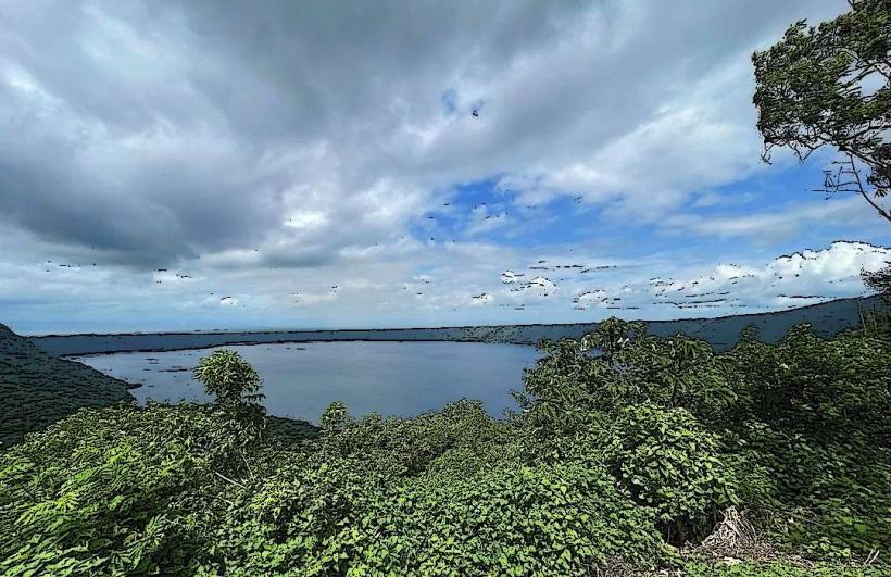
Mombacho Volcano is a stratovolcano located south of Granada City, Nicaragua. It is part of the Central American Volcanic Arc.
Visual Characteristics
The volcano's slopes are covered in dense cloud forest vegetation. The summit features three distinct craters, two of which are extinct and filled with vegetation, while the third, Las Pichardas, is active and emits fumaroles. The elevation reaches 1,344 meters (4,409 feet).
Location & Access Logistics
Mombacho Volcano is situated approximately 10 kilometers (6.2 miles) south of Granada City. Access is via a paved road leading to the Mombacho Volcano National Park entrance. From the entrance, a 4x4 shuttle service is required to reach the summit parking area due to steep gradients. Public transport does not reach the summit; buses to Granada City are available from Managua. Parking is available at the park entrance.
Historical & Ecological Origin
Mombacho Volcano is a stratovolcano formed by volcanic activity over thousands of years. Its last significant eruption occurred approximately 2,000 years ago. The surrounding cloud forest is an ecosystem characterized by high humidity and frequent mist, supporting a unique biodiversity.
Key Highlights & Activities
Hiking trails are available, including the "Crater Trail" (1.5 km loop) and the "Las Palmas Trail" (1.3 km loop). Guided tours of the fumaroles are offered. Ziplining tours operate from the summit area. Birdwatching is a common activity due to the diverse avian population.
Infrastructure & Amenities
Restrooms are available at the park entrance and at the summit visitor center. Limited shade is present on the hiking trails. Cell phone signal (4G) is generally available at the summit. Food vendors are located at the park entrance; no vendors are present at the summit.
Best Time to Visit
The best time of day for photography is generally between 9:00 AM and 11:00 AM for clearer views before cloud cover typically increases. The dry season, from December to April, offers the most consistent weather. High humidity is present year-round.
Facts & Legends
Local legend suggests that the volcano is home to spirits that protect the forest. A specific geological feature is the presence of "El Crater El Tigre," a smaller, extinct crater on the volcano's flank.
Nearby Landmarks
- Granada City Center (10km North)
- Lake Nicaragua (5km East)
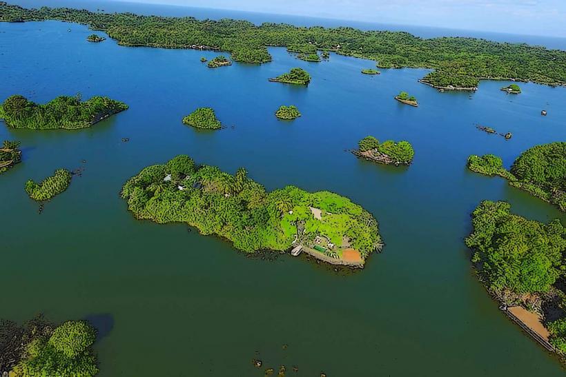
- Isletas de Granada (7km Northeast)
- Apoyo Lagoon (15km West)