Information
Landmark: Phu Ruea National ParkCity: Loei
Country: Thailand
Continent: Asia
Phu Ruea National Park, Loei, Thailand, Asia
Phu Ruea National Park is a protected area located in the Loei Province of Thailand. It is characterized by its mountainous terrain and diverse flora.
Visual Characteristics
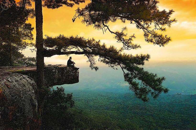
The park features a central peak, Phu Ruea, reaching an elevation of 1,316 meters. The landscape is dominated by mixed deciduous forests and pine plantations. Rock formations are present, particularly on the summit. During cooler months, morning mist is common.
Location & Access Logistics
Phu Ruea National Park is situated approximately 50 kilometers west of Loei City. Access is via Highway 203 (Loei-Phu Ruea Road). The park entrance is clearly marked. Parking is available at designated areas near the visitor center. Public transport options include local buses traveling between Loei and Phu Ruea town, with a short onward taxi or songthaew ride to the park entrance.
Historical & Ecological Origin
Phu Ruea National Park was established as a protected area in 1979. Ecologically, it is part of the Phetchabun mountain range, characterized by its montane evergreen and dry dipterocarp forest ecosystems. The area serves as a watershed for local rivers.
Key Highlights & Activities
Hiking trails are available, including a path to the summit of Phu Ruea. Observation points offer panoramic views. Photography of the landscape and flora is a primary activity. During the cool season (November-February), visitors can experience cooler temperatures and potential frost.
Infrastructure & Amenities
A visitor center provides information. Restrooms are located near the visitor center and at key points within the park. Limited shade is available along trails. Cell phone signal (2G/3G) is intermittent within the park. Food vendors are typically found near the park entrance and in Phu Ruea town.
Best Time to Visit
The best time for clear views and cooler temperatures is during the dry season, from November to February. Mornings between 6:00 AM and 8:00 AM offer optimal lighting for photography, especially when mist is present. The rainy season (June-October) can make trails slippery.
Facts & Legends
A notable feature is the "Hin Dat Fa," a large rock overhang on Phu Ruea's summit that provides shelter. Local folklore suggests that the mountain's name, "Phu Ruea," meaning "boat mountain," derives from its shape resembling an overturned boat.
Nearby Landmarks
- Phu Kradueng National Park (35km Southwest)
- Wat Phra That Si Song Rak (40km East)
- Chiang Khan Walking Street (65km Northeast)
- Namtok Tat Ton National Park (70km Southeast)