Information
Landmark: Pic de ComapedrosaCity: La Massana
Country: Andorra
Continent: Europe
Pic de Comapedrosa, La Massana, Andorra, Europe
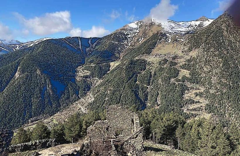
Pic de Comapedrosa is the highest mountain in Andorra, reaching an elevation of 2,942 meters. It is located in the northwest of the country within the La Massana parish, situated near the borders of both France and Spain.
Visual Characteristics
The mountain is a massive pyramid of dark Paleozoic slate and schist. The lower slopes are covered in dense forests of Scots pine and silver fir, transitioning into alpine meadows and eventually bare, jagged rock and scree fields near the summit. Several glacial tarns, including the Estany Negre, sit in the rocky hollows beneath the peak, characterized by their deep black and blue coloration.
Location & Access Logistics
Access begins in the village of Arinsal, approximately 5km from the center of La Massana. The primary trailhead starts at the Prats de la Ribera, following the GR-11 long-distance trail. It is a strenuous hike with a vertical gain of nearly 1,400 meters. Public transport is available via the L5 bus line from Andorra la Vella to Arinsal; from the final stop, hikers must proceed on foot.
Historical & Ecological Origin
The peak was formed during the Hercynian orogeny and subsequently shaped by Quaternary glacial activity. It is the centerpiece of the Comapedrosa Highland Nature Park, a protected area established in 2003 to preserve its high-mountain biodiversity. The ecology includes rare species such as the Pyrenean rock lizard and various birds of prey like the bearded vulture.
Key Highlights & Activities
The primary activity is high-altitude mountaineering and trekking. A popular route involves staying at the Comapedrosa Refugi before the final summit push. Scrambling is required on the final ridge. During the winter, the peak is a destination for technical ski mountaineering, while the Estany Negre provides a site for high-altitude scuba diving under ice.
Infrastructure & Amenities
The Comapedrosa Refugi at 2,265 meters provides the only significant infrastructure, offering food, water, and dormitory beds during the summer season. There is a small unmanned emergency shelter (Refugi de l'Estany Negre) higher up. Cell phone signal (4G) is intermittent on the ascent but generally available at the summit. There are no restrooms or vendors outside of the managed mountain huts.
Best Time to Visit
The climbing season runs from late June to September when the terrain is mostly free of snow. Photography is best at sunrise from the summit, providing 360-degree views of the Pyrenean range. In winter and spring, crampons and ice axes are mandatory due to steep snow slopes and ice on the final ridges.
Facts & Legends
Despite its height, the first recorded scientific ascent did not occur until 1858 by a Spanish commission. A local legend describes the mountain as the "Roof of the Pyrenees" where ancient giants were said to rest, while modern hikers often look for the "Comapedrosa heart," a natural rock formation near the peak that resembles a heart shape when viewed from certain angles.
Nearby Landmarks
Estany Negre – 0.8km South
Comapedrosa Refugi – 1.4km Southeast
Pic de Baiau – 0.6km West
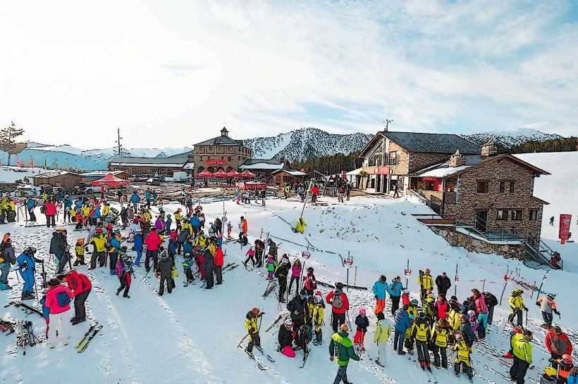
Arinsal Ski Resort – 3.5km East
Port de Baiau – 0.5km West