Information
Landmark: Port of ColónCity: Colon
Country: Panama
Continent: North America
Port of Colón, Colon, Panama, North America
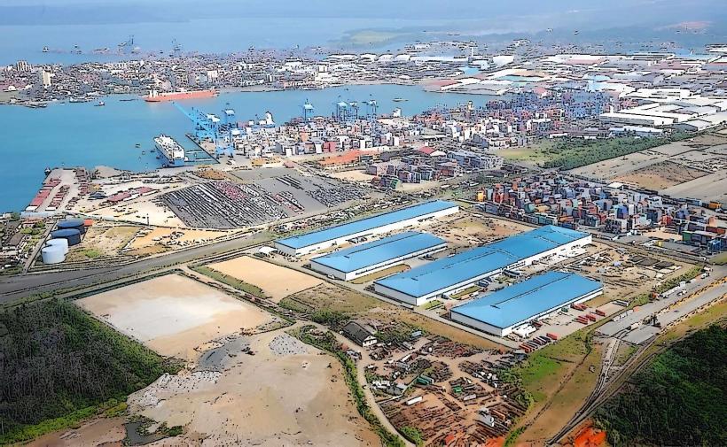
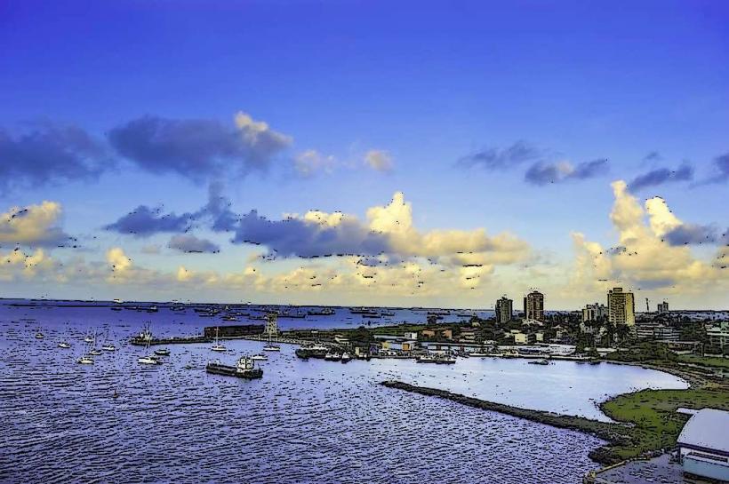
The Port of Colón is a major maritime and logistics hub situated at the Atlantic entrance of the Panama Canal in Colón, Panama.
Visual Characteristics
The port area comprises extensive concrete docks, large warehouses constructed from corrugated metal and concrete, and numerous shipping containers stacked in organized arrays. Cranes of varying sizes, predominantly painted in industrial yellow and red, dominate the skyline. The water within the port is typically a murky grey-brown due to sediment and vessel activity. Surrounding the immediate port facilities are industrial buildings and administrative offices, generally constructed from concrete and steel with flat roofs.
Location & Access Logistics
The Port of Colón is located at the northern end of Colón City, directly adjacent to the Atlantic terminus of the Panama Canal. Access is primarily via Avenida Roosevelt (also known as Highway 9) which connects to the Pan-American Highway. From Panama City, the distance is approximately 80 kilometers east. Vehicle access is restricted to authorized personnel and commercial traffic; visitor access requires pre-arranged permits. Public transportation to Colón City is available via bus from Panama City (e.g., Metro Bus lines). Within Colón City, local taxis can reach the port vicinity, but direct entry into operational areas is controlled.
Historical & Ecological Origin
The development of the Port of Colón is intrinsically linked to the construction and operation of the Panama Canal, which began in 1904. The port's expansion and modernization have occurred in phases since the early 20th century to support canal traffic and international trade. Its location is on a coastal plain that was historically mangrove swamp and shallow bay, now largely reclaimed and engineered for industrial use.
Key Highlights & Activities
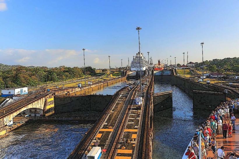
Observation of large-scale cargo operations, including container loading and unloading. Viewing of diverse international shipping vessels. Access to the Panama Canal's Atlantic Locks (Miraflores Locks are on the Pacific side, Gatun Locks are on the Atlantic side) for observing ship transits. Limited visitor access to specific viewing platforms may be available through organized tours, subject to port authority approval.
Infrastructure & Amenities
The port infrastructure includes extensive dockage, specialized cargo handling equipment, warehousing facilities, and administrative buildings. Basic restroom facilities are available within administrative areas for authorized personnel. Cell phone signal (4G/5G) is generally available within the port complex. Food vendors are typically located in designated areas outside the immediate operational zones, primarily serving port workers.
Best Time to Visit
For observing ship movements and crane operations, daytime hours (08:00 to 17:00) offer the most activity. Specific times for observing Gatun Locks operations can be checked with the Panama Canal Authority. Weather is generally hot and humid year-round; the dry season (December to April) offers slightly less rainfall, improving visibility and comfort.
Facts & Legends
The port's strategic position at the Atlantic entrance of the Panama Canal has made it a critical node in global trade for over a century. A notable historical oddity is the port's role in the economic development of Colón City, which was largely built to support the canal and its associated maritime activities.
Nearby Landmarks
- Gatun Locks (10km Southwest)
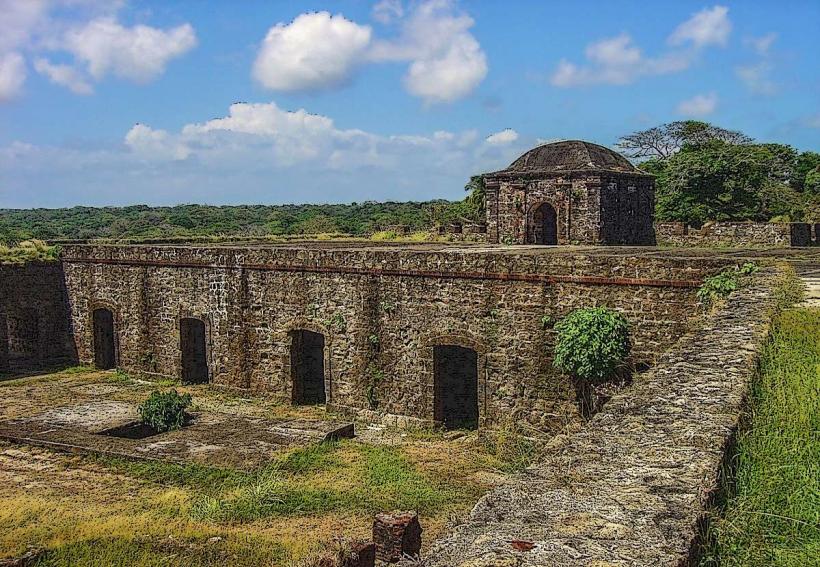
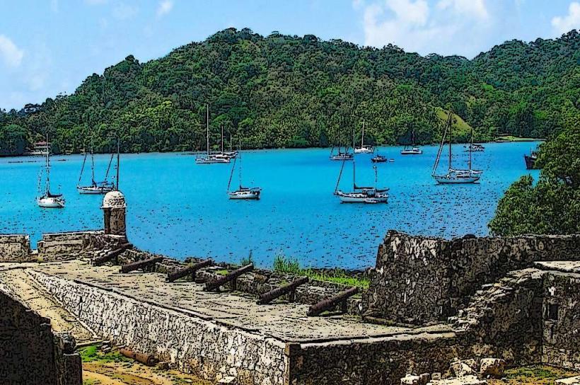
- Fort San Lorenzo (15km Northwest)
- Isla Colón (part of Bocas del Toro archipelago, accessible via ferry/flight, significantly further)
- Colon-free-trade-zone_colon" class="underline">Colón Free Trade Zone (1km South)
- Panama Canal Museum (Colón City) (2km South)