Information
Landmark: Reinebringen MountainCity: Reine
Country: Iceland
Continent: Europe
Reinebringen Mountain, Reine, Iceland, Europe
Visual Characteristics
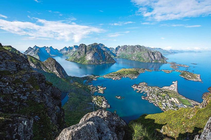
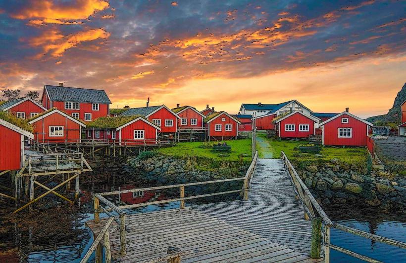
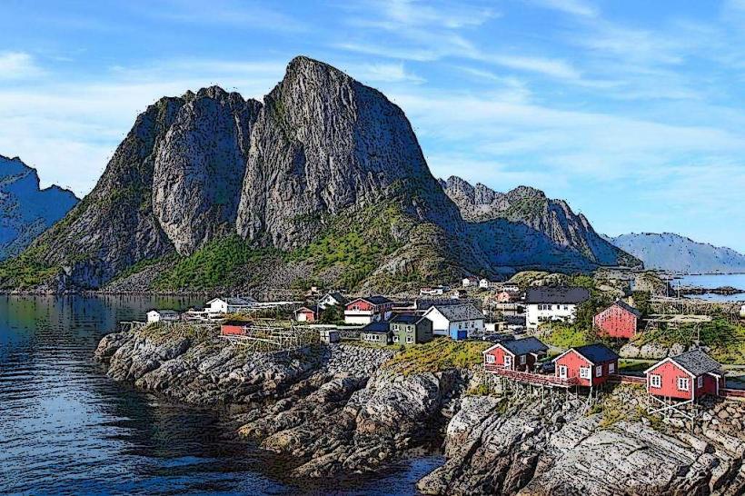
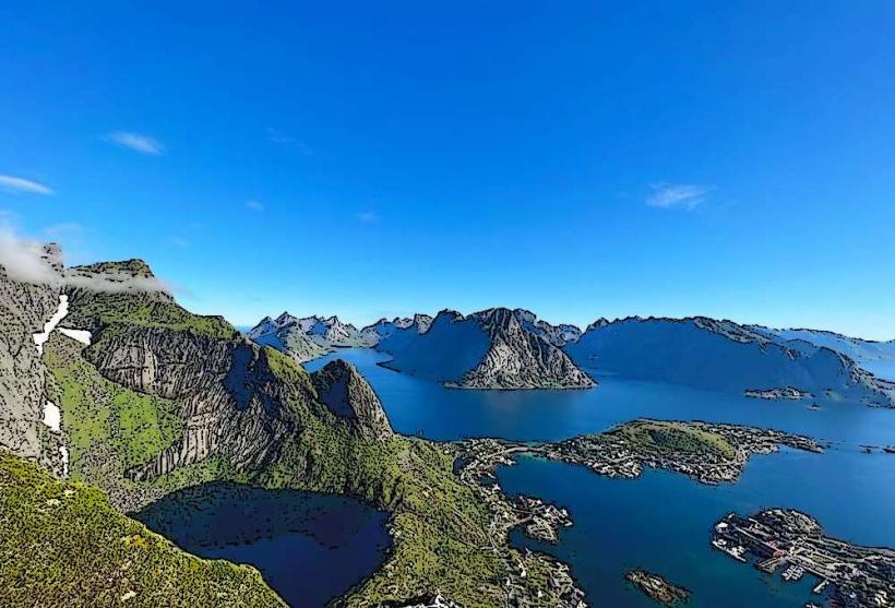
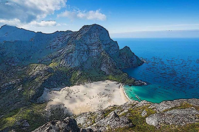
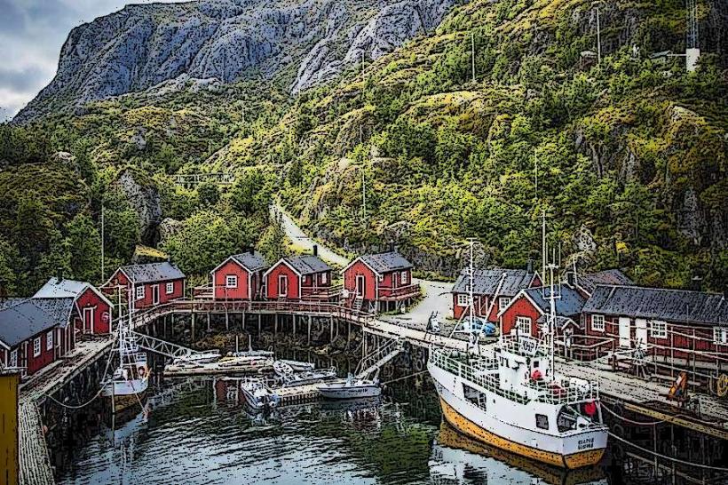
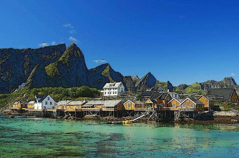
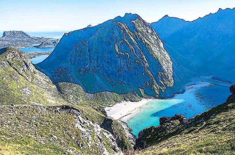
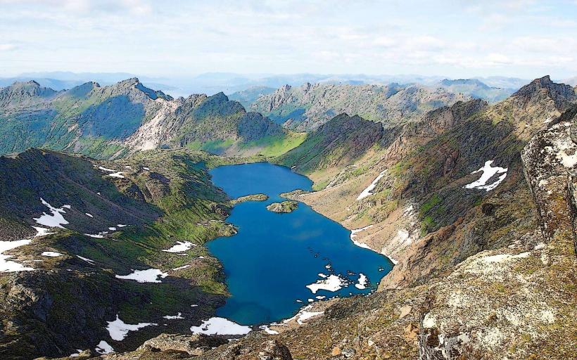
Reinebringen is characterized by its steep, rocky slopes and an elevation of 448 meters above sea level. The summit provides expansive vistas of the surrounding fjords, numerous islands, and the red fishing huts (rorbuer) of Reine village. The mountain's geology consists primarily of ancient granite and gneiss bedrock, with sparse alpine vegetation clinging to the rock faces.
Location & Access Logistics
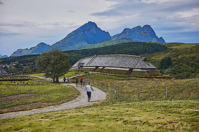
The trailhead for Reinebringen is located directly west of the village of Reine, accessible from European Route E10. From the center of Reine, the trailhead is approximately 0.5 kilometers west. Parking is limited near the trailhead; visitors typically park in designated areas within Reine village and walk to the starting point. Public transport options include local bus services that operate along E10 and stop in Reine, but no direct bus service reaches the trailhead itself.
Historical & Ecological Origin
Reinebringen is part of the ancient mountain range forming the Lofoten archipelago, which originated from geological processes over hundreds of millions of years. The bedrock is predominantly Precambrian granite and gneiss, shaped by glacial erosion during successive ice ages. The mountain's formation is a result of tectonic uplift and subsequent weathering, characteristic of the Norwegian coastal landscape.
Key Highlights & Activities
The primary activity is hiking the stone-stepped trail, known as the Sherpatrappa, to the summit of Reinebringen. This ascent offers opportunities for panoramic photography of the Lofoten landscape, including the villages of Reine, Hamnøy, and Sakrisøy, as well as the surrounding fjords and islands. The trail is steep and requires a moderate to high level of physical fitness.
Infrastructure & Amenities
There are no dedicated restrooms or shelter facilities directly on the Reinebringen trail. Shade is minimal, particularly during midday. Cell phone signal (4G/5G) is generally available at the summit and along significant portions of the ascent. Food vendors and restaurants are located in the nearby village of Reine, approximately 0.5 kilometers from the trailhead.
Best Time to Visit
The optimal period for visiting Reinebringen is during the summer months, from June to August, when the trail is typically free of snow and ice, and daylight hours are extended. For photography, early morning or late evening hours provide softer light and longer shadows, enhancing the landscape's contours. The trail should be avoided during wet conditions due to slippery surfaces, and during winter due to snow and ice accumulation.
Facts & Legends
The ascent to Reinebringen was historically challenging and prone to erosion. To improve safety and accessibility, a stone staircase, known as the Sherpatrappa, was constructed by skilled Nepalese Sherpas between 2016 and 2021. This project transformed the hike into a more manageable and sustainable experience, significantly reducing environmental impact from foot traffic.
Nearby Landmarks
- Reine village: 0.5km East
- Sakrisøy: 1.5km West
- Hamnøy: 3km East
- Å i Lofoten: 5km West
- Kirkefjord: 2km South