Information
Landmark: Royal MileCity: Edinburgh
Country: United Kingdom
Continent: Europe
Royal Mile, Edinburgh, United Kingdom, Europe
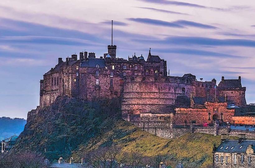
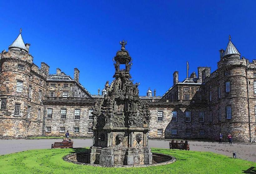
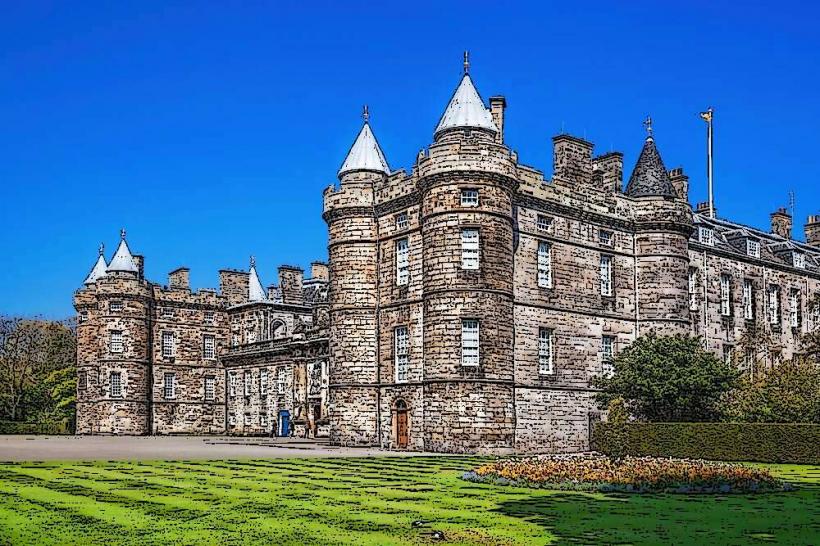
The Royal Mile is a succession of thoroughfares forming the primary artery of the Old Town in Edinburgh, Scotland. It connects Edinburgh Castle at the western summit of the volcanic ridge to the Palace of Holyroodhouse at the eastern base.
Visual Characteristics
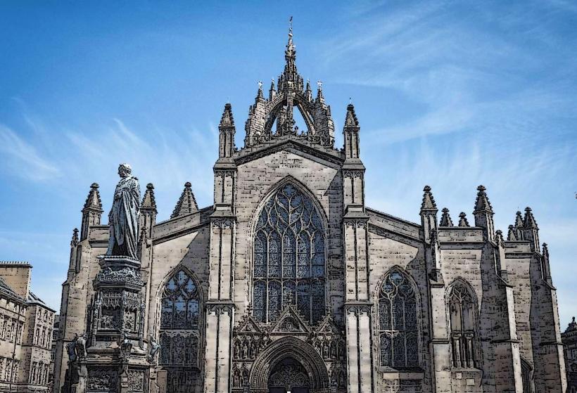
The route is characterized by high-density, multi-story tenements built of grey sandstone, many dating from the 16th and 17th centuries. The primary roadway is paved with granite setts (cobblestones). The visual profile is defined by narrow, steep alleyways known as "closes" and "wynds" that branch off the main street, and the prominent open-work spire of St Giles' Cathedral.
Location & Access Logistics
The Royal Mile is approximately 1.8km (one Scots mile) in length. It consists of five consecutive streets: Castlehill, the Lawnmarket, the High Street, the Canongate, and Abbey Strand. It is within 0.3km of Edinburgh Waverley railway station. Numerous bus routes intersect the Mile at North Bridge and George IV Bridge. Vehicular access is restricted in several zones to prioritize pedestrian traffic, particularly during the festival season.
Historical & Ecological Origin
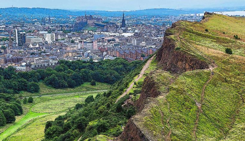
The thoroughfare developed along a glacial "crag and tail" formation created during the last Ice Age. It became the administrative and commercial heart of Scotland in the 12th century under King David I. The architecture reflects the historical need for residents to build upward within the safety of the city walls, resulting in some of the world's earliest high-rise residential structures.
Key Highlights & Activities
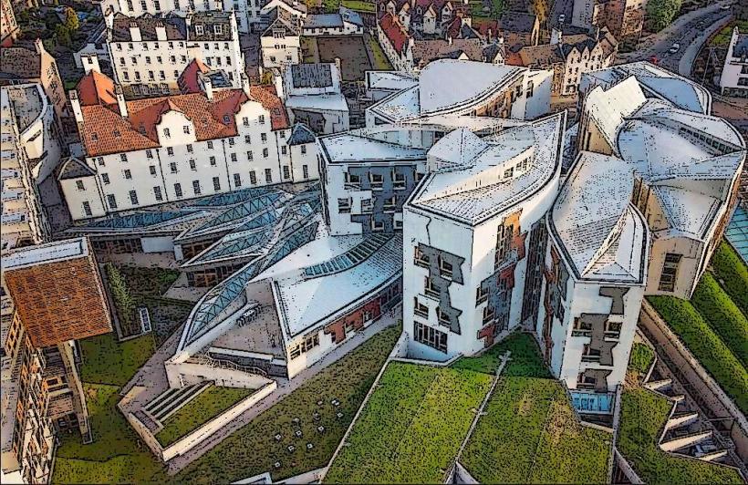
The route contains a high concentration of historical landmarks, including the Scottish Parliament Building, John Knox House, and the Museum of Edinburgh. It serves as the primary performance hub for the Edinburgh Festival Fringe in August. Retail activity is dominated by vendors of Scottish textiles, whiskies, and traditional crafts.
Infrastructure & Amenities
Public restrooms are located at High Street and near the Scottish Parliament. The area is a high-density 5G cellular zone. Due to the historical nature of the street, the granite setts and steep gradients can present challenges for those with limited mobility, though the main sidewalks are generally paved with smoother stone. Numerous cafes, pubs, and restaurants occupy the ground floors of the tenements.
Best Time to Visit
To avoid peak pedestrian congestion, visit before 10:00. The street is most atmospheric at dusk when the architectural lighting and traditional lanterns are active. During August, the area is at maximum capacity due to festival events; May and September offer a balance of favorable weather and lower crowd density.
Facts & Legends
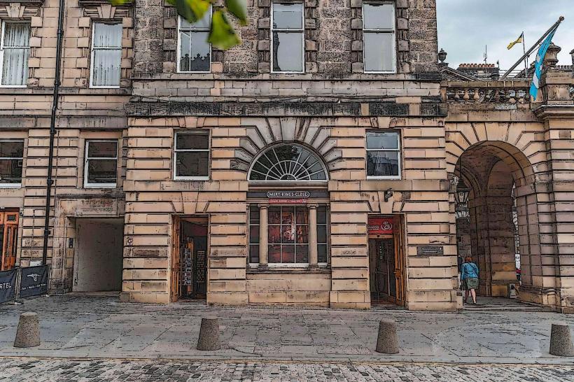
The "Heart of Midlothian" is a heart-shaped mosaic in the pavement near St Giles' Cathedral marking the site of the Old Tolbooth prison; local tradition involves spitting on it for good luck. A local historical oddity is the "Mary King's Close," a series of plague-era streets preserved intact beneath the current Royal Exchange. A specific tip is to explore the smaller closes, such as Dunbar’s Close, which contains a recreated 17th-century knot garden.
Nearby Landmarks
St Giles' Cathedral - 0.0km (Central)
Real Mary King's Close - 0.01km North
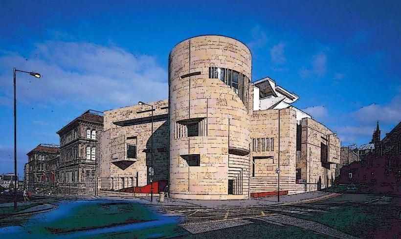
National Museum of Scotland - 0.4km South
Victoria Street - 0.2km Southwest
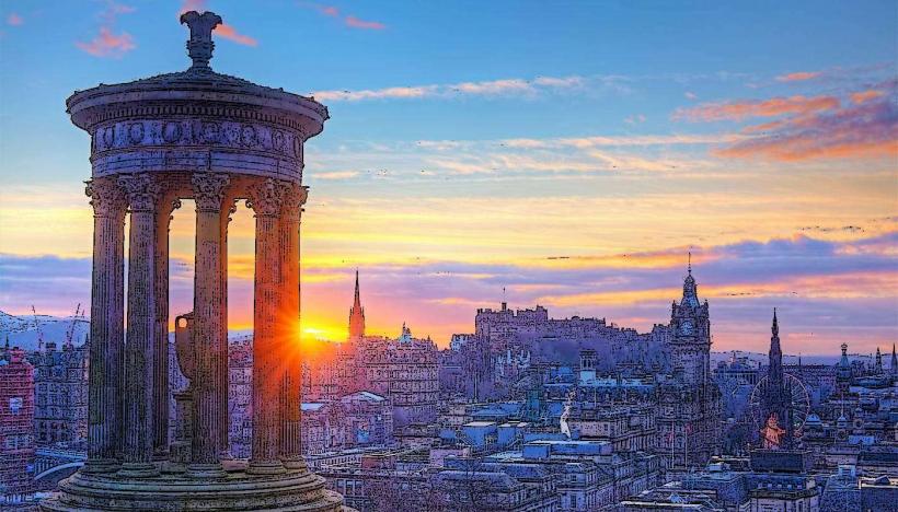
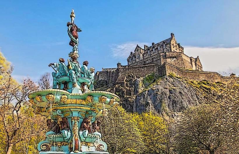
Calton Hill - 0.6km North