Information
Landmark: Santan Mountain Regional ParkCity: Mesa
Country: USA Arizona
Continent: North America
Santan Mountain Regional Park, Mesa, USA Arizona, North America
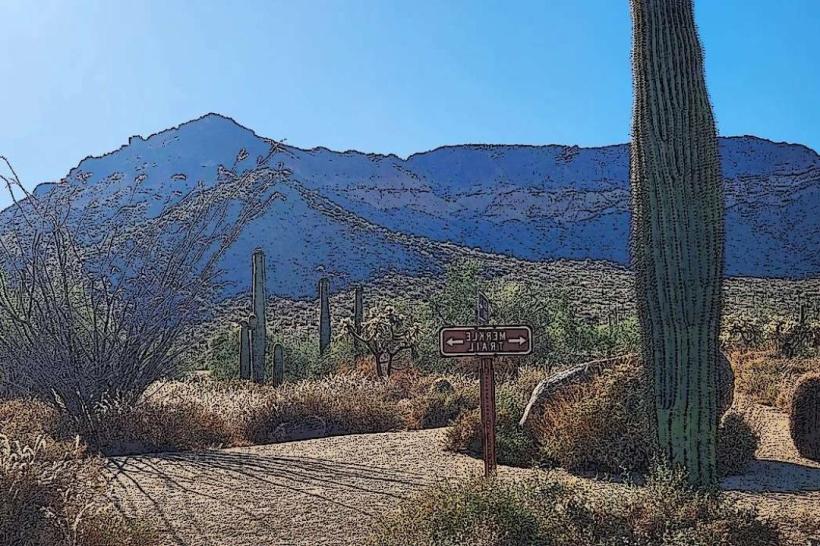
Santan Mountain Regional Park is a protected natural area located in Mesa, Arizona. It encompasses a significant portion of the Santan Mountains, providing public access to desert landscapes.
Visual Characteristics
The park features rugged desert terrain characterized by low-lying mountains, canyons, and washes. Dominant vegetation includes saguaro cacti, palo verde trees, creosote bushes, and various desert wildflowers. Rock formations are primarily sedimentary and volcanic, exhibiting shades of brown, red, and grey. Elevation ranges from approximately 1,200 feet to over 2,000 feet.
Location & Access Logistics
Santan Mountain Regional Park is situated in the southeastern portion of Mesa, Arizona. Access is via South Power Road, which intersects with State Route 202. The park entrance is approximately 10 miles south of the city center. Ample parking is available at the main trailhead and designated staging areas. No public transportation routes directly serve the park entrance.
Historical & Ecological Origin
The Santan Mountains are geologically diverse, with formations dating back millions of years, including volcanic activity and sedimentary deposition. The area is classified as Sonoran Desert, a hot desert ecoregion. Historically, the land was utilized by indigenous peoples for millennia. The park was established to preserve the natural desert environment and provide recreational opportunities.
Key Highlights & Activities
Hiking is a primary activity, with designated trails such as the 3.5-mile Desert Classic Trail and the 2.2-mile Ridgeline Trail. Birdwatching is possible throughout the park. Photography of desert flora and fauna is encouraged. Rock climbing and bouldering are permitted in designated areas, subject to park regulations.
Infrastructure & Amenities
Restrooms are available at the main trailhead. Shaded ramadas are located near the parking areas. Cell phone signal (4G/5G) is intermittent within the park, particularly in canyon areas. No food vendors are present within the park; visitors should bring their own provisions.
Best Time to Visit
The optimal time for visiting is during the cooler months, from October through April. Mornings between 7:00 AM and 10:00 AM offer favorable lighting for photography and cooler temperatures for hiking. Summer months (May-September) are extremely hot, with daytime temperatures frequently exceeding 100°F (38°C).
Facts & Legends
A unique geological feature is the presence of petroglyphs, ancient rock carvings, found in scattered locations within the park, indicating early human presence. Local folklore sometimes refers to the mountains as a place where desert spirits reside, though these are unverified accounts.
Nearby Landmarks
- Usery Mountain Regional Park (3.2km Northwest)
- Goldfield Ghost Town (4.5km Northeast)
- Lost Dutchman State Park (4.8km Northeast)
- Superstition Mountains (visible to the Northeast, distance varies)