Information
Landmark: Sweetheart Rock (Puu Pehe)City: Lanai
Country: USA Hawaii
Continent: North America
Sweetheart Rock (Puu Pehe), Lanai, USA Hawaii, North America
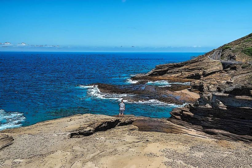
Sweetheart Rock, known locally as Puu Pehe, is a prominent sea stack located off the southern coast of Lanai, Hawaii, USA.
Visual Characteristics
Puu Pehe is a monolithic rock formation rising approximately 60 feet (18 meters) from the ocean. It is composed of dark volcanic rock, primarily basalt. The base of the rock is eroded by wave action, creating a distinct undercut. The summit is sparsely vegetated with hardy coastal plants.
Location & Access Logistics
Puu Pehe is situated approximately 1.5 miles (2.4 km) southwest of the Lanai Hotel in the city of Lanai. Access is via a paved road, Manele Road, which leads to the Manele Bay area. From the Manele Bay parking lot, a well-maintained, unpaved trail extends for approximately 0.5 miles (0.8 km) to the viewpoint overlooking Puu Pehe. No public transport directly serves the viewpoint; private vehicles or taxis are required to reach the parking area.
Historical & Ecological Origin
Puu Pehe is a natural geological formation, a remnant of volcanic activity that shaped the Hawaiian Islands. Its current form is a result of coastal erosion over millennia, with the softer surrounding rock worn away by wave action, leaving the harder basaltic core standing.
Key Highlights & Activities
Observation of the rock formation from the designated viewpoint is the primary activity. Photography is popular, particularly during sunrise and sunset. Swimming and snorkeling are possible in the waters surrounding the rock, but conditions can be rough and are dependent on ocean state. Access to the base of the rock itself is not recommended due to hazardous wave action and slippery surfaces.
Infrastructure & Amenities
The Manele Bay parking lot offers restroom facilities. Shade is limited along the trail to the viewpoint. Cell phone signal (4G/5G) is generally available in the Manele Bay area. No food vendors are present at the viewpoint; provisions should be made prior to arrival.
Best Time to Visit
For photography, the hours around sunrise (approximately 6:00 AM HST) and sunset (approximately 6:30 PM HST) offer optimal lighting conditions. The best months for generally calm ocean conditions are typically from April to October. High tide can increase wave action around the base of the rock.
Facts & Legends
According to local legend, Puu Pehe is named after a beautiful maiden who was captured by a sorcerer. Her lover, a young warrior, fought the sorcerer and, in his victory, hid Pehe in a cave on the rock. However, a large wave swept into the cave, drowning her. The warrior, heartbroken, leaped to his death from the rock's summit. The rock is said to represent their tragic love story.
Nearby Landmarks
- Manele Bay (0.8km Northeast)
- Hulopoe Bay (1.2km North)
- Lanai City (4.5km Northwest)
- Garden of the Gods (Keahiakawir) (12km West - outside 5km radius, but significant nearby)