Information
Landmark: Tamarin BayCity: Tamarin
Country: Mauritius
Continent: Africa
Tamarin Bay, Tamarin, Mauritius, Africa
Tamarin Bay is a natural inlet located on the west coast of Mauritius in the Black River district. It serves as a primary recreational hub for surfing and marine mammal observation, characterized by the convergence of the Tamarin River and the Indian Ocean.
Visual Characteristics
The bay features a dark, volcanic sand beach and a wide estuary where the river meets the sea. The water color transitions from murky tea-colored river water to deep turquoise and navy blue in the bay. The shoreline is relatively narrow, flanked by ironwood trees and basaltic rock formations. To the south, the landscape is dominated by the sharp, triangular peak of La Tourelle du Tamarin mountain, while the Rempart Mountain (Trois Mamelles) is visible to the northeast.
Location & Access Logistics
The bay is located approximately 25 kilometers southwest of Port Louis and 10 kilometers north of Black River Gorges National Park.
Driving: Access is via the A3 coastal road. Visitors turn onto Tamarin Beach Road to reach the public parking area adjacent to the beach.
Public Transport: Bus route 123 (Port Louis to Rivière Noire) stops on the main road, followed by a 10-minute walk to the shore.
Water Access: Small boat ramps and jetties are available for launching kayaks, stand-up paddleboards, and dolphin-watching excursions.
Historical & Ecological Origin
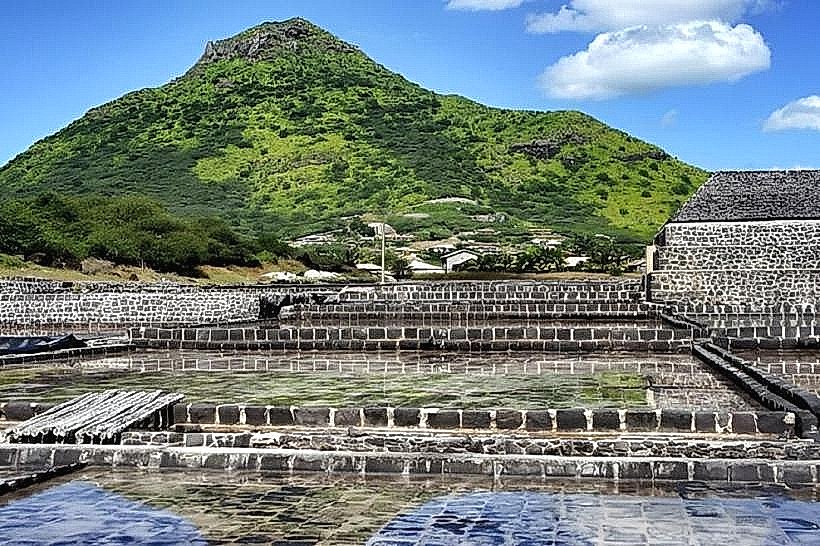
Geologically, the bay was formed by the erosion and sediment deposition of the Tamarin River into the volcanic shelf. Historically, the area was known for its salt pans (Les Salines), some of which still exist in the village. Ecologically, the bay is a critical habitat for a permanent pod of spinner and bottlenose dolphins, which use the calm waters of the bay for resting and socializing during the morning hours.
Key Highlights & Activities
Surfing is a primary activity, as the bay is home to one of the island's most famous reef breaks, "Dale." Kayaking and stand-up paddleboarding are common on the calm river estuary. Dolphin-watching tours depart daily from the bay at sunrise. The beach is a popular sunset viewing point due to its western orientation. Swimming is possible, though the presence of river currents and a lack of a protective outer reef can lead to stronger swells than at other Mauritian beaches.
Infrastructure & Amenities
The Tamarin Public Beach area includes basic restrooms and outdoor showers. Shade is available under the trees lining the sand. There is stable 4G/5G cellular coverage throughout the bay. Food and beverage options are located within walking distance, including several beach bars, a surf school cafe, and mobile vendors in the parking area.
Best Time to Visit
The bay is accessible 24 hours a day, but peak activity occurs between 06:00 and 10:00 for dolphin sightings. For surfing, the best swells typically occur during the winter months (May to September). Photography is optimal at sunset (17:30–18:30) when the sun aligns with the bay's opening. Morning light is best for capturing the mountains to the east and south.
Facts & Legends
Tamarin Bay gained international fame in the 1970s following the surf documentary Forgotten Island of Santosha, which highlighted the bay's consistent and powerful left-hand reef break. A local "secret" is the "Black Rock" area, where the river current creates a unique thermal mixing zone that attracts diverse fish species, making it a preferred spot for local artisanal fishers.
Nearby Landmarks
La Tourelle du Tamarin: 1.5km South
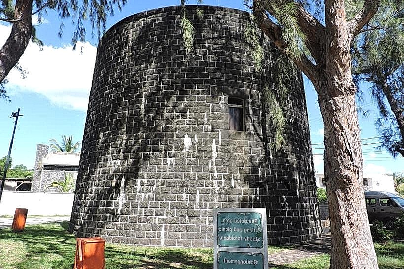
The Martello Tower (Museum): 2.2km South
Flic en Flac Beach: 4.8km North
Casela Nature Parks: 4.5km Northeast
Wolmar Nature Reserve: 3.0km North