Information
Landmark: The BurrenCity: Clare
Country: Ireland
Continent: Europe
The Burren, Clare, Ireland, Europe
The Burren is a glaciated karst region in North County Clare, covering approximately $250$ $\text{km}^2$. It is defined by its vast limestone pavements, significant archaeological sites, and a unique ecosystem where Arctic, Alpine, and Mediterranean flora coexist.
Geological Characteristics
The landscape was formed $350$ million years ago from the skeletal remains of marine organisms in a tropical sea.
Limestone Pavement: The surface consists of flat slabs of rock called clints, separated by deep vertical fissures known as grykes.
Karst Topography: The limestone is soluble in rainwater, leading to an extensive underground network of caves, disappearing streams, and turloughs (seasonal lakes).
Erratic Boulders: Large granite boulders transported by glaciers during the last Ice Age are scattered across the limestone, left behind as the ice melted.
Location & Access Logistics
Region: North Clare, bounded by the Atlantic Ocean and Galway Bay.
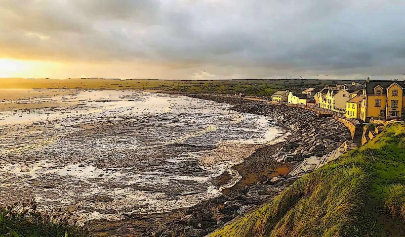
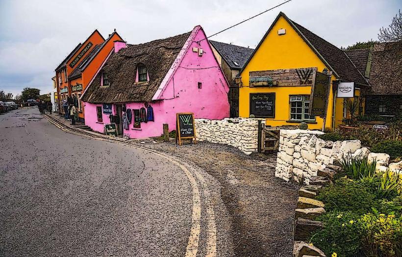
Primary Hubs: Doolin, Lisdoonvarna, Ballyvaughan, and Kilfenora.
Transit: The Wild Atlantic Way passes through the region. Private vehicle is the most efficient travel method. The Burren Way is a $114$ km long-distance walking trail for hikers.
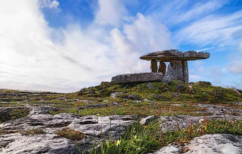
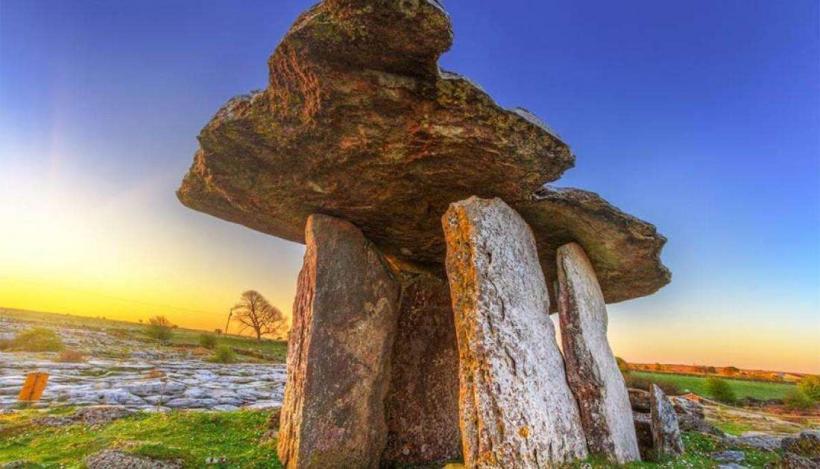
Parking: Located at major points of interest such as Poulnabrone Dolmen or the Burren Centre in Kilfenora.
Archaeological Significance
The Burren contains over $2,700$ recorded historic sites, reflecting $6,000$ years of human habitation.
Poulnabrone Dolmen: A portal tomb dating to the Neolithic period ($3800$ BC – $3200$ BC).
Caherconnell Stone Fort: A well-preserved medieval ringfort used for habitation and livestock protection.
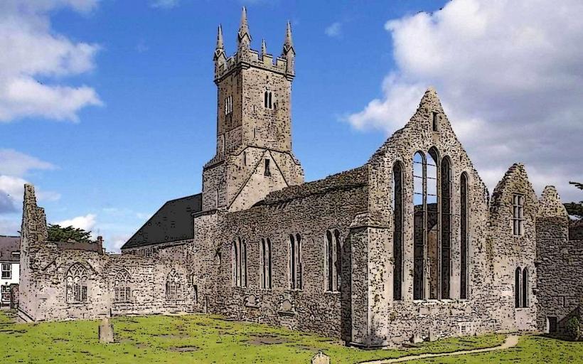
Corcomroe Abbey: A 12th-century Cistercian monastery noted for its stone carvings.
Flora and Fauna
The region is famous for its botanical diversity.
Floral Overlap: Species such as the Spring Gentian (Alpine) grow alongside the Mountain Avens (Arctic) and Maidenhair Fern (Mediterranean).
Soil Conditions: The grykes provide a sheltered, humid microclimate that allows delicate plants to thrive in an otherwise exposed environment.
Fauna: Home to the Pine Marten, feral goats, and various rare butterfly species.
Infrastructure & Amenities
Visitor Centres: The Burren Centre in Kilfenora and the Burren National Park Information Point in Corofin.
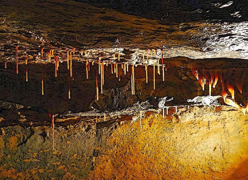
Caves: Aillwee Cave and Doolin Cave (home to one of the world's longest free-hanging stalactites) offer guided underground tours.
Connectivity: 4G is reliable in villages; however, the high limestone plateaus often have significant dead zones.
Technical Details
The Burren is a UNESCO Global Geopark. The term "Burren" is derived from the Irish word Boireann, meaning "a rocky place." The drainage is almost entirely subterranean; despite high rainfall, there are very few surface rivers because the water immediately enters the limestone joints.
Nearby Landmarks
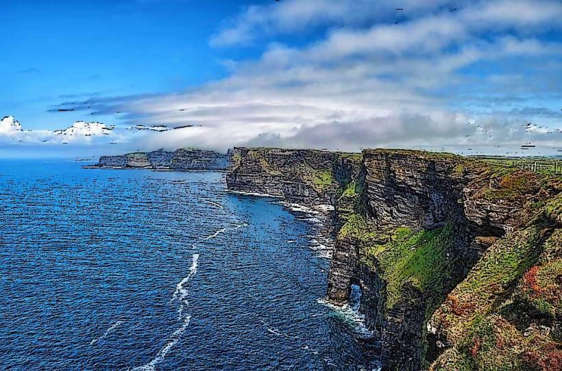
Cliffs of Moher – 15 km South
Aran Islands – Accessible by ferry from Doolin
Fanore Beach – Northwest coast of the Burren
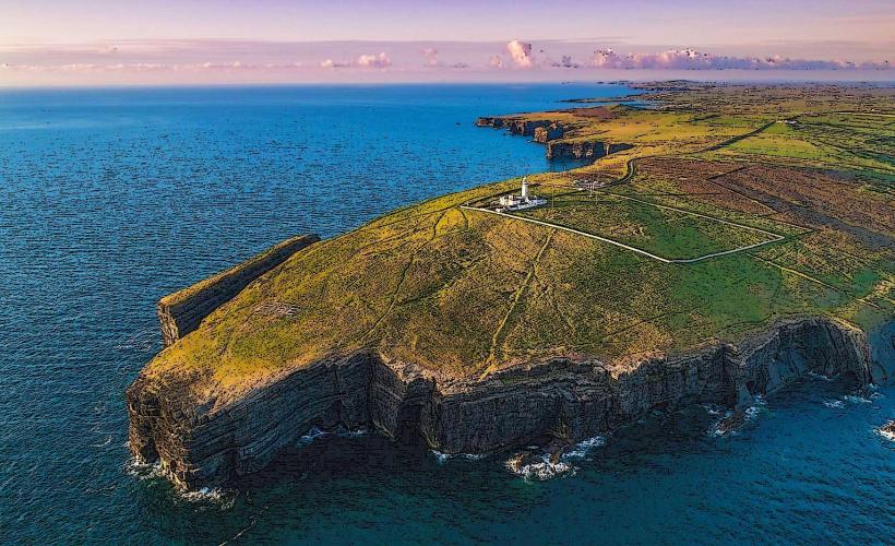
Black Head Lighthouse – Northern tip overlooking Galway Bay