Information
Landmark: Wilder DamCity: Lebanon
Country: USA New Hampshire
Continent: North America
Wilder Dam, Lebanon, USA New Hampshire, North America
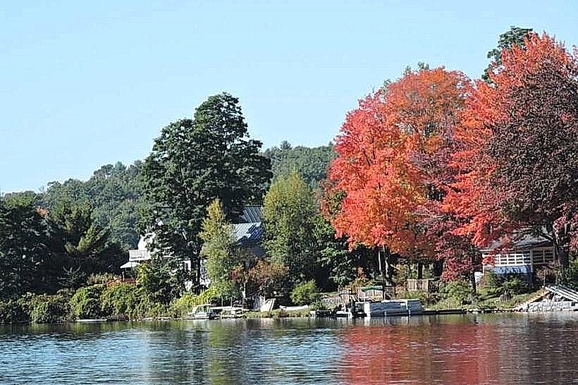
Wilder Dam is a hydroelectric dam located on the Connecticut River, forming the border between Lebanon, New Hampshire, and Hartford, Vermont.
It is a significant component of the federal flood control and hydroelectric power generation system for the Connecticut River Valley.
Visual Characteristics
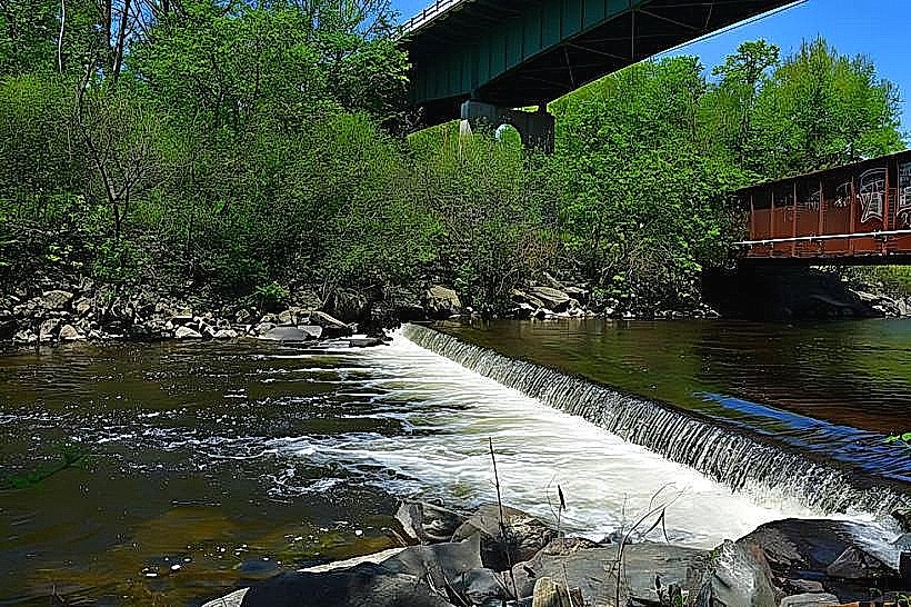
The dam is a concrete gravity structure, approximately 2,100 feet (640 meters) in length and 110 feet (34 meters) in height. It features a spillway section and an earth embankment section. The reservoir it creates, known as the Connecticut River Reservoir or Wilder Reservoir, has a surface area of approximately 5,500 acres (2,200 hectares) at normal full pool elevation.
Location & Access Logistics
Wilder Dam is situated approximately 3 miles (4.8 kilometers) north of downtown Lebanon, New Hampshire. Access is via New Hampshire Route 12A, which runs along the eastern bank of the Connecticut River. Parking is available at designated areas near the dam's administrative buildings and public access points. Public transportation options are limited; the nearest bus service is in Lebanon, requiring a taxi or personal vehicle for the final approach.
Historical & Ecological Origin
Construction of Wilder Dam began in 1947 and was completed in 1951 by the United States Army Corps of Engineers. Its primary purpose was flood control for downstream communities and the generation of hydroelectric power. The dam impounds the Connecticut River, creating a reservoir that significantly altered the river's flow dynamics and surrounding riparian environment.
Key Highlights & Activities
Observation of the dam's structure and spillway operations is possible from designated viewing areas. Fishing is permitted within the reservoir, subject to state regulations. Kayaking and canoeing are possible on the reservoir, with access points available at various locations along its shoreline. Birdwatching is a common activity due to the diverse avian species attracted to the reservoir habitat.
Infrastructure & Amenities
Restrooms are available at the main visitor access points. Limited shade is provided by trees in some picnic areas adjacent to the reservoir. Cell phone signal (4G/5G) is generally available in the vicinity of the dam and along Route 12A. No food vendors are located directly at the dam; dining options are available in nearby Lebanon, New Hampshire, and White River Junction, Vermont.
Best Time to Visit
For optimal viewing of water flow and potential spillway activity, late spring (April-May) during snowmelt is recommended. Summer months (June-August) offer pleasant weather for reservoir activities. Photography is best in the early morning or late afternoon for softer light. No specific tide requirements apply.
Facts & Legends
A notable historical oddity is the dam's role in managing the Connecticut River's flow, which historically experienced significant spring flooding. The reservoir's creation submerged several small communities and farms, leading to relocation efforts during its construction.
Nearby Landmarks
- Colburn Park (Lebanon, NH) - 3.5km South
- Montshire Museum of Science (Norwich, VT) - 4.0km Southwest
- Quechee Gorge (Quechee, VT) - 10.0km West
- Mascoma Lake (Canaan, NH) - 15.0km Northeast