Information
City: AlajuelaCountry: Costa Rica
Continent: North America
Alajuela, Costa Rica, North America
Alajuela serves as the secondary industrial and logistical hub of Costa Rica and the primary gateway to the country via Juan Santamaría International Airport. It is located in the Central Valley, approximately 20 kilometers west of San José, at an elevation of 952 meters.
Historical Timeline
Alajuela was founded in 1782 as Villa de San Juan Nepomuceno de Alajuela. The city gained national prominence during the 19th century as a center for coffee and sugarcane production. The primary event shaping the city's identity was the 1856 Campaign against William Walker, specifically the Battle of Rivas, which elevated local resident Juan Santamaría to national hero status. The modern urban form was defined by the 1958 opening of the international airport, which shifted the city's economic focus from agriculture to global logistics and free-trade zone manufacturing.
Demographics & Population
The city has a population of approximately 45,000 within the urban core, while the broader Alajuela canton exceeds 300,000. The demographic is predominantly White/Mestizo (90%), with a growing population of Nicaraguan immigrants (8%). The median age is 31.4 years.
Urban Layout & Key Districts
The city follows a grid pattern centered on Central Park. El Centro (Central) is the commercial heart, housing the cathedral and markets. La Agonía (East) is a historic residential district known for its namesake church. El Coyol (West) serves as the primary industrial district, containing major medical and technology free-trade zones. Desamparados (North) is a high-density residential suburb.
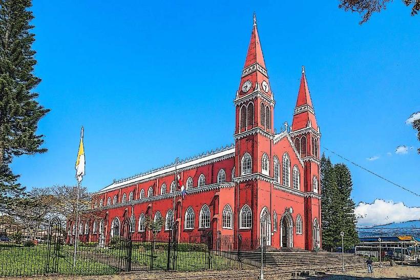
Top City Landmarks
Juan Santamaría Historical Cultural Museum
Alajuela Cathedral (Catedral de Nuestra Señora del Pilar)
Central Park (Parque General Tomás Guardia)
Juan Santamaría Statue
Church of La Agonía
Transportation Network
Internal movement relies on a dense network of local buses connecting to the Central Terminal. There is no metro. Uber and DiDi are the primary ride-sharing apps. Official taxis are red with a yellow triangle. Traffic density is high, particularly on the General Cañas Highway and around the "Radial Francisco J. Orlich" entrance. The city is a major transit node for long-distance buses heading to the Pacific coast and the northern lowlands.
Safety & "Red Zones"
Alajuela is generally safer than San José, but petty theft is common in crowded areas. Avoid Infiernillo and parts of San José de Alajuela at night due to localized drug-related activity. Common scams include "maleteros" at the airport offering unauthorized transport or bag handling at inflated prices.
Digital & Financial Infrastructure
Internet speeds average 100–250 Mbps via fiber optics (Liberty/Kölbi). Card acceptance is universal in the city center; contactless (tap-to-pay) is standard. ATMs are abundant in the City Mall and around the Central Park, dispensing Colones and US Dollars.
Climate & Air Quality
Temperatures range from 18°C to 30°C. Alajuela is notably warmer and drier than San José. The rainy season peaks from September to November. Air quality is fair, though humidity and vehicle exhaust can concentrate in the city center during the afternoon.
Culture & Social Norms
Tipping is included as a 10% service charge in restaurants. The "Pura Vida" ethos dictates a relaxed social pace. Handshakes are the standard greeting for men; a single cheek kiss is common for women. Dress is casual-formal; shorts are acceptable in most daytime settings but discouraged for government or religious visits. Smoking is prohibited in all public parks and buildings.
Accommodation Zones
City Center: Stay here for proximity to the Central Market and cultural sites.
Airport/Cariari: Stay here for logistics, high-end business hotels, and immediate access to the international terminal.
Local Cost Index
1 Espresso: 1,400 CRC ($2.75 USD)
1 Standard Lunch (Casado): 4,000 CRC ($7.85 USD)
1 Bus Ticket (Local): 400 CRC ($0.80 USD)
Nearby Day Trips
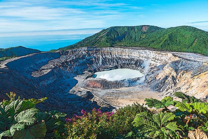
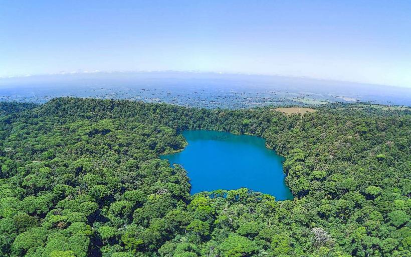
Poás Volcano National Park: 31 km (1 hour), an active crater with a sulfuric lake.
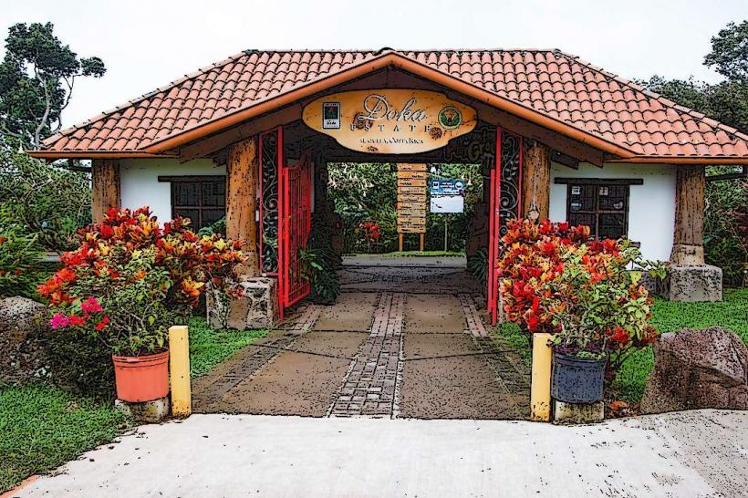
Doka Estate: 15 km (30 minutes), a historic coffee plantation and mill.
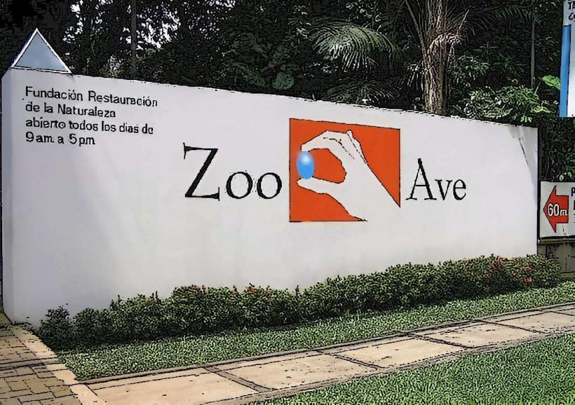
Zoo Ave (Rescate Wildlife Centre): 10 km (20 minutes), a bird and reptile sanctuary.
Facts & Legends
Alajuela is known as the "City of Mangoes" due to the high density of mango trees in its central park. A local legend describes "La Segua," a beautiful woman who appears to unfaithful men on dark roads; when they approach, her face transforms into a horse's skull. Historically, Alajuela served as the capital of Costa Rica for a brief period between 1834 and 1835 under the "Ley de la Ambulancia," a law that attempted to rotate the capital between major cities every four years.