Information
Landmark: Laguna de HuleCity: Alajuela
Country: Costa Rica
Continent: North America
Laguna de Hule, Alajuela, Costa Rica, North America
Laguna de Hule is a volcanic crater lake situated in the Alajuela province of Costa Rica.
This body of water occupies a depression formed by volcanic activity.
Visual Characteristics
The lake's surface is typically dark blue to green, reflecting the surrounding vegetation. The crater rim is covered in dense tropical forest, characterized by a variety of broadleaf trees and epiphytes. The shoreline is irregular, with some areas featuring exposed volcanic rock and others transitioning into muddy banks.
Location & Access Logistics
Laguna de Hule is located approximately 30 kilometers northwest of Alajuela city center. Access is via Route 120, turning onto a gravel road (unmarked, locally known as the "Laguna de Hule road") approximately 5 kilometers past the town of Poás. The gravel road extends for about 4 kilometers and is passable by 4x4 vehicles, especially during the dry season (December to April). Standard vehicles may struggle with muddy conditions during the rainy season. Parking is informal and available at the end of the gravel road, near the lake's edge. No public transport directly serves the lake; a taxi or private vehicle is required from Alajuela.
Historical & Ecological Origin
Laguna de Hule is a phreatomagmatic crater, formed by the interaction of magma and groundwater. The specific eruption event that created the crater is not precisely dated but is considered geologically recent. The surrounding forest is a secondary growth tropical rainforest, regenerating on volcanic soils.
Key Highlights & Activities
Observation of birdlife is a primary activity, with species such as toucans, hummingbirds, and various waterfowl present. Limited fishing is permitted by local residents. Hiking is possible along the crater rim, though trails are not formally maintained and can be overgrown. Kayaking or canoeing is feasible on calm days, but no rental services are available.
Infrastructure & Amenities
There are no formal facilities at Laguna de Hule. Restrooms are unavailable. Shade is provided by the dense forest canopy. Cell phone signal is intermittent and generally unreliable. No food vendors are present at the lake; visitors should bring their own supplies.
Best Time to Visit
The best time for photography is in the early morning or late afternoon when the sun angle provides softer light and potential mist on the water. The dry season (December to April) offers more stable road conditions. During the rainy season (May to November), the lake is fuller, but access can be challenging. Birdwatching is generally good year-round, with peak activity in the morning.
Facts & Legends
Local folklore suggests the lake is inhabited by water spirits, and offerings are sometimes left at its edge by those seeking good fortune. Geologically, the lake is part of a volcanic complex that includes the nearby Poás Volcano, though Laguna de Hule itself is considered extinct.
Nearby Landmarks
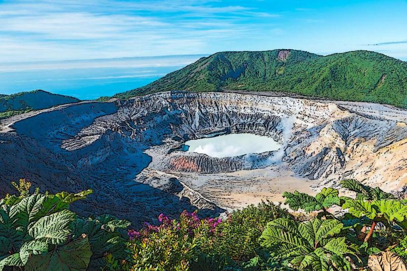
- Poás Volcano National Park (5km Northeast)
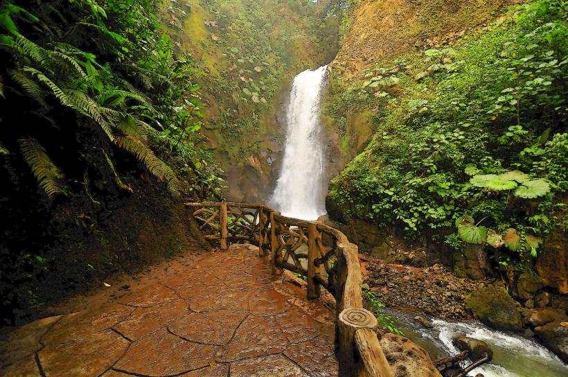
- La Paz Waterfall Gardens (12km Southeast)
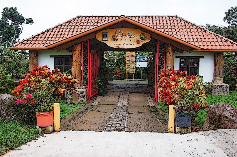
- Doka Estate Coffee Tour (8km South)
- Catarata del Toro (15km Northwest)