Information
City: Antigua GuatemalaCountry: Guatemala
Continent: North America
Antigua Guatemala, Guatemala, North America
Antigua Guatemala is the former colonial capital of the Captaincy General of Guatemala and a UNESCO World Heritage site. It is located in the central highlands at an altitude of 1,530 meters, surrounded by the Agua, Fuego, and Acatenango volcanoes. It serves as the country’s primary cultural tourism hub and a global center for Spanish language instruction.
Historical Timeline
Founded on March 10, 1543, as Santiago de los Caballeros, the city served as the regional capital for over 200 years. The primary era of governance ended following the Santa Marta earthquakes in 1773, which caused the Spanish Crown to order the capital's relocation to present-day Guatemala City. The 1773 destruction and the subsequent 1776 abandonment decree are the primary events that preserved its 16th-century Renaissance grid and Baroque architecture, as major new construction was legally prohibited for decades.
Demographics & Population
The population is approximately 46,000 within the urban core and 155,000 in the wider municipality. The demographics are a mix of Ladino (65%), Indigenous Mayan (32%), and a significant expatriate community (3%). The median age is 24.8 years, reflecting a youthful population engaged in the service and tourism sectors.
Urban Layout & Key Districts
The city is organized on a strict Renaissance grid. Calles (streets) run East-West and Avenidas (avenues) run North-South.
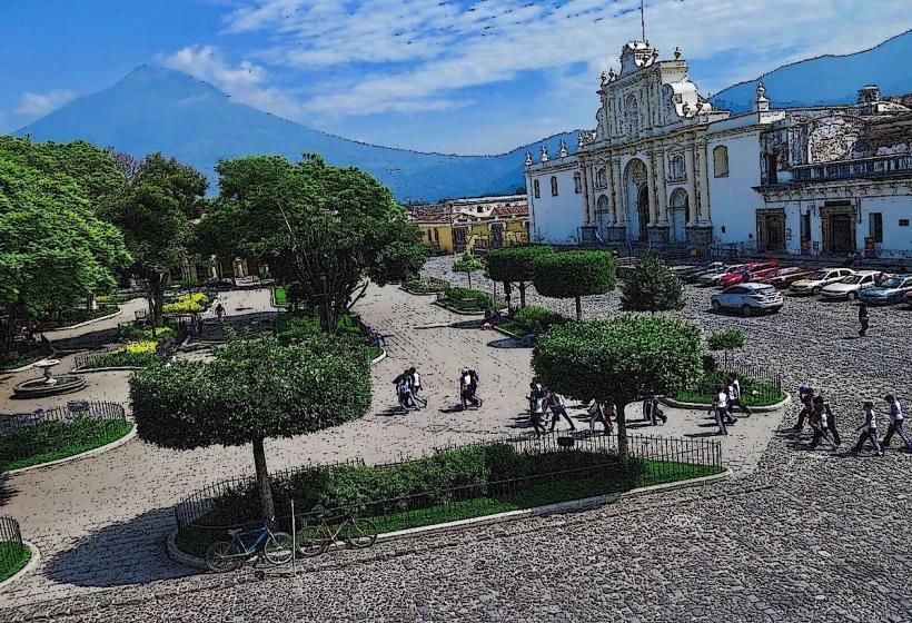
Parque Central: The geographic and social heart of the city.
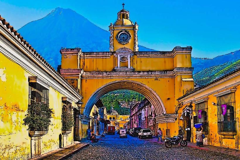
Calle del Arco (5ta Avenida Norte): The primary tourist corridor featuring the Santa Catalina Arch.
Barrio de San Francisco: A quieter district in the southeast centered around the San Francisco Church.
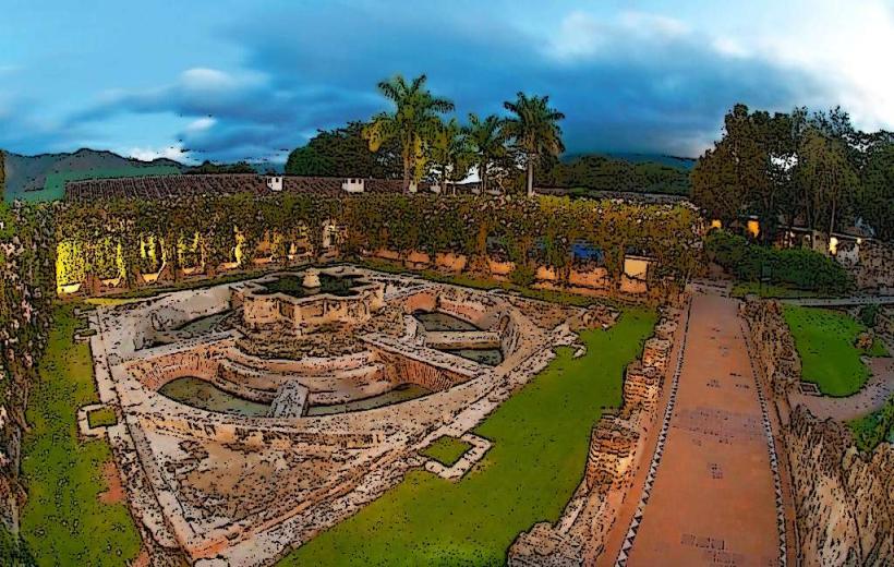
Barrio de la Concepción: The eastern entrance to the city, known for its colonial ruins.
Top City Landmarks
Santa Catalina Arch: The iconic 1694 yellow archway.
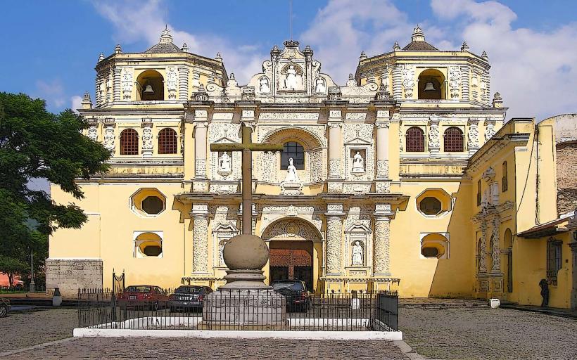
Iglesia de La Merced: Known for its ultra-Baroque yellow stucco facade.
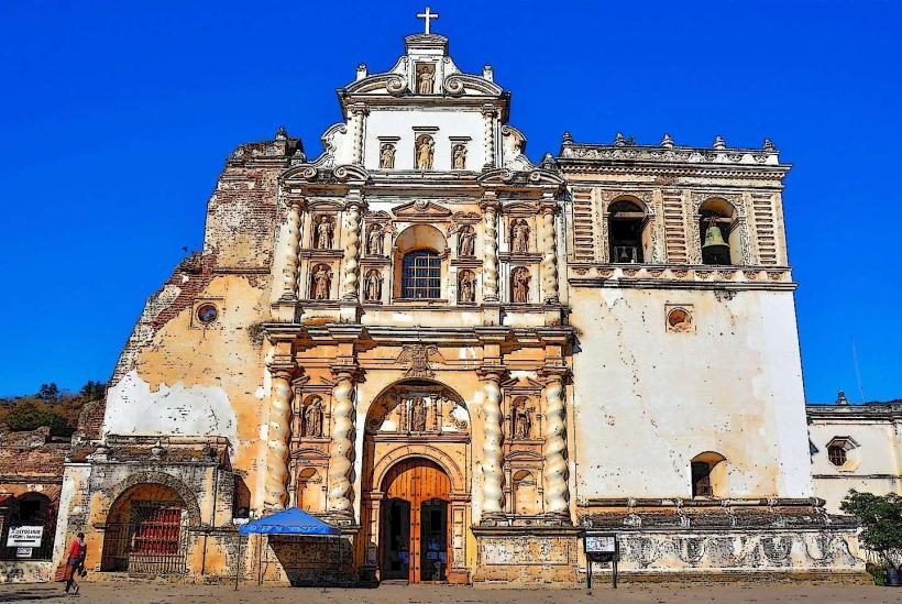
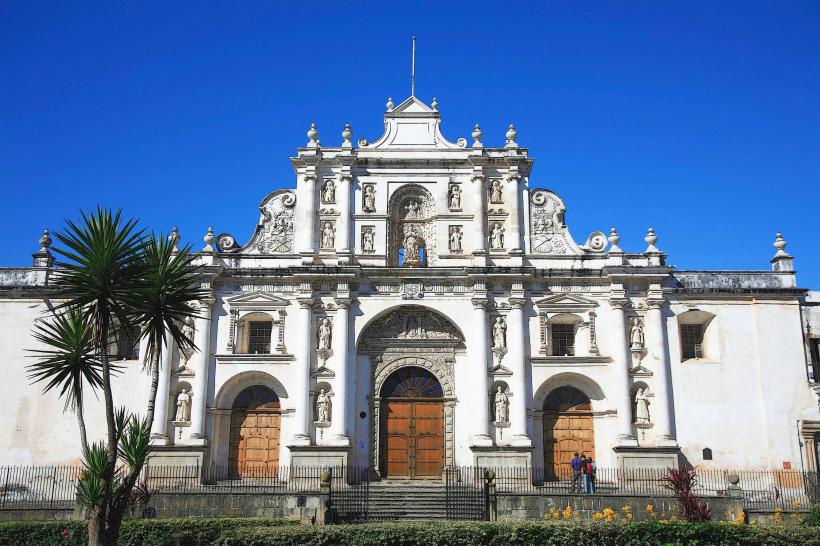
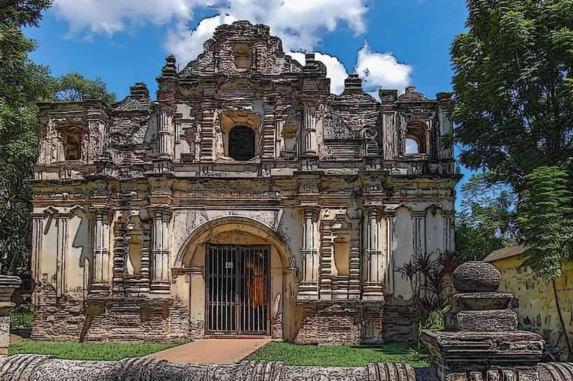
Catedral de Santiago Ruins: The remains of the 16th-century cathedral behind the modern parish.
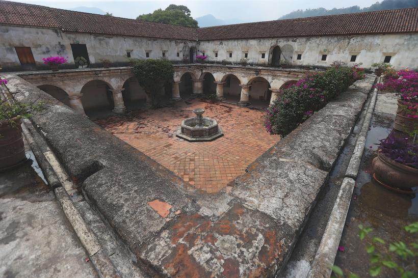
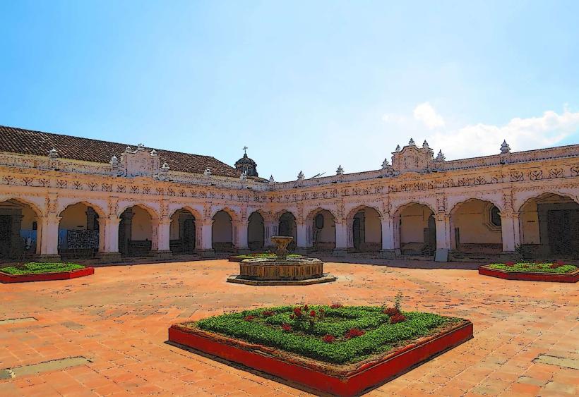
Convento de las Capuchinas: An 18th-century convent with unique circular dormitory cells.
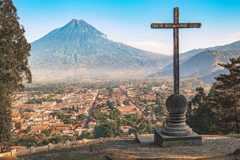
Cerro de la Cruz: A hilltop viewpoint providing a panoramic vista of the city and Agua Volcano.
Transportation Network
Movement within the historic core is conducted almost entirely on foot due to the cobblestone streets and compact size. Tuk-tuks (three-wheeled taxis) are the primary motorized transport for short distances. There is no metro or city bus system; inter-city transit relies on "chicken buses" or private shuttles. Uber is widely available and the preferred method for transit to Guatemala City or the airport. Traffic density is high on weekends due to domestic tourism.
Safety & "Red Zones"
The general safety level is high compared to the capital. There are no designated "red zones" within the historic grid. Visitors should avoid walking alone on the outskirts (such as the trail to Cerro de la Cruz) after sunset. Common scams include "fake volcano guides" and overcharging by unmetered tuk-tuks; always confirm the price (typically Q10–Q20 within town) before boarding.
Digital & Financial Infrastructure
Average internet speed is 45 Mbps. Main mobile carriers are Tigo and Claro. Card acceptance is near-universal in hotels, restaurants, and cafes, though a 5% surcharge is common in smaller shops. ATMs (5B and BAC) are ubiquitous around Parque Central. Cash (Quetzales) is required for markets and tuk-tuks.
Climate & Air Quality
Temperatures range from 12°C at night to 25°C during the day. The dry season (November–April) offers clear skies, while the rainy season (May–October) features heavy afternoon thunderstorms. Air quality is generally good, though wood-smoke from traditional cooking and occasional ash from the nearby active Fuego Volcano can affect local conditions.
Culture & Social Norms
Tipping of 10% is standard and often pre-included as "propina." Standard greetings are formal: "Buenos días" or "Buenas tardes" are preferred over "Hola." Dress code is casual but neat; revealing clothing is discouraged in churches. Public behavior is generally quiet; loud noise is restricted in the evenings to preserve the "colonial atmosphere."
Accommodation Zones
City Center (Zones near Parque Central): Best for walking access to major ruins and dining.
South/East Outskirts (San Francisco area): Best for high-end boutique hotels and a quieter atmosphere.
Local Cost Index
1 Espresso: Q22.00 ($2.85)
1 Standard Lunch: Q65.00 ($8.40)
1 Tuk-Tuk Trip: Q15.00 ($1.95)
Nearby Day Trips
Pacaya Volcano: 1.5 hours (Active volcano hike)
Hobbitenango: 20 mins (Eco-park with mountain views)
Lake Atitlán: 2.5–3 hours (Deep volcanic lake)
Iximché: 1.5 hours (Post-classic Maya ruins)
Facts & Legends
A prominent local legend is that of "La Llorona" (The Weeping Woman), who is said to haunt the fountain in Parque Central. A verified historical oddity is the "Geronimo" figure in the La Merced fountain, which is the largest of its kind in Central America. Additionally, local folklore suggests the existence of secret colonial tunnels (túneles) connecting the major convents and the Cathedral, though most are actually 18th-century drainage systems.