Information
City: Belle MareCountry: Mauritius
Continent: Africa
Belle Mare, Mauritius, Africa
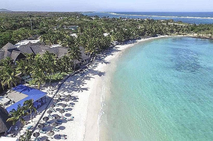
Belle Mare serves as a primary luxury tourism and agricultural hub on the east coast of Mauritius within the Flacq District. It functions as a strategic center for high-end hospitality and industrial-scale vegetable production, characterized by one of the island's longest stretches of white sand coastline.
Historical Timeline
The area was named by French settlers in the 18th century, meaning "Beautiful Pond," referring to the local water features. It remained a sparsely populated sugar estate zone until the 1970s. The primary event shaping the current urban form was the 1980s government-led zoning initiative which designated the eastern coastal strip for integrated resort development, transforming the former lime-kiln and fishing village into a luxury corridor.
Demographics & Population
The permanent population of the village core is approximately 5,700. The demographic profile is 75% Indo-Mauritian and 25% Creole. During the high season (October–March), the transient tourist population adds several thousand inhabitants to the coastal zone. The median age is 37 years.
Urban Layout & Key Districts
The village is organized along the B58 coastal road. Key districts include the Public Beach Zone (North), a protected recreational area; the Resort Strip (East), a restricted-access zone featuring luxury hotels; and the Agricultural Interior (West), characterized by large-scale onion and cucumber plantations.
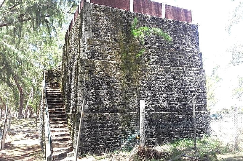
Top City Landmarks
Belle Mare Public Beach
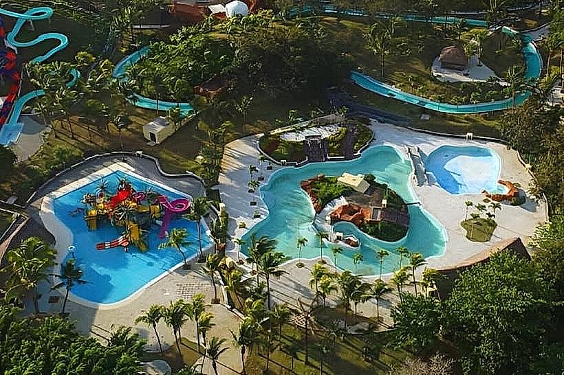
The Waterpark (Cinespina)
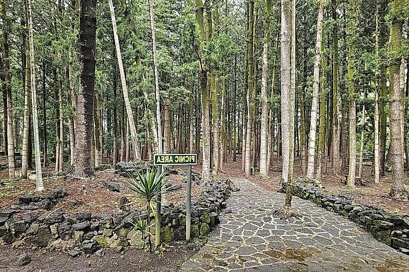
Bras d'Eau National Park (North periphery)
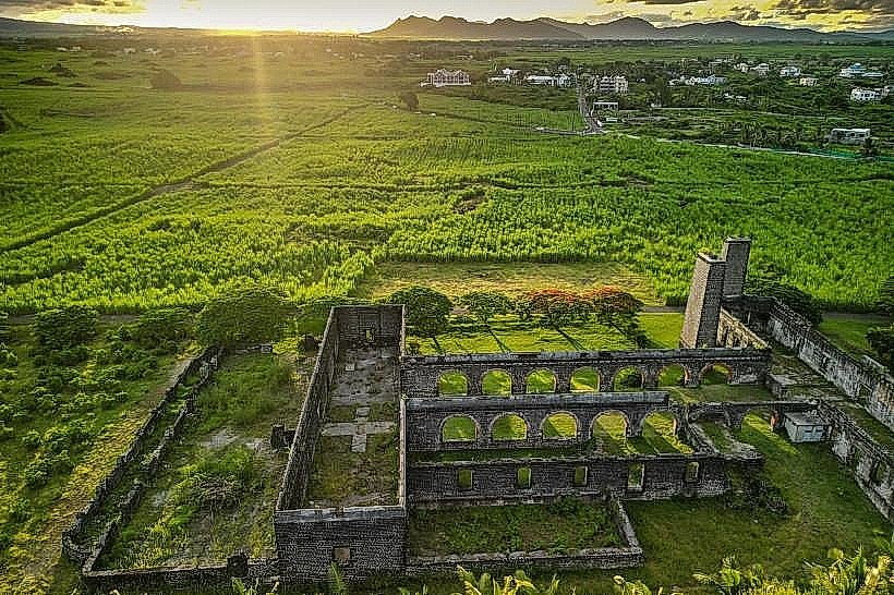
Ruins of the Belle Mare Sugar Mill
Links and Legends Golf Courses
Transportation Network
Movement is facilitated by the B58 and B62 roads. Bus transit connects the village to the major inland hub of Centre de Flacq. Ride-sharing via the Yugo app is available but wait times are frequent. Official taxis are white with yellow markings and operate primarily from hotel ranks. Traffic density is low except on weekends when local visitors converge on the public beach.
Safety & "Red Zones"
The safety level is high. Avoid unlit sections of the public beach after dark and the isolated rural roads leading toward Palmar at night. Common scams involve unlicensed "parasailing" or "undersea walk" operators offering cut-rate prices without safety certification.
Digital & Financial Infrastructure
Average internet speed is 40-60 Mbps. Main carriers are my.t and Emtel. Card acceptance is universal in resorts and the Super U in nearby Flacq, but cash is required for local "snacks" and craft stalls. ATMs are located within the larger resorts or 6 km away in Centre de Flacq.
Climate & Air Quality
Temperatures range from 17°C to 24°C in winter and 23°C to 31°C in summer. The region is directly exposed to the Southeast Trade Winds, making it windier and slightly cooler than the west coast during winter. Air quality is exceptional due to the absence of heavy industry and constant oceanic filtration.
Culture & Social Norms
A 10% tip is standard in restaurants. Handshakes are the common greeting. Dress code is conservative in the village center; swimwear is restricted to the beach and resort grounds. Public smoking is prohibited in the National Park and near government buildings.
Accommodation Zones
Stay in the Coastal Strip for direct lagoon access and high-end resort amenities.
Stay in the Palmar area (South) for quieter, boutique lodgings and proximity to the public beach.
Local Cost Index
1 Espresso: 130 MUR ($2.85 USD)
1 Standard Lunch (Beachfront Cafe): 500 MUR ($11.00 USD)
1 Bus Ticket: 35 MUR ($0.75 USD)
Nearby Day Trips
Île aux Cerfs: 15 km (25 minutes to jetty)
Centre de Flacq (Market): 6 km (10 minutes)
Sagar Shiv Mandir (Temple): 10 km (15 minutes)
Bras d'Eau National Park: 8 km (12 minutes)
Facts & Legends
Belle Mare is home to a unique "deep water" legend regarding the Pass of Belle Mare, where local fishermen claim a giant sea serpent guards the entrance to the lagoon. A verified historical oddity is the presence of several 19th-century lime kilns near the coast, which were used to process coral into lime for the construction of the island's early sugar mills.