Information
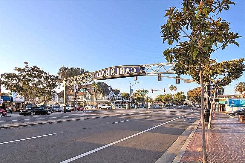
City: CarlsbadCountry: USA New Mexico
Continent: North America
Carlsbad, USA New Mexico, North America
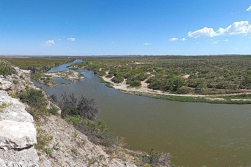
Carlsbad serves as the seat of Eddy County and is a primary hub for petroleum extraction, potash mining, and national park tourism. It is situated on the Pecos River in the Chihuahuan Desert, approximately 40 km north of the Texas border.
Historical Timeline
Founded in 1888 as Eddy, the town was renamed Carlsbad in 1899 to capitalize on the discovery of mineral springs similar to those in Karlsbad, Bohemia. It was incorporated as a city in 1918. The most significant structural development occurred after 1923, following the designation of the nearby caverns as a national monument, which shifted the city’s economic focus toward tourism. The primary event shaping its current urban form was the mid-20th century discovery of the Delaware Basin oil reserves, which led to a massive expansion of industrial infrastructure and heavy-vehicle transport routes.
Demographics & Population
The 2026 estimated population within city limits is 31,920, with a county-wide population of approximately 61,000. The primary ethnic demographics are White (75.4%), Two or More Races (12.1%), and Native American (1.3%). Approximately 52.4% of the total population identifies as Hispanic or Latino. The median age is 35.8 years.
Urban Layout & Key Districts
The city is organized on a grid system bisected by the Pecos River and Canal Street (US-285). The Downtown District (Central) contains the historic core and county government buildings; the Cascades/Riverside District (East) features municipal parks and riverfront recreational zones; and the South Canal Corridor (South) serves as the primary gateway to the national parks and industrial service sectors.
Top City Landmarks
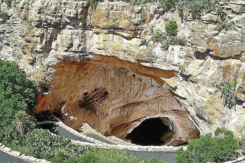
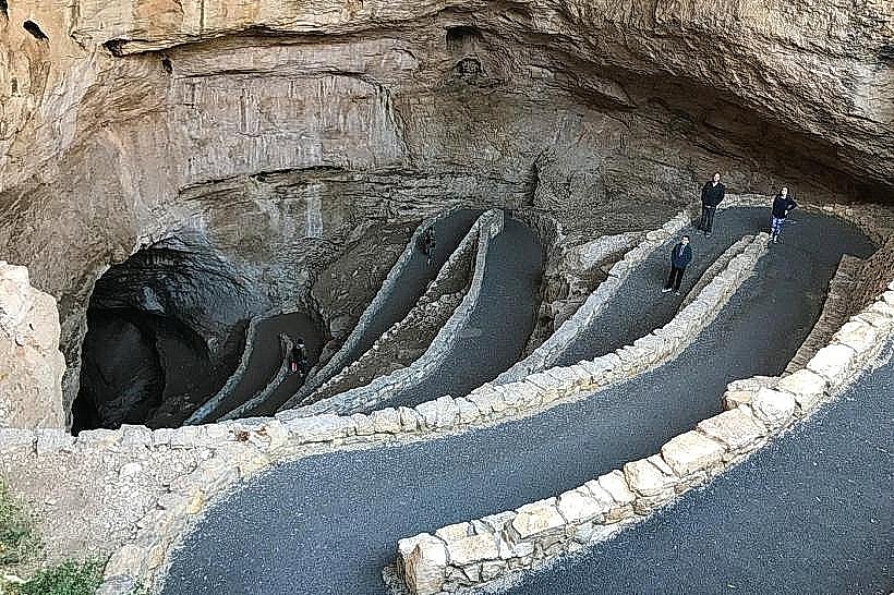
Carlsbad Caverns National Park (32 km SW)
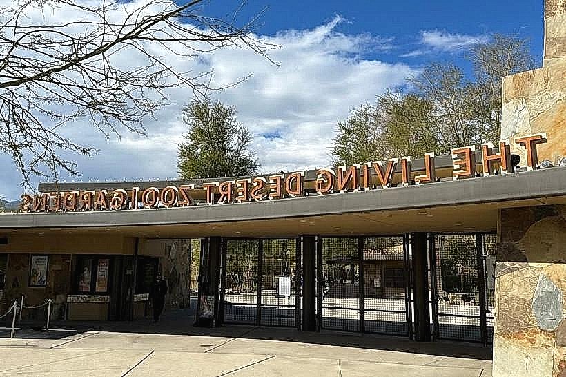
Living Desert Zoo and Gardens State Park
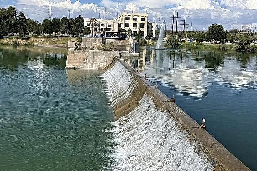
Pecos River Flume (The "River across a River")
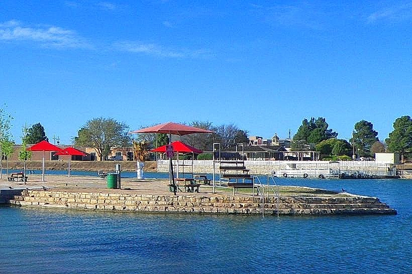
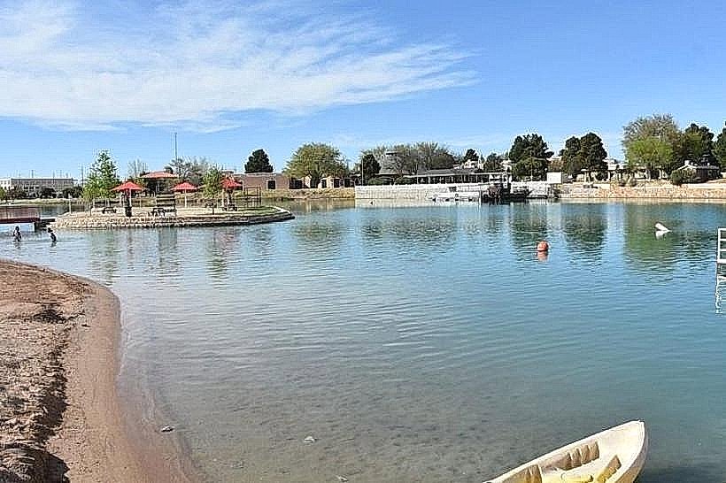
Lake Carlsbad Beach Park
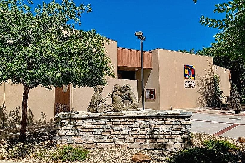
Carlsbad Museum and Art Center
Transportation Network
Internal movement is facilitated by Carlsbad Municipal Transit, which operates fixed-route buses Monday through Saturday. Ride-sharing via Uber and Lyft is available but maintains low vehicle density. Official taxis are provided by private dispatch services like Cavern City Cab. Traffic density is high on US-285 and National Parks Highway (US-62/180) due to heavy industrial oil-field traffic and tourist convoys.
Safety & "Red Zones"
The general safety level is moderate. Property crime is the primary concern, particularly in high-traffic tourist areas and industrial parking zones. There are no designated "no-go" zones, but standard caution is recommended in the neighborhoods immediately west of the Canal Street corridor at night. Visitors should be extremely vigilant on regional highways due to high volumes of heavy commercial trucks.
Digital & Financial Infrastructure
Average internet speeds reach 200 Mbps via Sparklight or Windstream, with 1 Gbps fiber available in select residential developments. Main mobile carriers are Verizon, AT&T, and T-Mobile. Card acceptance is universal in the city. ATMs are concentrated along the National Parks Highway and inside Albertsons and Walmart locations.
Climate & Air Quality
Summers (June–August) are hot and arid, with temperatures frequently reaching 36°C to 40°C. Winters (December–February) are mild and dry, ranging from -1°C to 15°C. The region faces significant wind and dust events in spring. Air quality is generally "Good," though localized ozone levels and particulate matter can increase due to regional oil and gas activity and heavy truck emissions.
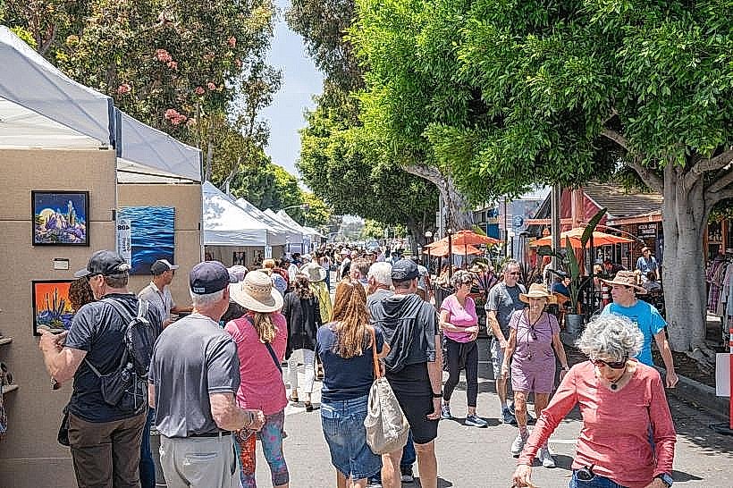
Culture & Social Norms
Tipping of 18–20% is standard. Social norms are a blend of industrial "oil patch" culture and outdoor tourism. Greetings are informal and direct. Dress code is "Industrial Casual," often involving high-visibility gear or western wear. Smoking is prohibited in public indoor spaces. Alcohol regulations follow New Mexico state law; Sunday sales begin at 11:00 AM.
Accommodation Zones
National Parks Highway (South): Stay here for proximity to the caverns, national hotel chains, and major dining options.
Riverside/Lake Carlsbad: Stay here for walking access to the Pecos River Park system and a quieter residential environment.
Local Cost Index
Espresso: $4.50
Standard Lunch: $16.00
Metro/Bus Ticket: $0.75
Nearby Day Trips
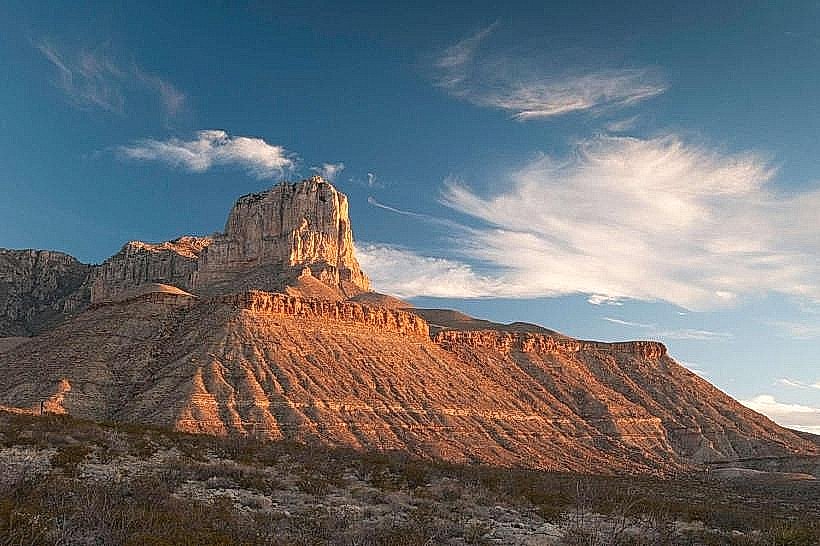
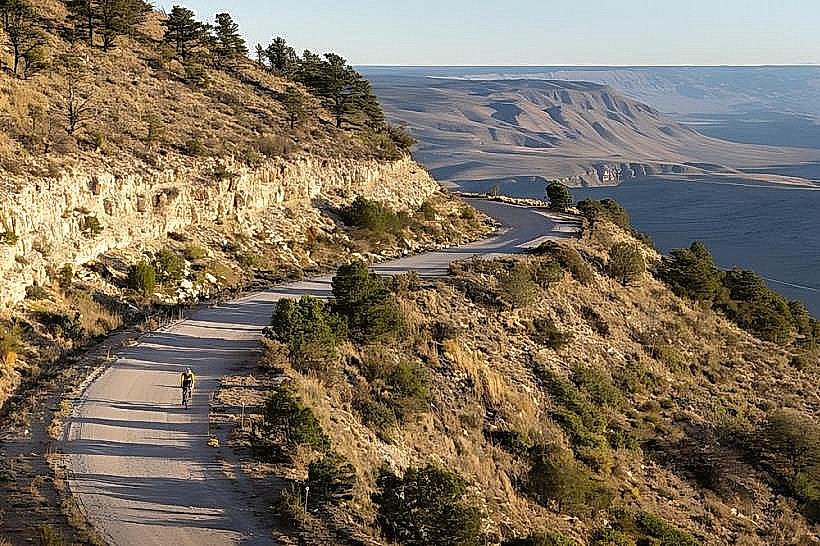
Guadalupe Mountains National Park: 85 km (55 mins)
Sitting Bull Falls: 70 km (1 hour)
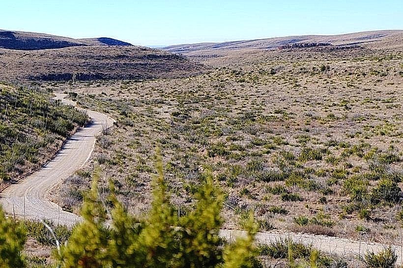
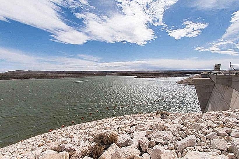
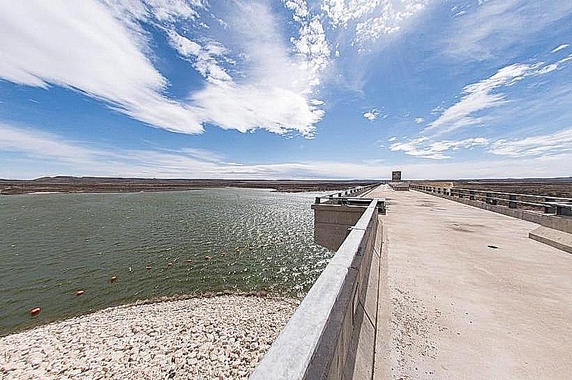
Brantley Lake State Park: 25 km (25 mins)
Roswell: 120 km (1.5 hours)
Facts & Legends
Carlsbad is home to the Waste Isolation Pilot Plant (WIPP), the nation’s only deep geologic repository for nuclear waste, located 655 meters underground in an ancient salt formation. A local historical oddity is the Pecos River Flume, an aqueduct originally built of wood in 1890 and later rebuilt in concrete; it was once the only place in the world where a river crossed over itself. Local legend also includes "The Cavern Giant," a supposed prehistoric occupant of the caves whose oversized footprints were claimed to be seen by early explorers.