Information
City: ChalatenangoCountry: El Salvador
Continent: North America
Chalatenango, El Salvador, North America
Chalatenango is a department and city in northern El Salvador, located 72 km from San Salvador. Known as "Chalate," it is the most mountainous region in the country and houses the highest point in El Salvador, Cerro El Pital.
Historical Timeline
The region was inhabited by the Lenca and Pipil people before the Spanish arrived in the 1500s. It was officially established as a department in 1855. During the Salvadoran Civil War (1980–1992), Chalatenango was a strategic stronghold for guerrilla forces and saw heavy combat, leading to significant displacement. Since the Peace Accords, the region has been repopulated and has shifted its economy toward high-altitude coffee production and ecotourism.
Demographics & Population
The department has a population of approximately 200,000. It is known for having a higher proportion of fair-skinned residents (of Spanish and Galician descent) compared to other parts of El Salvador. The population is predominantly rural (70%), with a median age of 29.1 years.
Urban Layout & Key Districts
Chalatenango consists of 33 districts, the most of any department in the country.
Chalatenango City: The departmental capital and administrative center.
La Palma: Famous for the colorful "naïf" art style pioneered by Fernando Llort and its artisan workshops.
San Ignacio: A high-altitude agricultural hub serving as the base for mountain trekking.
Nueva Concepción: A major commercial and livestock center in the flatter, western part of the department.
Top City Landmarks
Cerro El Pital: At 2,730 meters, it is the highest peak in El Salvador. It is famous for being the only place in the country that experiences frost and occasional "snow" (hail).
Cathedral of San Juan Bautista: The central landmark of the capital city, known for its pristine white facade.
The Artisans of La Palma: A collection of workshops along the main street where the town’s signature wood and seed art is produced.
Cihuatán: One of the largest archaeological sites in the country, located on the border of Chalatenango and San Salvador departments.
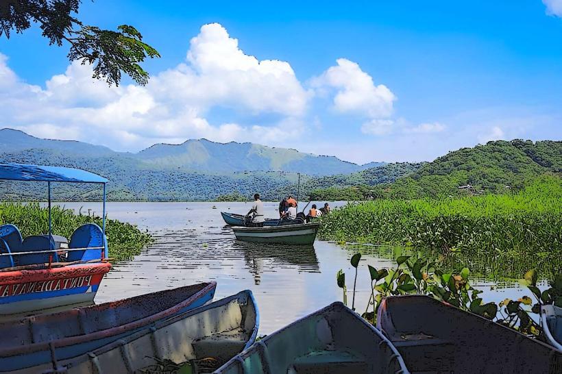
Sumpul River: A scenic river with high historical significance, now used for ecotourism and birdwatching.
Transportation Network
Northern Trunk Highway (Carretera Troncal del Norte): The primary artery connecting the department to San Salvador and the Honduran border (El Poy).
Public Transit: Route 125 connects the capital city to San Salvador. Mototaxis are the standard for short-distance travel within towns.
Road Conditions: While main highways are paved, many mountain roads leading to sites like El Pital are steep, narrow, and require high-clearance or 4WD vehicles.
Safety & Security
Current status is stable under the 2026 security protocols.
General Profile: Violent crime has decreased significantly. Chalatenango is considered one of the safer departments for travelers.
Precautions: Avoid driving mountain roads at night due to poor lighting and fog. When hiking near the Honduran border, it is recommended to stay on marked trails.
Digital & Financial Infrastructure
Internet: Average speeds of 30–50 Mbps in urban centers. Connectivity is spotty in high-mountain areas.
Finances: US Dollars and Bitcoin are legal tender. ATM access is concentrated in Chalatenango City, Nueva Concepción, and La Palma.
Bitcoin: Adoption is visible in tourist towns like San Ignacio and La Palma, though cash remains the primary medium for local markets.
Climate & Air Quality
Highlands (San Ignacio/La Palma): Cool temperate climate, ranging from 10°C to 22°C.
Lowlands (Chalatenango City): Tropical climate, ranging from 20°C to 33°C.
Air Quality: Excellent throughout the mountainous north due to forest cover and minimal industrial activity.
Culture & Social Norms
Naïf Art: The region’s identity is tied to the colorful wood-painted art depicting rural life.
Patron Saint Festival: The capital celebrates San Juan Bautista every June 24th.
Dining: Famous for Pupusas de Olocuilta (rice flour) and local high-altitude coffee.
Local Cost Index (USD)
1 Espresso (High-altitude bean): $2.75
1 Traditional Lunch: $4.50
1 Night in a Mountain Lodge: $45.00 – $80.00
Nearby Day Trips
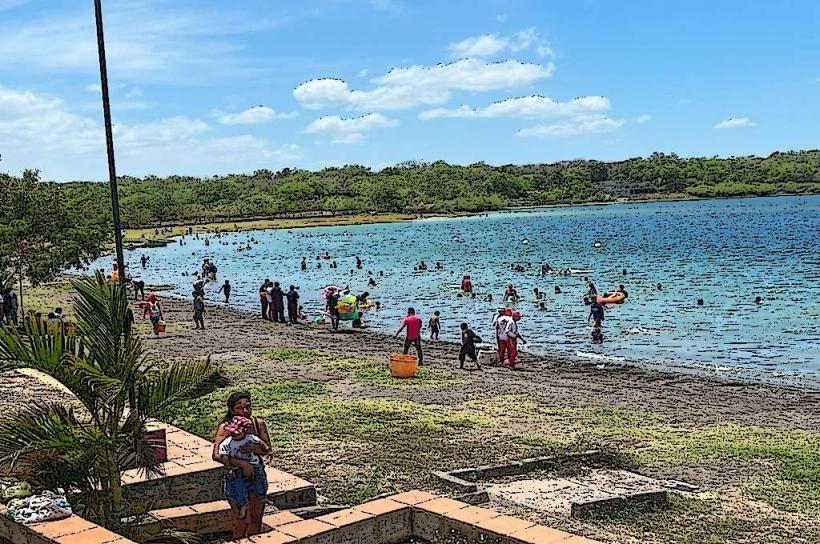
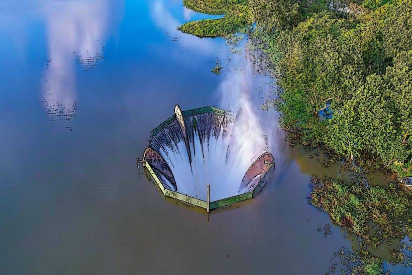
Cerrón Grande Dam (Lake Suchitlán): A massive reservoir for boat tours and birdwatching.
Miramundo: A mountain village known for its extremely cold climate and organic vegetable farms.
Citalá: A historic colonial town located right on the border with Honduras.
Facts & Legends
A verified historical oddity: Cerro El Pital once recorded a temperature of –6.1°C, the lowest ever recorded in El Salvador. A local legend tells of the "Siguanaba" appearing in the Tamulasco River, lureing men into the water before revealing her true form. Residents also claim that the "Golden Child" (El Cipitio) is frequently seen in the coffee plantations of San Ignacio, playing tricks on workers who leave their tools unattended.