Information
City: ChefchaouenCountry: Morocco
Continent: Africa
Chefchaouen, Morocco, Africa
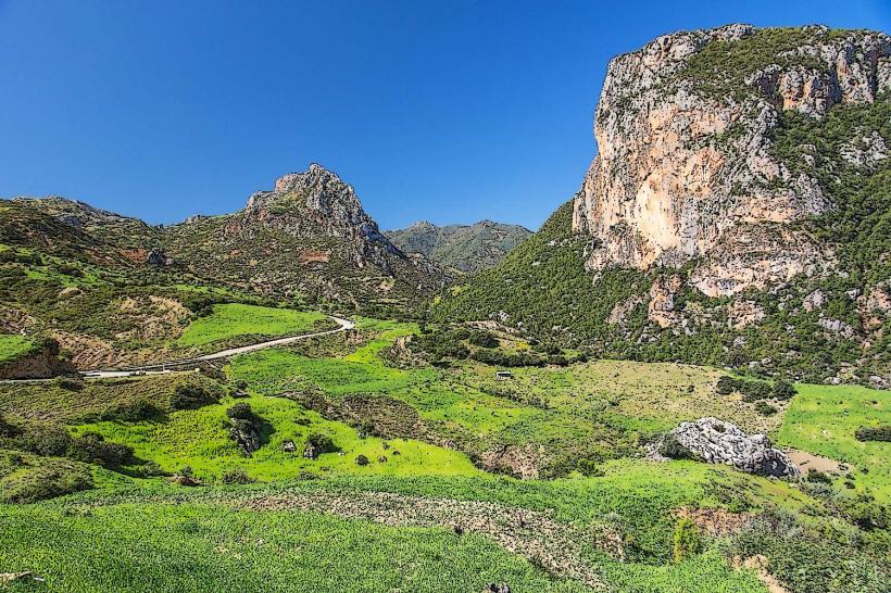
Chefchaouen is the provincial capital of the Tangier-Tétouan-Al Hoceima region, serving as a primary cultural landmark in northern Morocco. It is situated in the Rif Mountains, positioned between two horn-shaped peaks at an elevation of 564 meters.
Historical Timeline
The city was founded in 1471 by Moulay Ali Ben Moussa Ben Rached El Alami as a fortress (kasbah) to defend against Portuguese invasions. It served as a primary settlement for Moorish and Jewish refugees fleeing the Spanish Reconquista. The most significant architectural reconstruction occurred following the 1920 Spanish occupation, which integrated colonial administrative structures with the medieval core. The primary event shaping its current urban form was the mid-20th-century expansion of the "New City" down the mountain slope, distinct from the historic blue-washed Medina.
Demographics & Population
The estimated metropolitan population for 2026 is 46,200. The primary ethnic demographics are Ghomara Berbers (Imazighen) and Arabs. The median age is 28.6 years.
Urban Layout & Key Districts
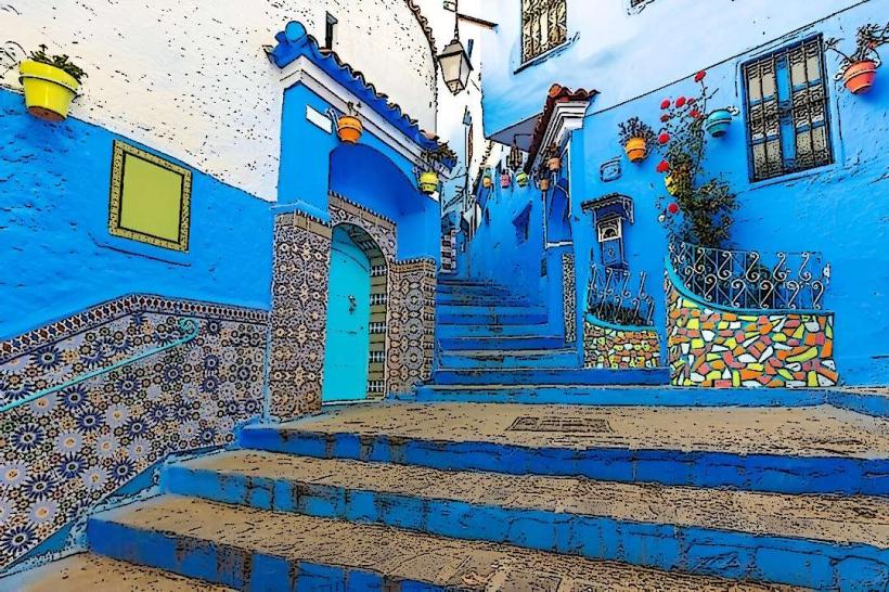
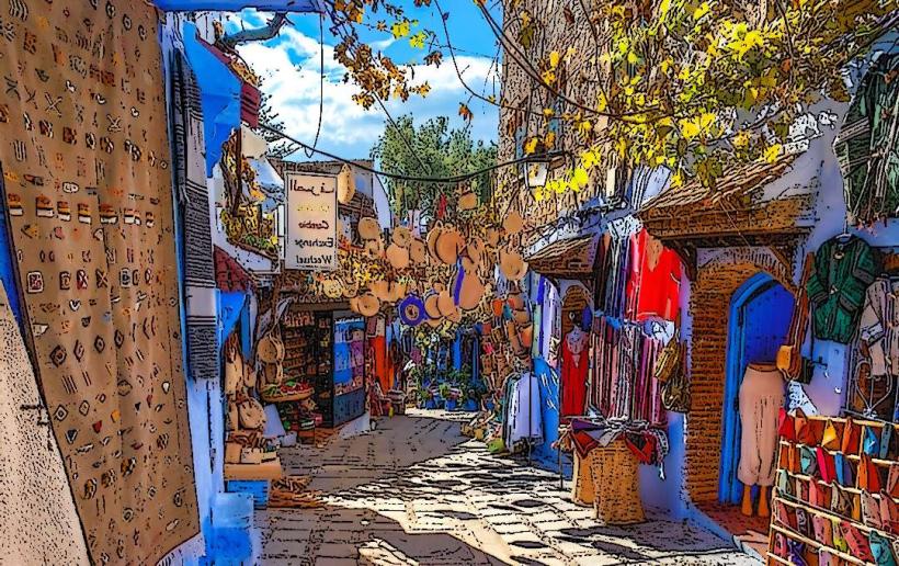
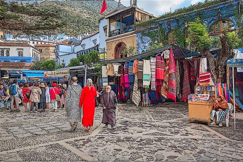
The city is organized on a steep incline. Key districts include the Medina (the historic blue-walled core to the east), the Kasbah (the fortified central square), and the Ville Nouvelle (the modern Spanish-built administrative area to the west). The city is oriented around the Outa el-Hammam square, with all major pedestrian traffic flowing toward the Ras el-Ma spring at the northeastern gate.
Top City Landmarks
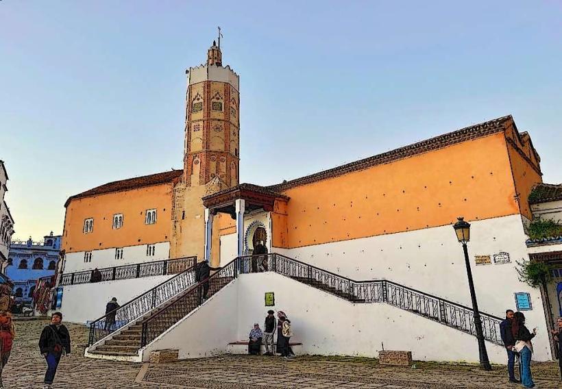
The Kasbah Museum (15th-century fortress and gardens)
Outa el-Hammam Square
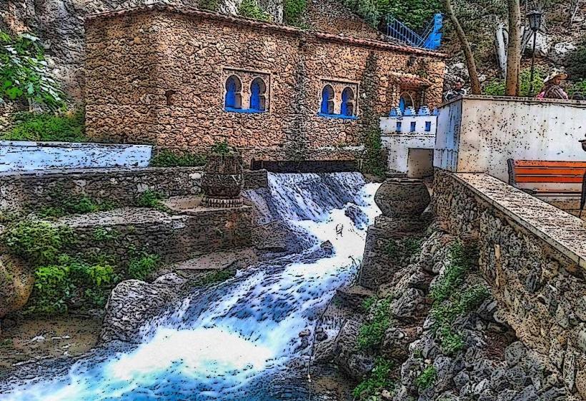
Ras el-Ma Spring
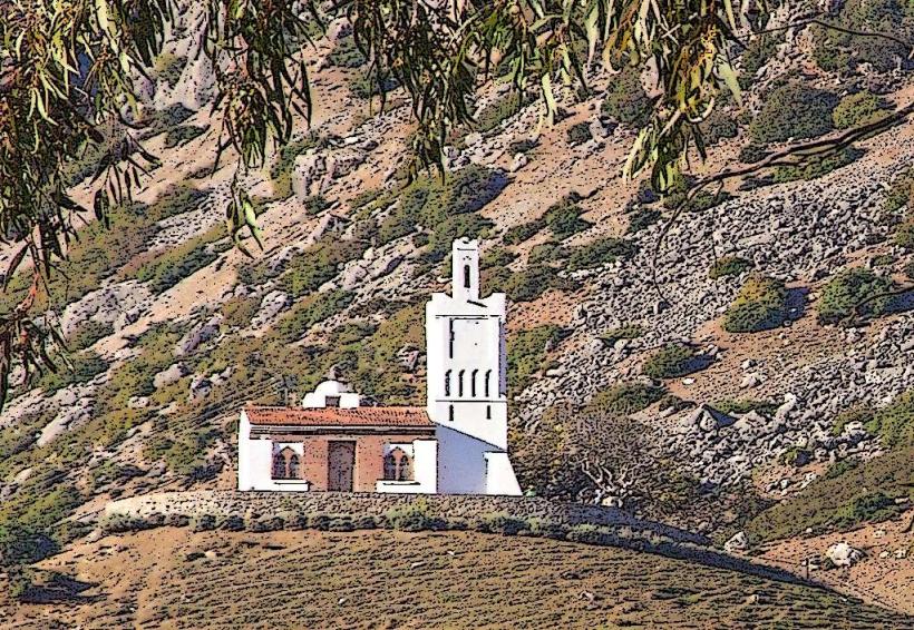
Spanish Mosque (Jemaa Bouzafar)
Bab el-Ain (The primary entrance to the Medina)
Transportation Network
Intra-city transit is restricted due to the mountainous terrain; the Medina is entirely pedestrian. Outside the walls, "Petit Taxis" (blue-colored hatchbacks) operate on fixed rates. There are no metro or tram systems. Inter-city CTM buses and "Grand Taxis" (white vehicles) operate from the main station located at the bottom of the hill. Traffic density is moderate but peaks during summer weekends at the city’s lower entry points.
Safety & "Red Zones"
The general safety level is high. Petty theft is rare compared to larger cities. Specific "red zones" involve the peripheral mountain trails where aggressive solicitation for cannabis (kif) tours is frequent; travelers should avoid unofficial guides in the hills north of the city. Common scams involve "closed road" claims to divert tourists into specific shops.
Digital & Financial Infrastructure
The average internet speed is 35-45 Mbps. Main mobile carriers are Maroc Telecom, Orange, and Inwi. Credit card acceptance is low, restricted to major hotels and upscale restaurants; cash (Dirham) is mandatory for souks and transport. ATMs are available primarily in the Ville Nouvelle and near Bab el-Ain.
Climate & Air Quality
Temperatures range from 3°C in winter nights to 35°C in summer. Air quality is excellent due to high elevation and lack of heavy industry. Significant weather risks include heavy rainfall and occasional snowfall between December and February, which can make the tiled Medina steps extremely slippery.
Culture & Social Norms
Tipping is expected at approximately 10% in cafes and restaurants. Handshakes are the standard greeting. Dress codes are conservative; modest attire is strictly expected in residential areas of the Medina. Public photography of locals without permission is often sensitive. Alcohol is extremely restricted, available only in a few specific licensed hotels and bars.
Accommodation Zones
Medina: Recommended for traditional Riad stays and proximity to historic sites.
Ville Nouvelle: Recommended for vehicle accessibility and larger, modern hotel facilities.
Local Cost Index
1 Espresso: 12 MAD ($1.20 USD)
1 Standard Lunch (Goat Cheese Salad/Tagine): 65 MAD ($6.50 USD)
1 Petit Taxi Trip: 15 MAD ($1.50 USD)
Nearby Day Trips
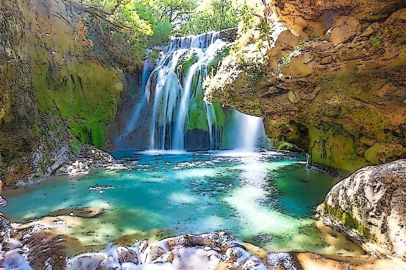
Akchour Waterfalls / God's Bridge: 30 km
Talasemtane National Park: 5 km (Trailhead access)
Tetouan: 65 km
Oued Laou (Coastal town): 55 km
Facts & Legends
The city is famous for its blue-washed buildings, a tradition introduced by Jewish refugees in the 1930s to symbolize the sky and heaven. A local historical oddity is that the city was closed to all non-Muslims on pain of death for nearly four centuries, from its founding until the Spanish arrival in 1920; it is said that only three Europeans successfully entered the city in disguise during that entire period.