Information
City: EscalanteCountry: USA Utah
Continent: North America
Escalante, USA Utah, North America
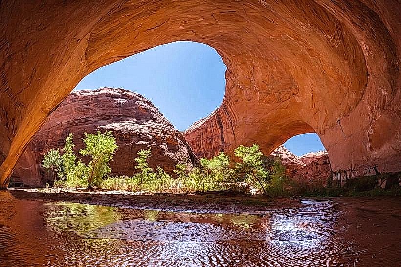
Escalante is a remote municipality in Garfield County, situated on the edge of the 1.9-million-acre Grand Staircase-Escalante National Monument (GSENM). Positioned along Scenic Byway 12, it is the primary basecamp for the most rugged slot canyons and backcountry adventures in the Colorado Plateau.
Historical Timeline
The area was named after Silvestre Vélez de Escalante, a Spanish Franciscan missionary who explored the region in 1776. Mormon pioneers from Panguitch settled the town in 1876, establishing an agrarian community based on cattle ranching and timber. The city’s economy was strictly agricultural until the 1996 designation of GSENM by President Bill Clinton, which triggered a controversial but rapid transition into a tourism and outdoor recreation hub.
Demographics & Population
The 2026 projected population is 822. The community is notable for its high median age of 59.8 years, nearly double the Utah state average. The racial composition is White (96.2%) and Two or More Races (3.8%).
Urban Layout & Key Districts
The Main Street Corridor (UT-12): The singular commercial vein containing the city’s outfitters, grocery stores, and the Interagency Visitor Center.
Historic Residential Core: Features approximately 95 original brick pioneer homes and barns still in use.
Escalante River District (East): The lush riparian zone providing immediate access to river walks and lower canyon trailheads.
Top City Landmarks
Grand Staircase-Escalante National Monument: A vast wilderness of multi-colored cliffs and plateaus.
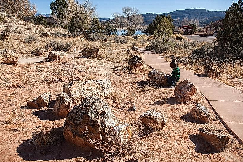
Escalante Petrified Forest State Park: Features a reservoir for fishing and trails through massive deposits of fossilized wood.
Hole-in-the-Rock Heritage Center: A museum dedicated to the 1879 pioneer expedition that carved a road through the desert.
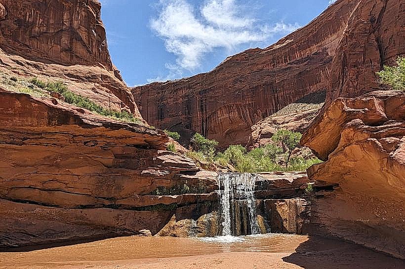
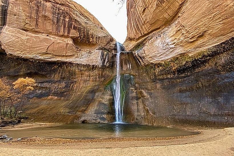
Lower Calf Creek Falls: A 39-meter waterfall and desert oasis located 24 kilometers northeast of town.
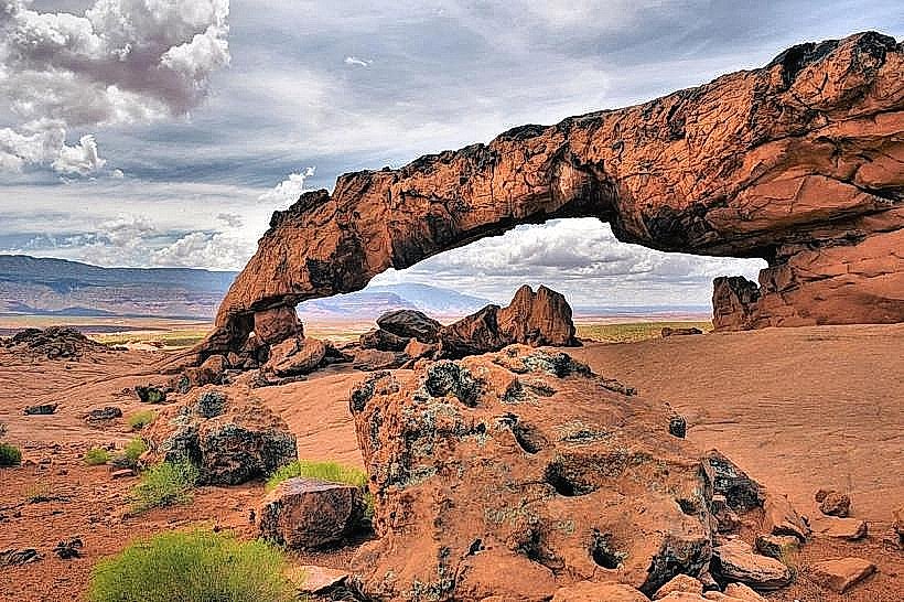
Devils Garden: A family-friendly area of arches and hoodoos located 19 kilometers down Hole-in-the-Rock Road.
Transportation Network
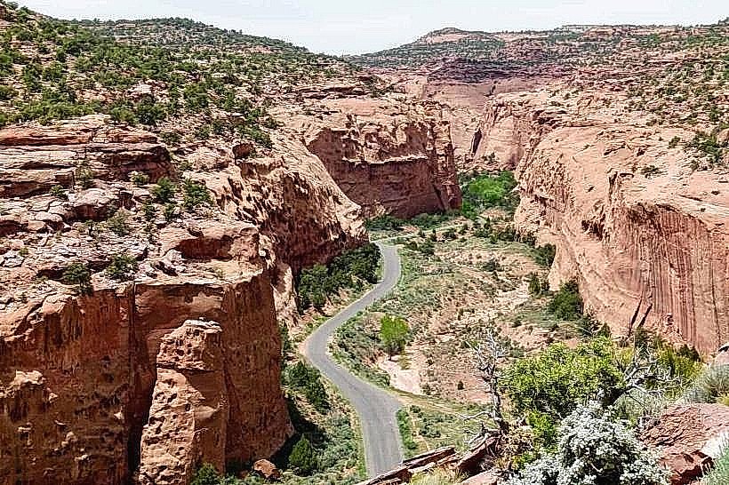
Movement is exclusively automotive via Scenic Byway 12. There is no public transit or regional bus service. The town serves as the terminus for Hole-in-the-Rock Road, a 100-kilometer unpaved route that provides access to most major slot canyons. High-clearance 4WD vehicles are strongly recommended for any travel off the main highway. The closest commercial airport is in Cedar City (230 km) or Salt Lake City (480 km).
Safety & "Red Zones"
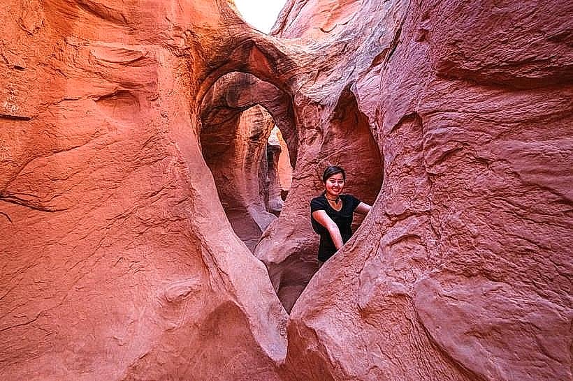
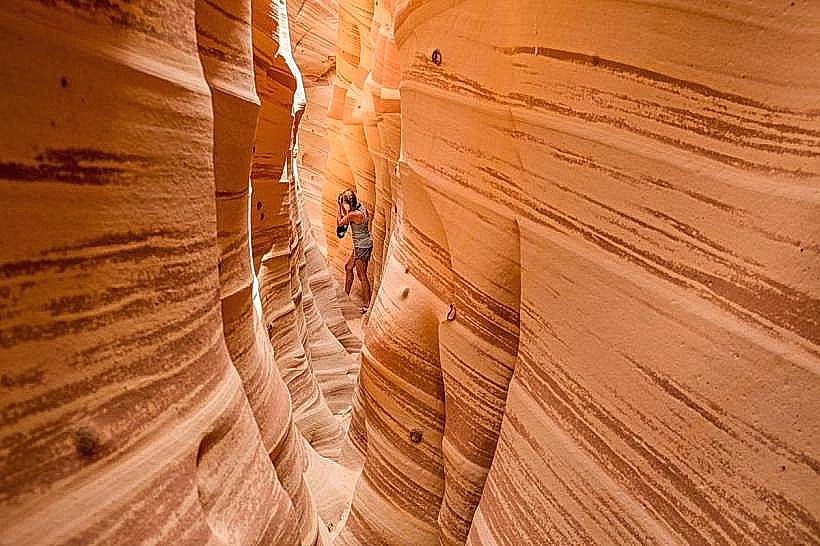
The general safety level within the town is high. The primary risks are environmental and extreme. Flash flooding in slot canyons is the leading cause of fatalities; canyons like Spooky and Peek-a-boo can flood from storms occurring 50 kilometers away. Cellular service is non-existent once you leave the city limits. Standard wilderness survival gear (extra water, maps, shovel) is required for all backcountry travel.
Digital & Financial Infrastructure
Average internet speed is 100–300 Mbps, with fiber optic services provided by South Central Communications. Mobile coverage is reliable in the town center but fails immediately upon entering the National Monument. Card acceptance is universal at established businesses. ATMs are located at the Sinclair station and within local lodges.
Climate & Air Quality
Temperatures range from -9°C to 5°C in winter (January) and 18°C to 35°C in summer (July). The area is arid, receiving only 25 centimeters of precipitation annually. Air quality is exceptionally high, though summer wildfire smoke can occasionally impact visibility.
Culture & Social Norms
The standard tipping rate is 18–20%. The culture is characterized by a "Frontier-Bohemian" mix: traditional cattle ranchers live alongside professional outdoor guides and artists. Dress code is "Technical Rugged"-heavy-duty hiking gear is standard attire in all settings. Escalante is an International Dark Sky Community; residents expect visitors to minimize light pollution at night.
Accommodation Zones
Main Street: Stay at Escalante Outfitters or the Circle of Destination Inn for central access to services.
Wilderness Perimeter: Stay at Escalante Escapes (luxury tiny homes) for immediate canyon access and stargazing.
Local Cost Index
1 Espresso: $4.50
1 Standard Lunch: $17.50
1 Gallon of Fuel: $0.40–$0.60 above state average due to remoteness.
Nearby Day Trips
Peek-a-boo and Spooky Slot Canyons: (45 km via Hole-in-the-Rock Road)
Zebra Slot Canyon: (13 km via Hole-in-the-Rock Road)
Boulder, UT: (45 km - Home to Hell’s Backbone Grill)
Kodachrome Basin State Park: (60 km)
Facts & Legends
Escalante is one of the most remote towns in the contiguous United States; it was the last place in the lower 48 to receive mail via pack mule (until 1940). A local legend involves the "Escalante Petrified Wood Curse," where dozens of visitors annually mail back stolen pieces of fossilized wood, claiming they have suffered immense bad luck since taking them. A verified historical oddity is that the town’s name was suggested by members of John Wesley Powell’s second expedition, who were surveying the area while the first Mormon settlers were arriving.