Information
City: FierCountry: Albania
Continent: Europe
Fier, Albania, Europe
Fier functions as the primary energy and agricultural pivot of southwestern Albania and serves as the administrative seat of Fier County. Situated on the Myzeqe plain, it serves as a specialized node for petroleum extraction, agro-industrial logistics, and classical archaeology. It is defined by its strategic proximity to the ancient city of Apollonia, its role as the center of Albania's oil industry, and its recent 2026 infrastructure integration into the "Blue Corridor" highway network.
Historical Timeline
Fier is a relatively modern city, established in 1864 by the Kahraman Pasha Vrioni family as a market center.
Classical Era: The region was dominated by Apollonia (600 BC), one of the most important Greek/Roman poleis in Illyria.
19th–20th Century: Developed as a commercial hub for the fertile Myzeqe plain; transformed into an industrial center during the communist era due to the nearby Patos-Marinëza oil fields.
2026 Context: The city has transitioned from a purely industrial town into a regional logistics hub, following the completion of the Lekaj–Konjat–Fier segment of the Adriatic-Ionian Highway (Blue Corridor).
Demographics & Population
The municipality population is approximately 112,000 (2026 estimate), while the county remains the second most populous in Albania with roughly 312,000 residents. The demographic profile is specialized toward petroleum engineering, large-scale agriculture, and transit services. Unlike the mountainous north, Fier's population is highly integrated, with a history of hosting diverse communities from all regions of Albania who migrated for industrial work.
Urban Layout & Key Districts
Fier is organized around a central axis defined by the Gjanica River, which has undergone radical environmental restoration.
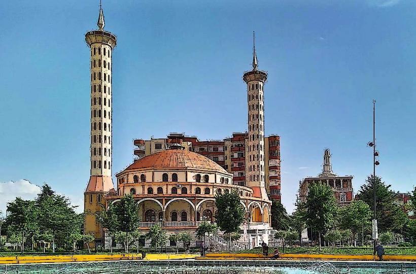
City Center: A specialized modern core featuring the Theater of Bylis and the Gjanica riverwalk, recently reclaimed from industrial pollution.
Apollonia District: A specialized archaeological zone located 12 km west of the center near the village of Pojan.
Lushnje Road Axis: The specialized industrial and retail corridor connecting Fier to the northern plains.
Darëzeza & Seman: Specialized coastal districts 15–20 km from the center, known for their high-iodine "healing" sand and kite-surfing conditions.
Top City Landmarks
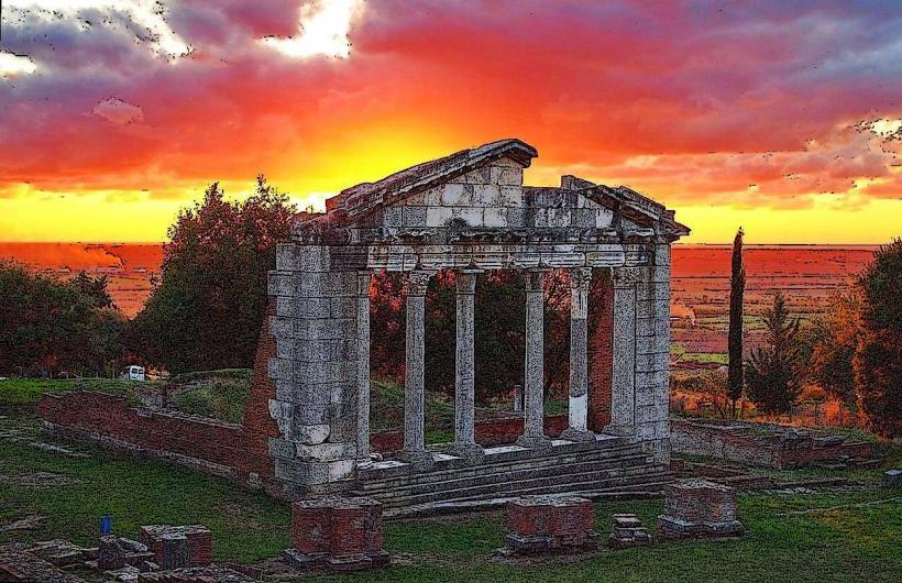
Apollonia Archaeological Park: A specialized 81-hectare site featuring the Monument of Agonothetes, a 2nd-century BC theater, and a library where the future Emperor Augustus once studied.
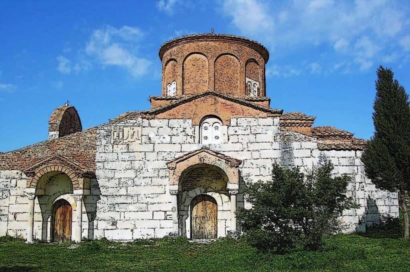
Monastery of Saint Mary (Pojan): A specialized 13th-century Byzantine site located within the Apollonia park, featuring rare 14th-century frescoes and a refectory.
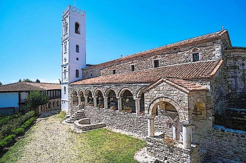
Ardenica Monastery: A specialized 13th-century Orthodox complex 15 km north, famous as the site where Skanderbeg married Donika Kastrioti in 1451.
History Museum of Fier: A specialized institution documenting the city's rapid evolution from a 19th-century market to an oil-industry capital.
Gjanica Riverwalk: A specialized 2026 urban park project that has transformed the previously contaminated riverbed into a central pedestrian green space.
Transportation & 2026 Logistics
Fier is the most important road junction in Southern Albania.
Blue Corridor (2026): The completion of the Lekaj–Fier highway segment has reduced transit time to Tirana to under 65 minutes and Durrës to 45 minutes.
Regional Hub: Serves as the primary transit point for all traffic moving toward Vlorë (south) and Gjirokastër (southeast).
Rail: Part of the specialized 2026 rail modernization plan to link the industrial zones of Fier back to the Port of Durrës and Porto Romano.
Safety & Environment
The general safety level is high. Fier is statistically secure and characterized by a pragmatic, trade-oriented social atmosphere. Warning: The Patos-Marinëza oil zone remains an environmental concern due to historical ground pollution, though 2026 regulations have tightened emission standards. The coastal areas of Seman and Darëzeza are prone to rapid erosion; specialized breakwaters and artificial dunes were implemented in 2025-2026 to protect the shoreline.
Local Cost Index (2026 Estimates)
1 Espresso: 70 – 110 ALL
1 Portion of Grilled Qofte: 350 – 600 ALL
Apollonia Entry Fee: 600 ALL
Monthly Rent (1-BR Center): 20,000 – 35,000 ALL
Nearby Day Trips
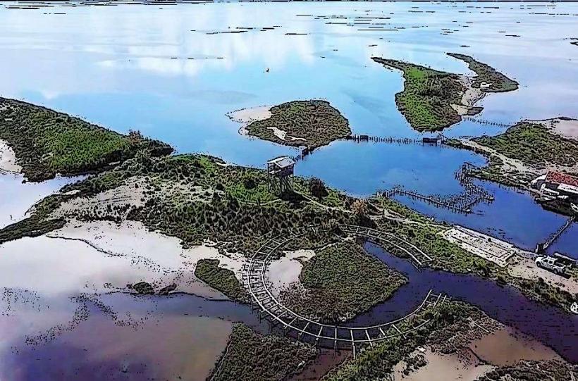
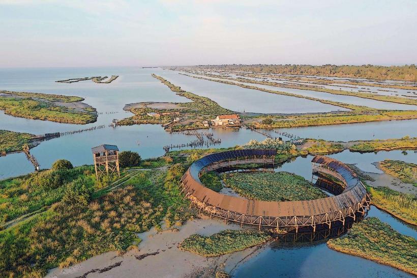
Karavasta Lagoon: 30 mins away; a specialized RAMSAR wetland site home to the rare Dalmatian Pelican and extensive pine forests.
Byllis Archaeological Site: 40 mins away; a specialized hilltop Illyrian-Roman city offering panoramic views over the Vjosa River valley.
Narta Lagoon: 30 mins away; a specialized salt-production site and flamingos habitat near Vlorë.
Facts & Legends
Fier is the site of the world's first documented school of rhetoric and philosophy to host a future Roman Emperor (Augustus). Legend states that the city's name comes from the Italian word fiera (market), referring to the massive trade fairs organized by the Vrioni family. A verified fact is that Fier’s Darëzeza beach has the highest concentration of iodine in the Adriatic, making it a specialized destination for therapeutic "sand baths." Historically, Fier was the primary laboratory for Albania’s agricultural modernization during the 1960s, turning the Myzeqe marshes into the "Breadbasket of Albania."