Information
City: FitchburgCountry: USA Massachusetts
Continent: North America
Fitchburg, USA Massachusetts, North America
Fitchburg is an independent city and a seat of Worcester County, situated along the Nashua River in North Central Massachusetts. It is a historic industrial center, defined by its "Gate City" identity, its steep "Hill City" topography, and its 21st-century evolution as a center for regional education and the creative economy.
Historical Timeline
Inhabited by the Nipmuc and Pennacook peoples for millennia. Primary governance eras include its 1764 founding and its 1872 incorporation as a city. A critical historical event was the 19th-century expansion of the paper and textile industries, powered by the Nashua River, which established Fitchburg as one of the state's most productive manufacturing hubs. The mid-20th century was defined by industrial decline, while the late 20th and early 21st centuries have been characterized by the growth of Fitchburg State University and a shift toward transit-oriented revitalization.
Demographics & Population
The population is approximately 41,500. The demographics are White (62%), Hispanic or Latino (28%), Black or African American (5%), and Asian (4%). It is a diverse, working-class community with a high density of multi-family "triple-decker" housing and a significant student population.
Urban Layout & Key Districts
Fitchburg is noted for its dramatic elevation changes and a layout centered on the river valley.
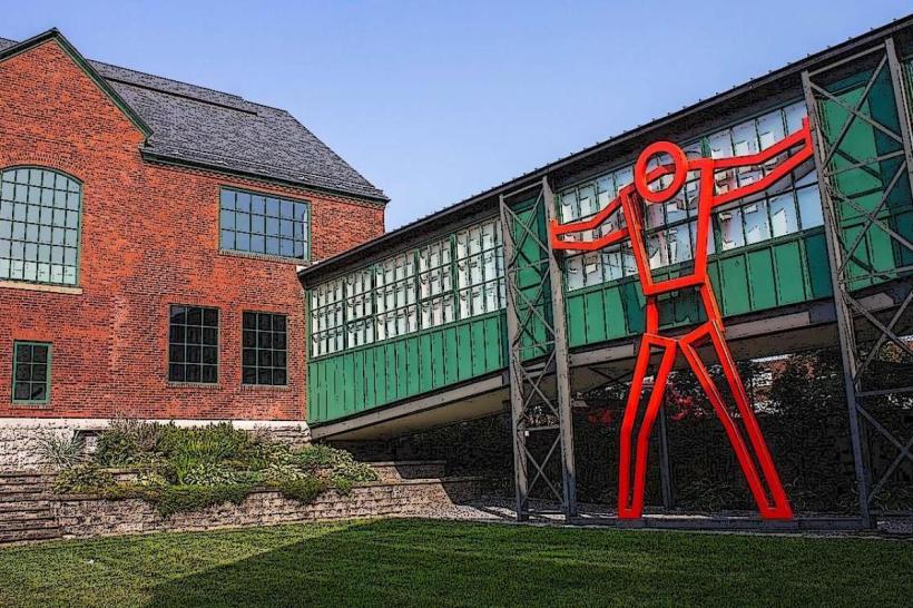
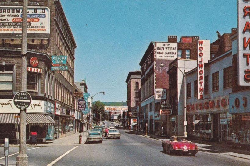
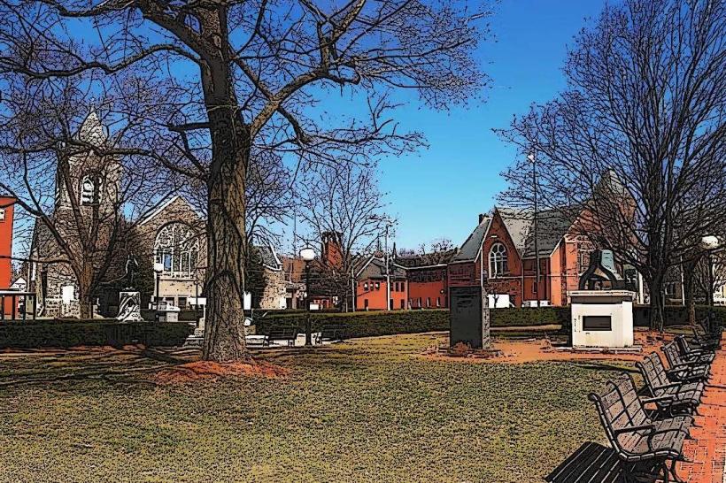
Downtown / Main Street: The commercial and civic core, featuring historic brick architecture, the Fitchburg Art Museum, and the intermodal transit center.
Upper Common: A historic residential and institutional district housing the university and many Gilded Age mansions.
Cleghorn: A historically French-Canadian neighborhood in the western sector, characterized by dense residential blocks and independent retail.
South Fitchburg: A mixed-use district bordering Leominster, housing larger commercial plazas and industrial sites.
Waites Corner: A more rural, residential area on the northern and western outskirts.
Top City Landmarks
Fitchburg Art Museum: One of the most significant regional museums in New England, featuring Egyptian antiquities and American art.
Fitchburg State University: A major educational institution whose campus is integrated into the city’s historic fabric.
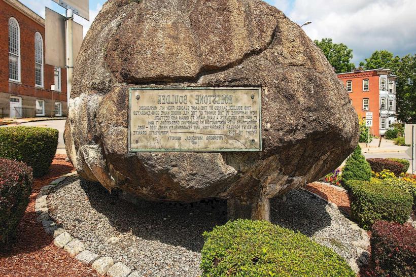
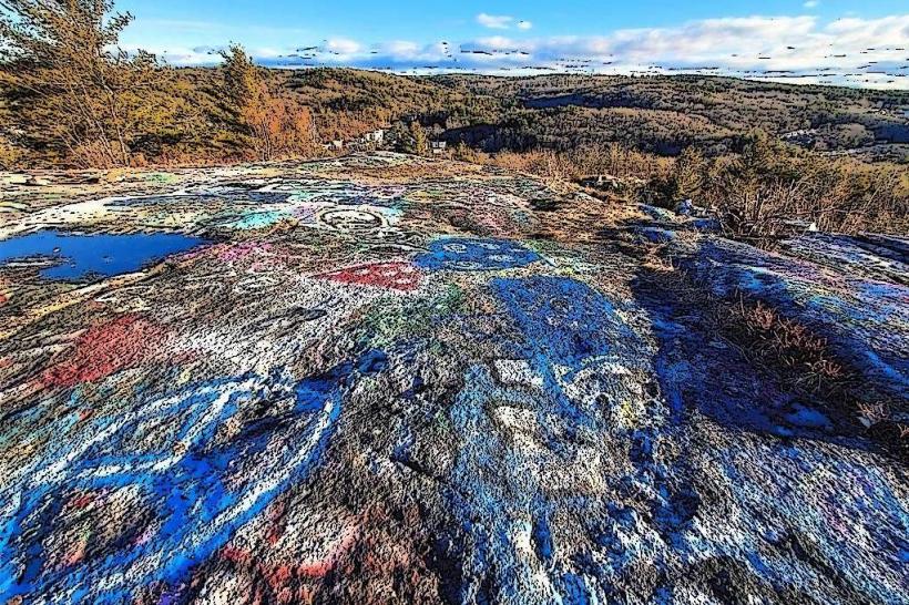
Rollstone Hill: A massive granite hill overlooking the city, formerly a quarry and home to the iconic "Rollstone Boulder" (now moved to the downtown).
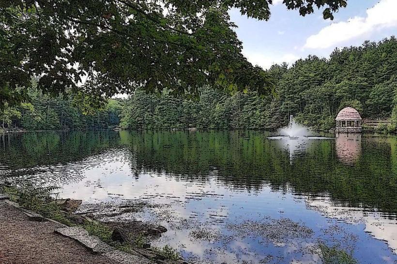
Coggshall Park: A 212-acre Victorian-era park featuring a mirror lake, stone gazebos, and extensive hiking trails.
Fitchburg Military Museum: Documenting the city’s extensive role in American military history.
The Longsjo Classic: A professional bicycle race (the second oldest in the U.S.) held annually on the city streets.
Transportation Network
Movement is serviced by the MART (bus system) and the MBTA Commuter Rail (Fitchburg Line), which terminates in the city and provides direct access to Boston. The city is the junction of Route 2, Route 12, and Route 31. Commercial air service is via Logan International (BOS) or Worcester Regional (ORH). Ride-sharing is universal. Traffic is light, but navigation is complicated by extremely steep grades and a one-way street system in the downtown core.
Safety & "Red Zones"
The general safety level is moderate. Property crime and narcotics-related activity are the primary issues. Caution is advised at night in parts of the Lower Cleghorn neighborhood and specific blocks in the Patch area due to higher rates of localized violent crime. There are no officially designated "red zones." Environmental hazards include severe winter road conditions on the city’s hills and the potential for flash flooding along the Nashua River.
Digital & Financial Infrastructure
Internet speeds average 400+ Mbps with fiber availability via Xfinity and Verizon Fios. Main mobile carriers are Verizon and AT&T. Card acceptance is universal in commercial hubs. ATMs are concentrated on Main Street and in the South Fitchburg retail corridors.
Climate & Air Quality
Temperatures range from -8°C to 1°C in winter and 16°C to 28°C in summer. Due to its higher elevation and valley location, it often experiences colder temperatures and higher snow totals than the Boston coastal plain. Air quality is high, benefiting from surrounding forest cover.
Culture & Social Norms
The standard tipping percentage is 18–25%. A handshake is the standard greeting. Dress codes are "Urban-Pragmatic" or "Academic." The city is culturally defined by its "Gate City" resilience, its strong Franco-American and Latino influences, and its identity as a gritty, authentic alternative to the more affluent sectors of Middlesex County.
Accommodation Zones
Main Street / University Area: Recommended for proximity to campus and the art museum.
Route 2 / South Fitchburg: Recommended for standard national hotel chains and easier highway access.
Local Cost Index
1 Espresso: $4.25 (USD)
1 Standard Lunch: $16.00 (USD)
1 Commuter Rail Fare (to Boston): $12.25 (Single).
Nearby Day Trips
Wachusett Mountain: (15 km south; skiing and hiking).
Mount Watatic: (15 km north; popular hiking peak).
Great Wolf Lodge: (10 km south in Fitchburg/Leominster line).
Facts & Legends
Fitchburg was once a world leader in the production of steam engines and saws. Historically, it was a major stop on the Underground Railroad. A local legend involves the "Rollstone Boulder," a 110-ton glacial erratic that sat atop Rollstone Hill for millennia before being blasted apart and reassembled downtown in the 1920s to prevent it from falling into a quarry. Another legend concerns the "Secret Industrial Tunnels," rumored subterranean passages used to move goods between 19th-century mill buildings.