Information
City: Guatemala CityCountry: Guatemala
Continent: North America
Guatemala City, Guatemala, North America
Guatemala City is the national capital and primary economic engine of Guatemala. Situated in the Valle de la Ermita in the south-central highlands, it serves as the political, cultural, and financial heart of the country and the most populous urban center in Central America.
Historical Timeline
Guatemala City was founded in 1776 as the third royal capital of the Captaincy General of Guatemala. This followed the catastrophic Santa Marta earthquakes in 1773, which decimated the previous capital, Antigua Guatemala. The move was a strategic shift to a more stable geologic location. The city was the site of the Act of Independence of Central America in 1821 and served as the capital of the Federal Republic of Central America until its dissolution. Modern urban expansion was largely dictated by the earthquakes of 1917–1918, which forced a massive reconstruction of the city center in the early 20th century.
Demographics & Population
The city proper has a population of approximately 1.2 million, while the Metropolitan Area exceeds 3.2 million. The primary ethnic demographics are Ladino (91.3%), Mayan (7.1%), and other minorities including European and East Asian (1.6%). The median age of the population is approximately 26.4 years.
Urban Layout & Key Districts
The city is organized into 25 numerical Zones arranged in a clockwise spiral.
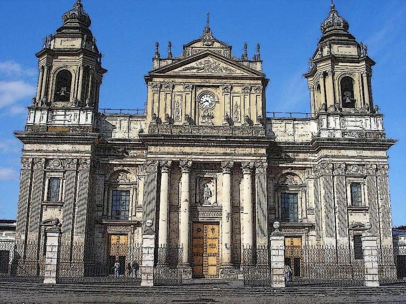
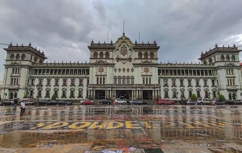
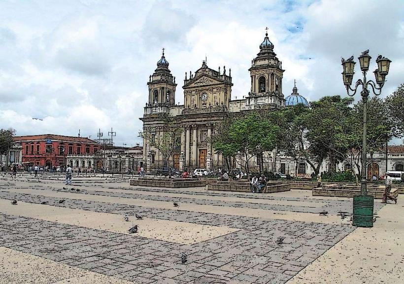
Zone 1 (Centro Histórico): The colonial heart, containing the National Palace and Cathedral.
Zone 4 (Cuatro Grados Norte): A revitalized, pedestrian-friendly district focused on technology, cafes, and creative industries.
Zone 10 (Zona Viva): The primary commercial and hospitality hub, featuring high-end hotels, malls, and corporate offices.
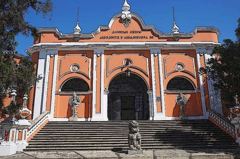
Zone 13: A quieter district housing the international airport and major national museums.
Zone 16 (Paseo Cayalá): A massive, private neo-urbanist development mimicking a European town, used for high-end dining and shopping.
Top City Landmarks
Palacio Nacional de la Cultura: The former seat of government, known for its green stone architecture and ornate murals.
Catedral Metropolitana: A landmark of neoclassical architecture on the central plaza.
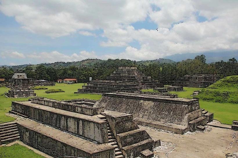
Kaminaljuyu: The ruins of a major Pre-Columbian Maya city located within the modern urban limits.
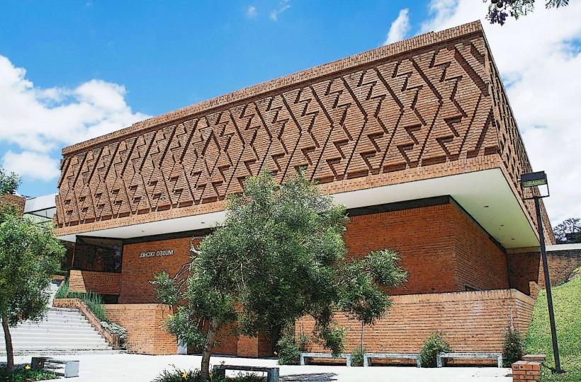
Museo Popol Vuh: Houses one of the world's most significant collections of Maya pottery and artifacts.
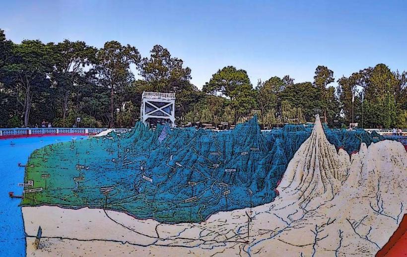
Mapa en Relieve: A giant 1905 outdoor relief map showing the entire topography of Guatemala.
Transportation Network
Public transit is dominated by the Transmetro, a Bus Rapid Transit (BRT) system. There is no heavy rail or underground metro. For short-distance transit, red city buses and "chicken buses" (repurposed US school buses) operate extensively but are high-risk for crime. Uber is the most reliable and safest transit method for visitors. Traffic density is extreme, particularly on the Calzada Roosevelt and Carretera a El Salvador during the 6:00 AM – 9:00 AM and 4:30 PM – 8:00 PM peak windows.
Safety & "Red Zones"
The general safety level is low. Explicit "Red Zones" to avoid include Zones 3, 5, 6, 7, 18, and 21. Visitors should exercise high caution in Zone 1 after dark. Common scams include "express kidnapping" at unverified ATMs and pickpocketing in crowded markets like Mercado Central. It is advised to avoid walking between zones; utilize verified vehicle transport for all movements.
Digital & Financial Infrastructure
Average internet speed is 60 Mbps via fiber-optic providers. Main mobile carriers are Tigo and Claro. Credit and debit cards (Visa/Mastercard) are accepted at almost all establishments in Zones 4, 10, 14, and 16. ATMs are ubiquitous in shopping malls and major hotels; avoid street-side ATMs due to card-skimming risks.
Climate & Air Quality
Guatemala City is known as the "Land of Eternal Spring." Temperatures range from 13°C (night) to 26°C (day) year-round. The rainy season runs from May to October, with risks of localized flooding and landslides in the canyon areas (barrancos). Air quality is often poor in the city center due to heavy diesel emissions and the valley's tendency to trap smog.
Culture & Social Norms
Tipping of 10% is standard and often pre-included in restaurant bills. Greetings are formal; "Buenos días" and "Mucho gusto" are expected. Dress code in business districts (Zones 10 and 14) is conservative and professional. Smoking is legally prohibited in all enclosed public spaces. Alcohol sales are restricted after 1:00 AM (Ley Seca).
Accommodation Zones
Zone 10 (Zona Viva): Best for logistics, safety, and proximity to high-end dining.
Zone 4: Best for a younger, artistic atmosphere and walkable access to local craft beer and coffee.
Zone 16: Best for a secluded, highly secured, and quiet suburban experience.
Local Cost Index
1 Espresso: Q24.00 ($3.10)
1 Inexpensive Lunch: Q45.00 ($5.80)
1 Transmetro Ticket: Q1.00 ($0.13)
Nearby Day Trips
Antigua Guatemala: 40 km (1–1.5 hours)
Pacaya Volcano: 50 km (1.5–2 hours)
Iximché Ruins: 80 km (2 hours)
Lake Atitlán: 120 km (3.5 hours - borderline for a single day trip)
Facts & Legends
A prominent urban legend is that of "El Sombrerón," a short man in a large hat who braids the manes of horses and the hair of beautiful women at night. A historical oddity: the National Palace (Palacio Nacional) features a "Gold Nut" in the floor of the central hall, marking "Kilometer Zero" from which all road distances in the country are measured. Local myth also persists that a complex network of colonial tunnels connects the Metropolitan Cathedral to various secret government buildings under Zone 1.