Information
City: HaysCountry: USA Kansas
Continent: North America
Hays, USA Kansas, North America
Hays serves as the primary economic and cultural hub for Northwest Kansas and is the seat of Ellis County. It is located at the intersection of Interstate 70 and U.S. Route 183, approximately halfway between Kansas City and Denver.
Historical Timeline
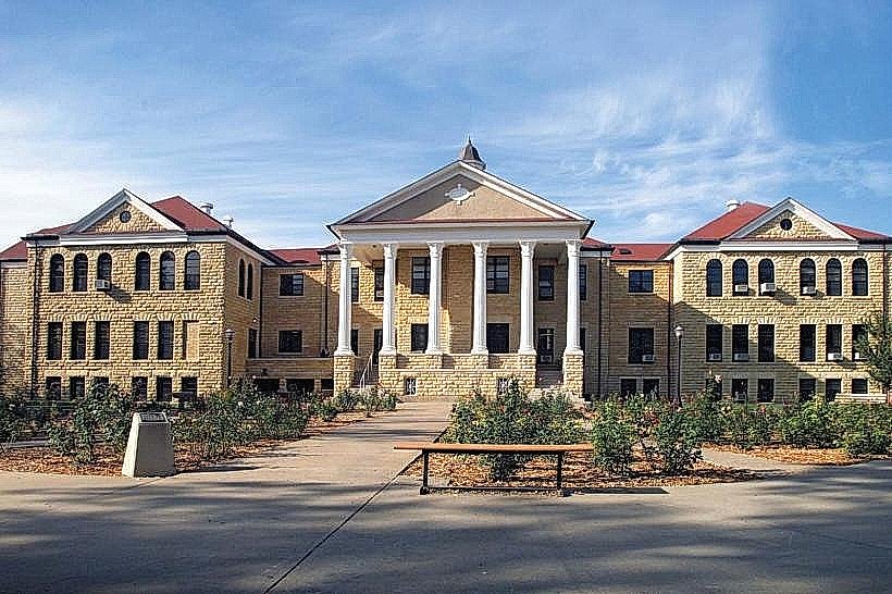
Founded in 1867 as Hays City, the town grew around Fort Hays (originally Fort Fletcher, established 1865) to serve the Kansas Pacific Railway. It was platted by the Big Creek Land Company and incorporated in 1885. The most significant architectural reconstruction followed a disastrous fire in 1895 that destroyed 60 downtown businesses. The primary event shaping the modern urban form was the 1889 closure of the military reservation, which led to the 1902 founding of Fort Hays State University on the former fort lands.
Demographics & Population
The 2026 estimated population within city limits is 21,213. The primary ethnic demographics are White (89.9%), Two or More Races (4.4%), and Hispanic (unspecified % in census but noted as a growing demographic). The median age is 30.2 years, heavily weighted by the university student population.
Urban Layout & Key Districts
The city is organized on a north-south grid divided by the Union Pacific railroad tracks. The Chestnut Street District (Central) serves as the historic downtown commercial core. The University District (Southwest) contains Fort Hays State University, while the North Vine Corridor (North) functions as the primary modern retail and hotel district.
Top City Landmarks
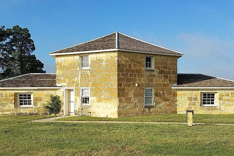
Fort Hays State Historic Site
Sternberg Museum of Natural History
The Basilica of St. Fidelis (Cathedral of the Plains - nearby Victoria)
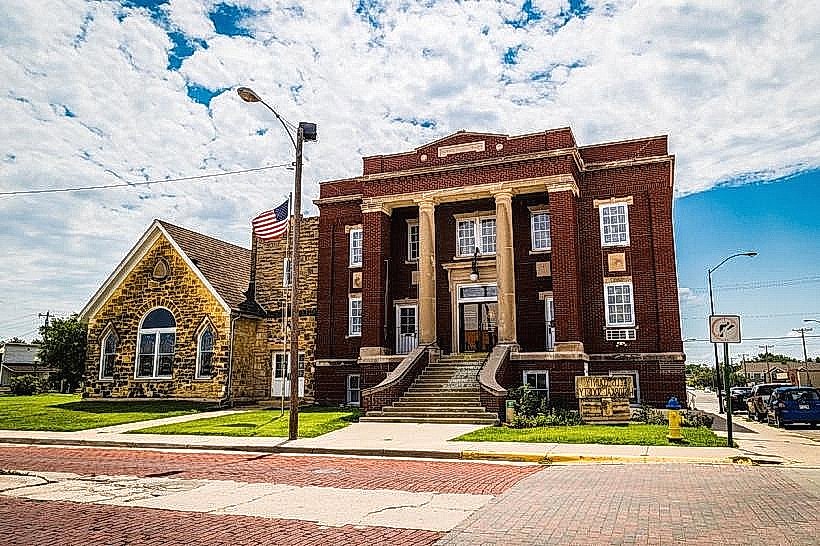
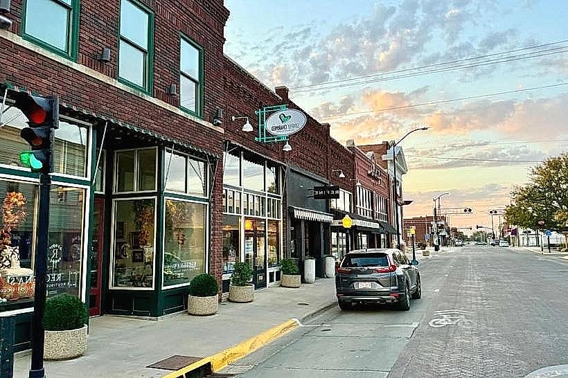
Chestnut Street Historic District
Ellis County Historical Society Museum
Transportation Network
Internal movement is served by Access Transit, providing demand-response bus services throughout the city. Ride-sharing via Uber and Lyft is the primary alternative for point-to-point transit. Official taxis are dispatched by private operators and are typically unmarked or carry local branding. Traffic density is low, with congestion primarily limited to the Vine Street (US-183) corridor during peak hours.
Safety & "Red Zones"
The general safety level is very high. There are no specific "red zone" neighborhoods to avoid. Visitors should exercise standard caution in the downtown district during late-night bar hours to avoid alcohol-related disturbances. Scams are rare, generally restricted to occasional phishing attempts targeting students.
Digital & Financial Infrastructure
Average internet speeds reach up to 1 Gbps via Nex-Tech (Fiber) or Vyve Broadband. Main mobile carriers include Verizon, T-Mobile, and AT&T. Card acceptance is universal across commercial zones. Surcharge-free ATMs are concentrated in the North Vine and Downtown districts, primarily through the Bank of Hays.
Climate & Air Quality
Summers (June–September) are hot and mostly clear, with temperatures between 19°C and 34°C. Winters (November–February) are very cold and windy, ranging from -7°C to 11°C. The region faces high tornado risk in May and June. Air quality is consistently good (AQI < 50), with occasional dust haze during high-wind events.
Culture & Social Norms
Tipping of 15–25% is customary for restaurant service. Standard greetings include a firm handshake and direct eye contact. Dress code is predominantly casual or "Western smart." Smoking is prohibited in most public indoor spaces, with designated areas provided outside. Alcohol is sold in grocery stores and specialized liquor stores; public consumption is prohibited outside licensed venues.
Accommodation Zones
North Vine Street: Stay here for proximity to national hotel chains, I-70 access, and modern dining.
Downtown/Chestnut Street: Stay here for walking access to historic sites, the Fox Theatre, and local boutiques.
Local Cost Index
Espresso: $4.25 (¥640)
Standard Lunch: $14.00 (¥2,100)
Metro/Bus Ticket: $2.00 (Access Transit)
Nearby Day Trips
Wilson Lake State Park: 70 km (45 mins)
Monument Rocks (Chalk Pyramids): 120 km (1.5 hours)
Fort Larned National Historic Site: 115 km (1.2 hours)
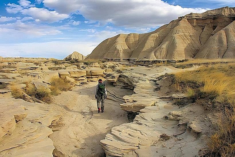
Little Jerusalem Badlands State Park: 160 km (2 hours)
Facts & Legends
Hays was once known as the deadliest town in the West, reporting 30 homicides between 1867 and 1873. Local legend centers on the "Blue Light Lady" of Elizabeth Bacon Custer's former residence. It is claimed that the ghost of a lonely woman wanders the area near the old fort site, carrying a blue lantern while searching for her lost lover, a soldier who never returned from a scouting mission.