Information
City: Logarska DolinaCountry: Slovenia
Continent: Europe
Logarska Dolina, Slovenia, Europe
Logarska Dolina is a high-alpine glacial valley and protected landscape park in the Kamnik-Savinja Alps of northern Slovenia. It is situated near the Austrian border, serving as the terminal basin for the Savinja River and a primary gateway for high-altitude mountaineering.
Historical Timeline
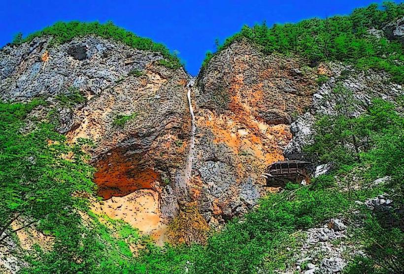
The valley was settled by high-mountain farmers (planšarji) in the 13th century, primarily focusing on timber and livestock. It remained under the governance of the Duchy of Styria and later the Austro-Hungarian Empire. The most significant architectural preservation occurred in 1987 when the valley was officially designated a Landscape Park, strictly regulating construction to maintain its traditional alpine character. The primary event shaping its current urban form was the retreat of a massive glacier 10,000 years ago, which created the U-shaped valley floor and the distinctive limestone cliffs that define its perimeter.
Demographics & Population
The valley is sparsely populated, with fewer than 100 permanent residents residing in traditional alpine farmsteads. Administratively, it belongs to the Municipality of Solčava, which has a total population of 518. The demographic is almost exclusively ethnic Slovene. The median age is approximately 48 years.
Urban Layout & Key Districts
The valley is organized linearly along a 7 km dead-end asphalt road. It is divided into three natural sections: Logar (Lower Part), characterized by green meadows and farmsteads; Plest (Middle Part), which is predominantly forested; and Kot (Upper Part), the rugged terminal end at the base of the Alps. The administrative and supply hub for the valley is the village of Solčava, located 7 km north of the valley entrance.
Top City Landmarks
Rinka Waterfall (One of Slovenia's highest at 90 meters)
The Fairytale Forest (Logar Valley educational park)
Ojstrica Peak (2,350 m, dominant mountain view)
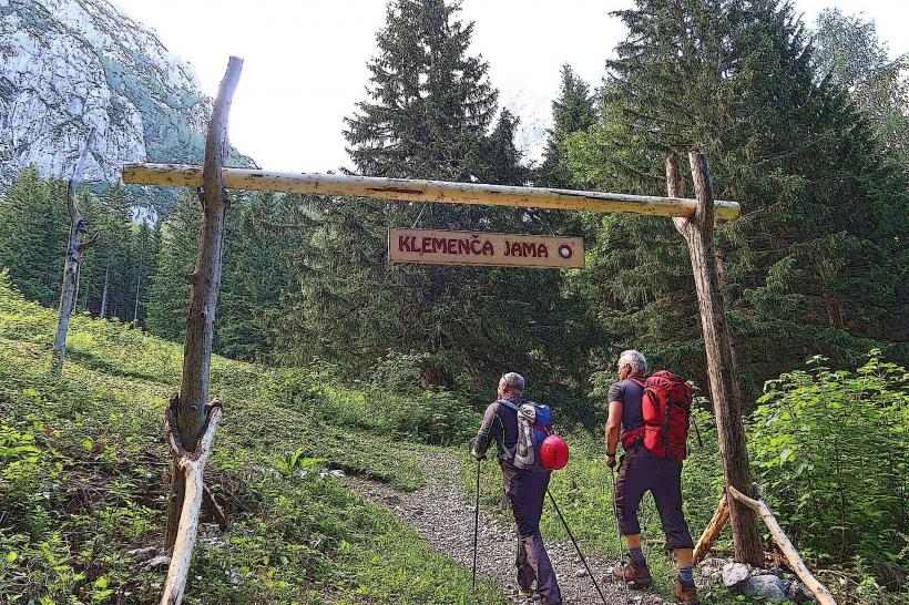
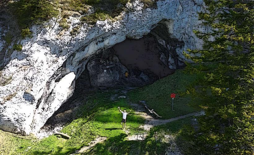
Olševa Pot (Archaeological trail to Potočka Zijalka Cave)
The Solčava Panoramic Road (High-altitude scenic route)
Transportation Network
Movement within the valley is best achieved via bicycle or on foot via the "Ethnographic Trail." A single asphalt road runs the length of the valley; a fee is charged for motorized vehicles entering the Landscape Park (approx. €7 per car). There is no metro, tram, or railway. Regional buses run from Celje to Solčava, but seasonal shuttle services into the valley itself are infrequent. Ride-sharing apps do not operate; local taxis must be pre-arranged from Mozirje or Celje. Traffic density is very low but peaks on summer weekends.
Safety & "Red Zones"
The safety level is absolute regarding crime. There are no neighborhoods or "red zones" to avoid. Safety risks are environmental: sudden thunderstorms, rockfalls on climbing routes, and the risk of hypothermia at high altitudes. Common scams are non-existent.
Digital & Financial Infrastructure
Average internet speed is 20-40 Mbps, with satellite and LTE being the primary connections. Main mobile carriers are Telekom Slovenije and A1; signal can be intermittent in the "Kot" section. Card acceptance is standard in hotels (Plesnik) and larger tourist farms, but cash is essential for mountain huts and small farm stands. There are no ATMs in the valley; the nearest one is in Solčava.
Climate & Air Quality
Temperatures range from -8°C to 2°C in January and 10°C to 22°C in July. Winter is characterized by heavy snow and frequent avalanches on the surrounding peaks. Air quality is pristine, consistently ranked among the highest in Central Europe due to its protected status and lack of through-traffic.
Culture & Social Norms
Tipping is not mandatory but 10% is standard for good service. The greeting is a formal handshake. Strict "Quiet Zones" are enforced to protect wildlife. Littering is a serious social and legal offense. Smoking is restricted in all indoor public spaces. Local culture centers on the Belski dialect and traditional sheep-farming (Jezersko-Solčava breed).
Accommodation Zones
Stay in The Lower Valley (Logar) for luxury hotel access and expansive meadow views. Stay in Upper Farmsteads for an authentic "Agritourism" experience and immediate access to high-alpine hiking trails.
Local Cost Index
1 Espresso: €1.80 ($1.98)
1 Standard Lunch (Alpine Stew): €15.00 ($16.50)
1 Park Entry (Car): €7.00 ($7.70)
Nearby Day Trips
Robanov Kot (Glacial valley): 10 km
Matkov Kot (Glacial valley): 5 km
Mozirski Gaj (Flower park): 35 km
Velika Planina (Shepherd's plateau): 50 km
Facts & Legends
Local legend tells of a giant named Lintver who lived in a lake that once filled the Matkov Kot valley. Lintver supposedly dug a hole through the mountain with his tail to drain the lake, creating the current landscape; his "bones" (large fossils) were said to have been found in the Potočka zijalka cave, which was actually a significant site for Cro-Magnon hunters 35,000 years ago.