Information
City: MoabCountry: USA Utah
Continent: North America
Moab, USA Utah, North America
Moab is the administrative seat of Grand County and the primary gateway to Arches and Canyonlands National Parks. Located in the high desert of the Colorado Plateau, it is globally recognized as a premier hub for mountain biking, off-roading, and river rafting.
Historical Timeline
The region was inhabited by the Ancestral Puebloans and later the Ute people. A Mormon mission established in 1855 was abandoned due to conflict, with permanent white settlement occurring in the late 1870s. Moab was incorporated in 1902. The most significant economic shift occurred in 1952 when Charlie Steen discovered a massive uranium deposit nearby, triggering a "uranium rush" that lasted until the early 1960s. The primary event shaping the modern urban form was the 1980s transition into an outdoor recreation mecca, following the designation of the Slickrock Bike Trail and the rise of the Jeep Safari.
Demographics & Population
The 2026 projected permanent population is 5,310. However, the city hosts over 3 million visitors annually, creating a massive transient demographic. The population is White (81.2%), Hispanic or Latino (14.6%), and Native American (2.9%). The median age is 37.3 years.
Urban Layout & Key Districts
Main Street (US-191): The commercial spine featuring gear shops, outfitters, and high-density dining.
North Moab: The primary entrance to Arches National Park and home to luxury resorts and the Colorado River bridge.
South Moab: A mixed residential and industrial zone featuring specialized off-road vehicle shops and camper-focused amenities.
Spanish Valley: An unincorporated residential area south of the city limits where most locals reside.
Top Landmarks
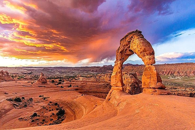
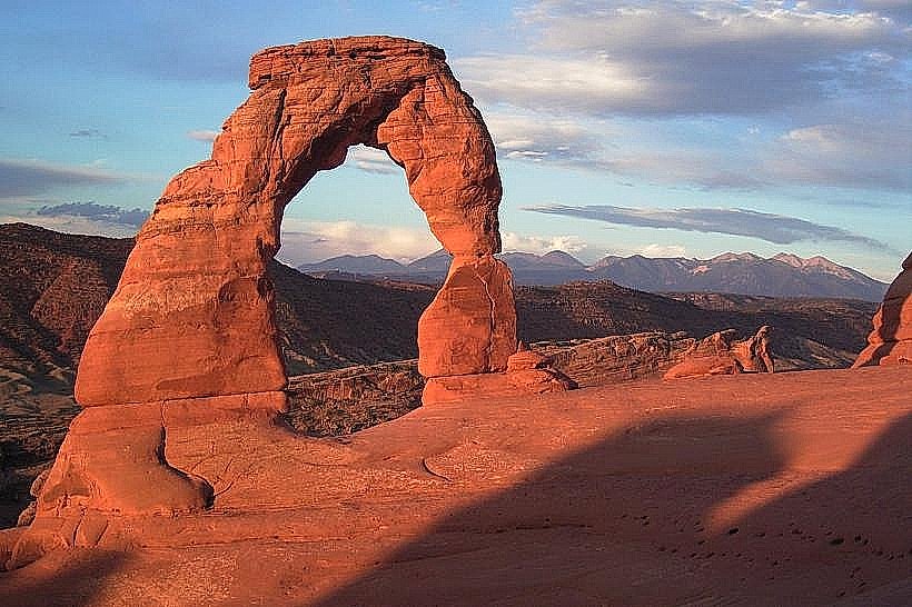
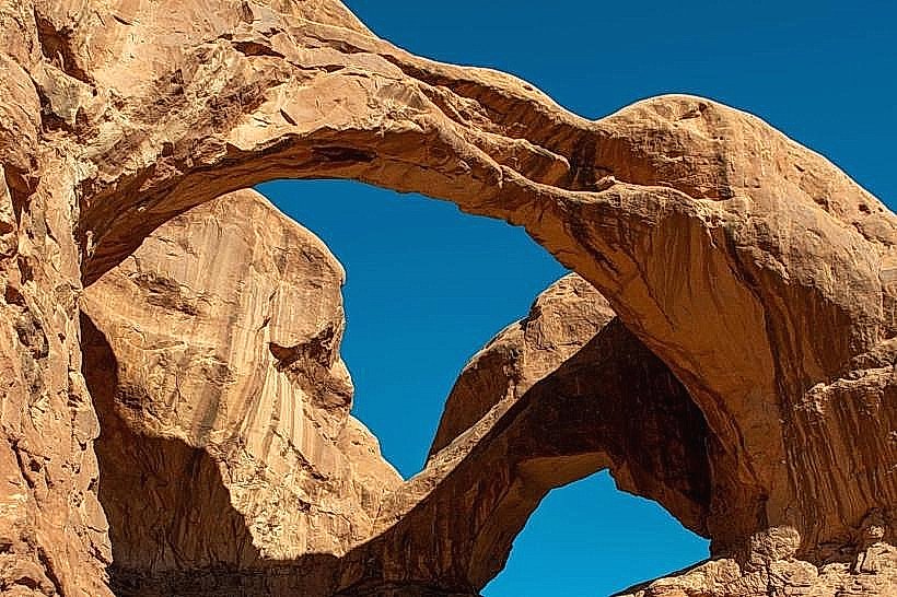
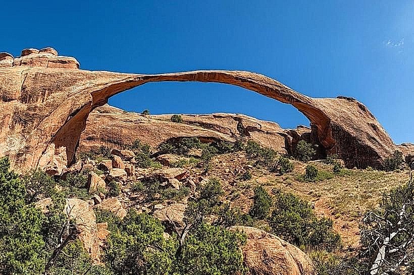
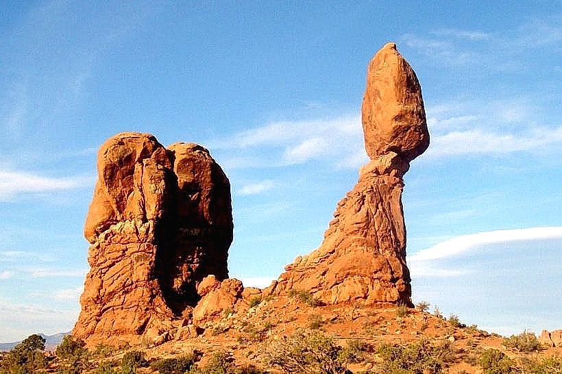
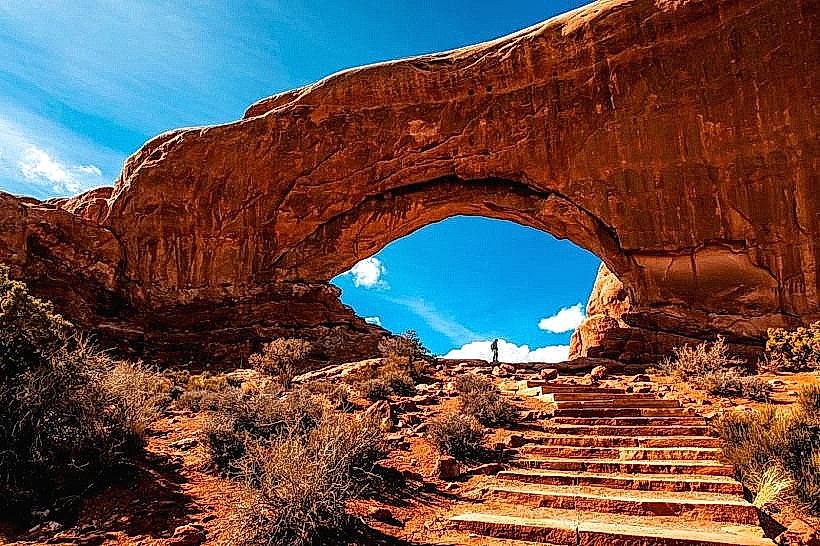
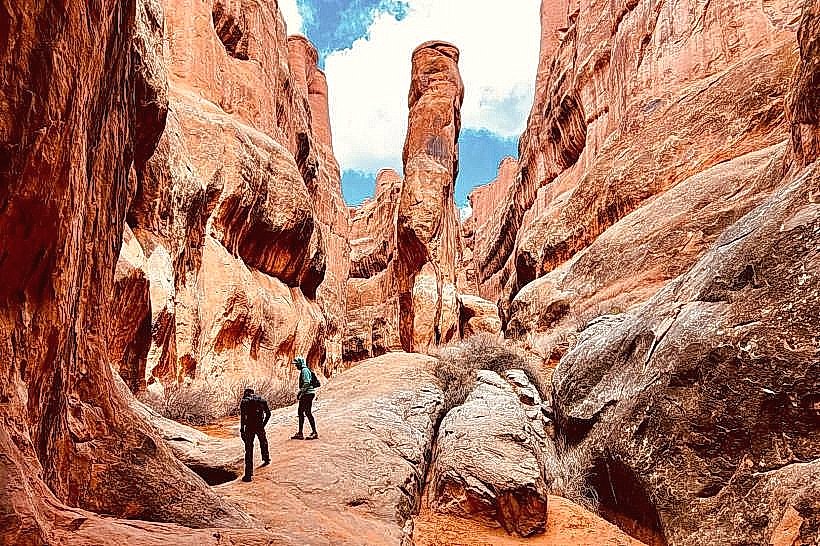
Arches National Park: Located 8 km north; contains over 2,000 natural sandstone arches.
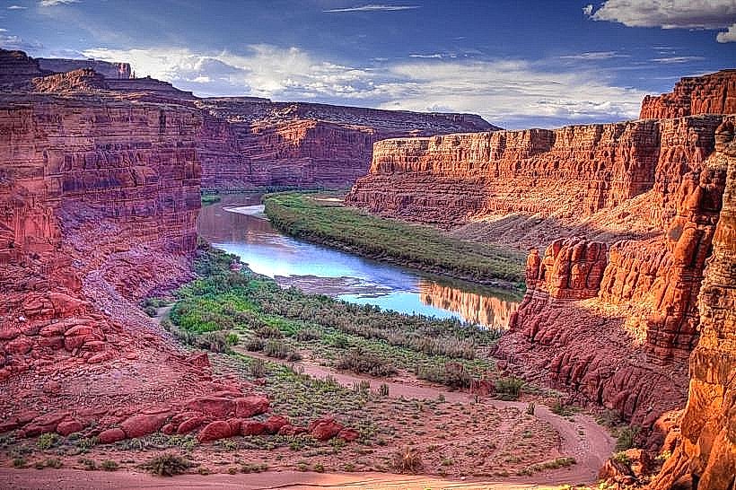
Canyonlands National Park (Island in the Sky): Located 50 km southwest; offers vast vistas of the Green and Colorado Rivers.
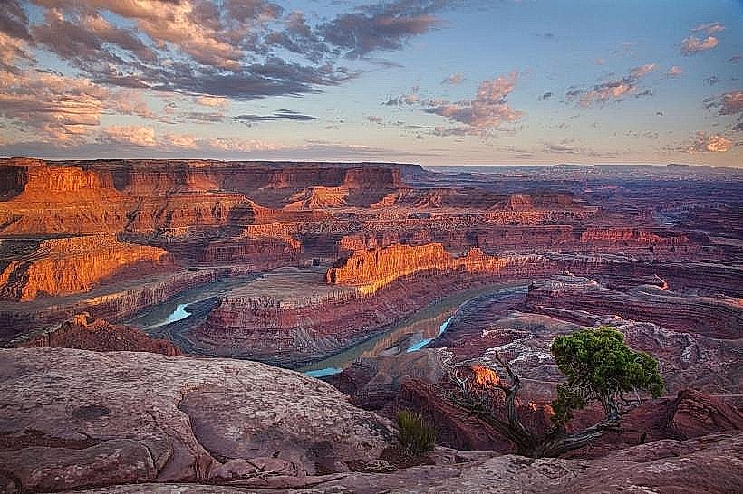
Dead Horse Point State Park: Provides a dramatic 600-meter vertical overlook of the Colorado River.
Slickrock Bike Trail: A world-famous 17 km mountain bike loop on petrified sand dunes.
Moab Giants: An interactive dinosaur park featuring life-size replicas and tracks found in the region.
Transportation Network
Movement is primarily automotive. Moab Transit (Moki) provides seasonal, fare-free shuttle services within city limits. There is no metro. Parking on Main Street is highly competitive during peak seasons (March–May, September–October). The Canyonlands Regional Airport (CNY) offers commercial flights to Denver and Salt Lake City. Access to Arches National Park now requires a Timed Entry Reservation for most of the year.
Safety & "Red Zones"
The general safety level is very high. Crime is negligible, primarily involving vehicle break-ins at remote trailheads. There are no "red zones." The primary risks are environmental: dehydration, flash floods in slot canyons, and heatstroke. Standard wilderness vigilance is required; cellular service is non-existent once 5 km outside the city limits.
Digital & Financial Infrastructure
Average internet speed is 100–300 Mbps, with fiber expansion underway via Emery Telcom. Mobile coverage is excellent in town but fails immediately upon entering canyons. Card acceptance is universal. ATMs are concentrated on Main Street.
Climate & Air Quality
Temperatures range from -6°C to 7°C in winter (January) and 18°C to 40°C+ in summer (July). Air quality is exceptionally high, though dust storms and regional wildfires can occasionally lead to "Moderate" AQI levels.
Culture & Social Norms
The standard tipping rate is 20%. The culture is a hybrid of "Dirtbag" athlete aesthetics and luxury tourism. Dress code is "Technical Outdoor"-performance fabrics are standard in all dining establishments. Grand County is "wet," though Utah state laws regarding high-ABV beer and spirits apply.
Accommodation Zones
Main Street: Stay here for walkability to outfitters and nightlife.
Kane Creek Boulevard: Stay here for riverside camping and proximity to the Amasa Back trail system.
North US-191: Stay here for high-end resorts (Hoodoos, Radcliffe) near the park entrances.
Local Cost Index
1 Espresso: $5.25
1 Standard Lunch: $19.00
1 Gallon of Fuel: $0.50–$0.70 above state average.
Nearby Day Trips
Castle Valley: (35 km - Iconic film location)
La Sal Mountains: (45 km - High-altitude alpine escape)
Cataract Canyon: (River access via Potash Rd)
Facts & Legends
Moab has served as the filming location for hundreds of films, including Thelma & Louise, Indiana Jones and the Last Crusade, and Westworld. A local legend involves the "Moab Mastodon," a petroglyph that some claim depicts a prehistoric elephant, though archaeologists identify it as a bear or a natural stain. A verified historical oddity is that the city was named after a Biblical kingdom, but early residents often claimed it was an acronym for the "Missouri-Oklahoma-Arkansas-Boy" who supposedly founded it.