Information
City: MolokaiCountry: USA Hawaii
Continent: North America
Molokai, USA Hawaii, North America
Molokaʻi functions as the primary center for Native Hawaiian subsistence culture and serves as a critical agricultural zone for non-GMO seed production. The island is the fifth largest in the Hawaiian chain, situated 40 kilometers east of Oʻahu and 15 kilometers northwest of Maui.
Historical Timeline
Molokaʻi was settled by Polynesians in approximately 650 CE. Primary eras of governance include the Hawaiian Kingdom and the U.S. Territorial period. The city of Kaunakakai emerged as the commercial center in the mid-19th century. The most significant political and social event was the 1866 establishment of the Hansen’s Disease (leprosy) settlement at Kalaupapa by King Kamehameha V. The primary event shaping the current urban form was the 2008 closure of Molokaʻi Ranch, which effectively halted large-scale resort development and preserved the island’s rural, anti-commercialist structure.
Demographics & Population
The total population of Molokaʻi is approximately 7,300. The demographics are 62% Native Hawaiian or Pacific Islander, 25% Asian, and 13% White. The median age is 45.2 years.
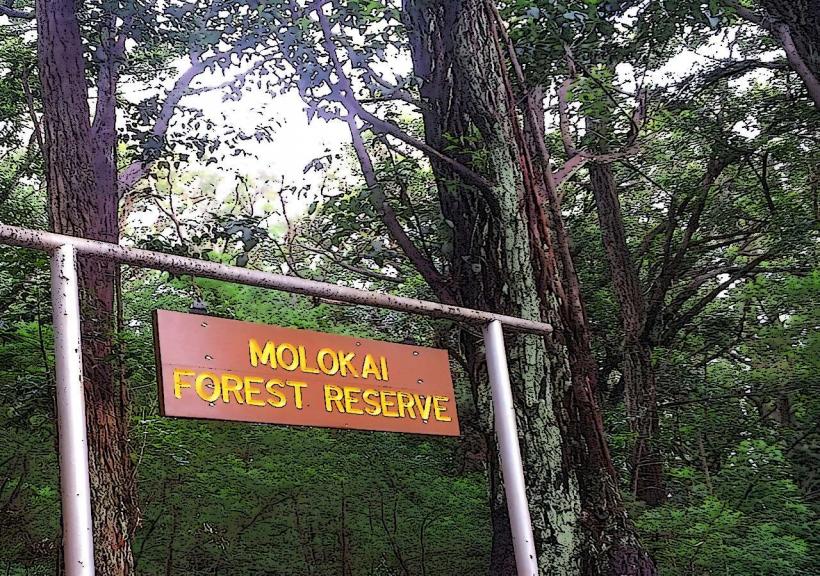
Urban Layout & Key Districts
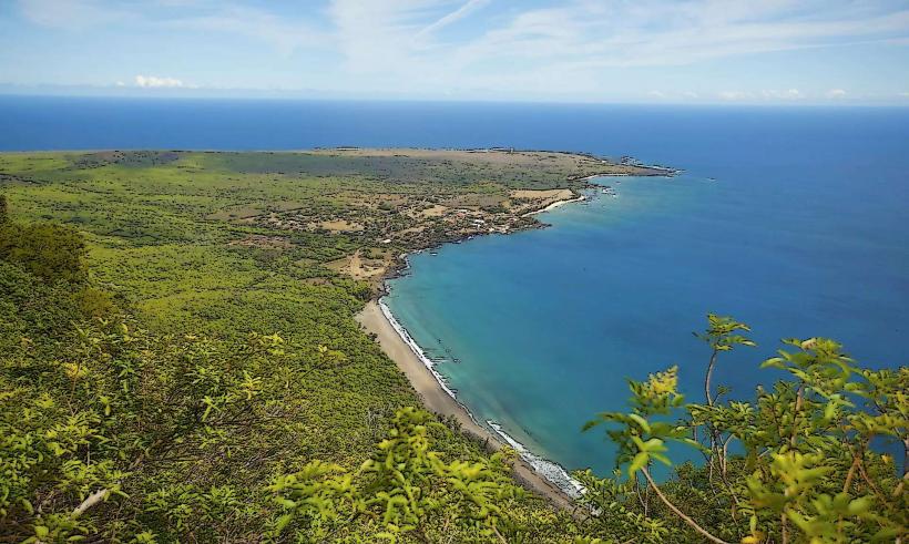
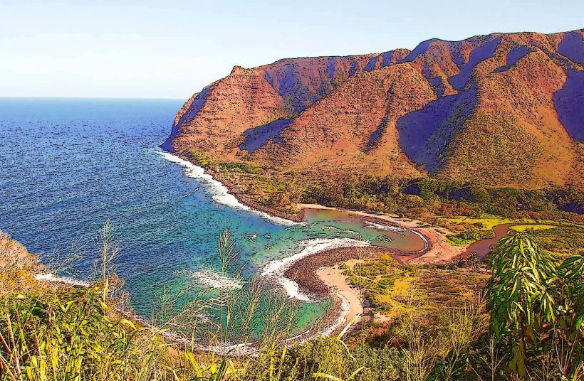
The island is organized along the Kamehameha V Highway (Route 450) and Mauna Loa Highway (Route 460). Kaunakakai (Central) is the primary commercial and logistical hub. The West End (Kaluakoi) contains former resort infrastructure and secluded beaches. The East End (Manaʻe) is a lush, high-rainfall residential and agricultural zone. Kalaupapa (North) is a federally managed isolated peninsula accessible only by permit.
Top City Landmarks
Kalaupapa National Historical Park
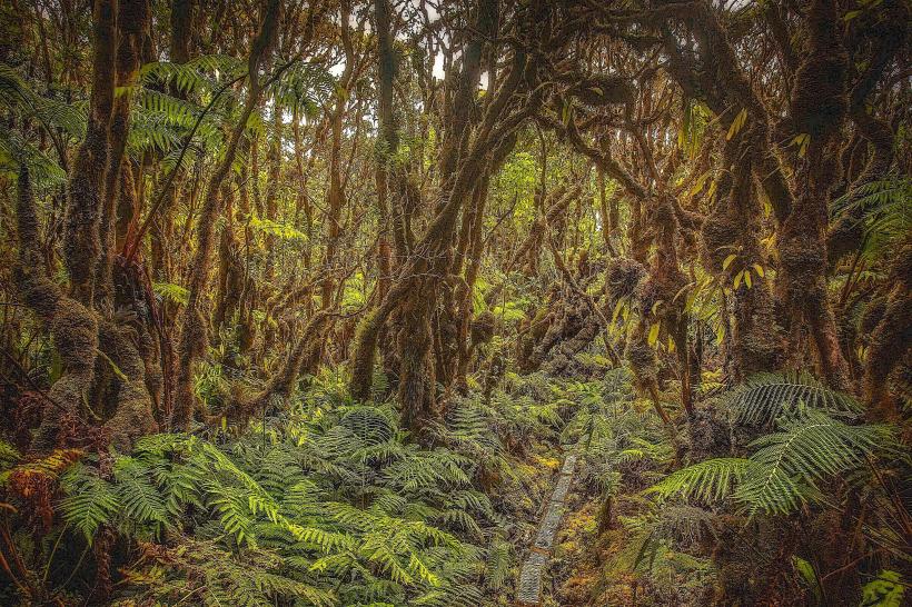
Hālawa Valley (One of the oldest inhabited sites in Hawaiʻi)
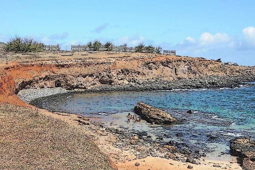
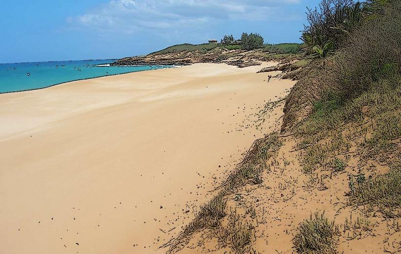
Pāpōhaku Beach (One of the largest white sand beaches in the state)
Kapuāiwa Coconut Grove
St. Joseph’s Church (Built by Father Damien in 1876)
Transportation Network
Movement on Molokaʻi is restricted to private vehicles and walking; there is no public bus system (TheBus does not operate here). There are no metro or tram lines. Ride-sharing apps like Uber and Lyft are non-functional. Official taxis are limited to a few independent operators that must be booked in advance. Traffic density is non-existent; the island has no traffic lights.
Safety & "Red Zones"
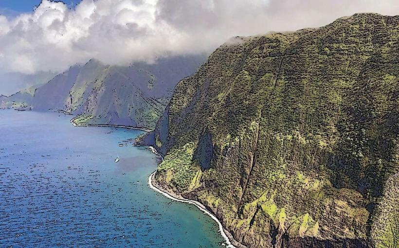
The island is statistically very safe. Physical "Red Zones" include the cliffs of the North Shore, which are the highest sea cliffs in the world and prone to landslides. Avoid trespassing on private homestead lands in the East End. Common "scams" are non-existent, but tourists may experience social friction if they fail to respect local "No Trespassing" signs or attempt to film residents without permission.
Digital & Financial Infrastructure
Internet speeds average 50–100 Mbps in Kaunakakai, with significantly slower speeds in rural zones. Main mobile carriers are Verizon and AT&T (T-Mobile coverage is spotty). Card acceptance is moderate; most shops in Kaunakakai accept cards, but many local vendors and fruit stands are "cash only." ATMs are limited to the Bank of Hawaii or American Savings Bank in Kaunakakai.
Climate & Air Quality
Temperatures range from 18°C–25°C in winter and 23°C–30°C in summer. Air quality is exceptionally high due to a lack of industrialization. Significant weather risks include flash flooding in Hālawa Valley and high winds on the West End.
Culture & Social Norms
Tipping is standard at 15–20%. Greetings are vital; "Slow Down" is the local mantra. Handshakes and "Aloha" are expected. Dress is strictly casual. Smoking is prohibited in public buildings and parks. Alcohol consumption is restricted to private areas or the few licensed restaurants in Kaunakakai; there are no bars on the island.
Accommodation Zones
Kaunakakai: Stay here for logistical proximity to the grocery store, pier, and airport.
The West End: Stay here for a secluded environment and access to large beaches, though amenities are minimal.
Local Cost Index
1 Espresso: $5.50
1 Standard Lunch (Plate Lunch): $15.00
1 Metro/Bus Ticket: N/A (No public transit)
Nearby Day Trips
Kalaupapa Peninsula: 5 km (Access via air or steep trail hike with permit).
Hālawa Falls: 45 km (1.5 hours), requires a guided hike to access the waterfall.
Lanai: 15 km (Accessible via occasional private charter; former ferry service is suspended).
Facts & Legends
Molokaʻi is known as Molokaʻi Nui A Hina (Great Molokaʻi, Child of Hina). A local legend concerns the "Phallic Rock" (Kaule o Nanahoa) in Palaʻau State Park; it is believed that if a woman spends the night at the rock and makes an offering, she will be cured of infertility. The island is also historically called "The Island of Powerful Prayers" due to its reputation for kahuna (priests) with immense spiritual power.