Information
City: MorondavaCountry: Madagascar
Continent: Africa
Morondava, Madagascar, Africa
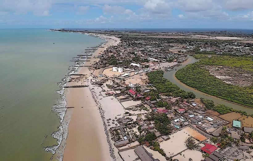
Morondava is a coastal city located in the Menabe region of western Madagascar. Situated at the delta of the Morondava River on the Mozambique Channel, it is the global gateway to the Baobab species Adansonia grandidieri and serves as a critical agricultural hub for rice and tobacco.
Historical Timeline
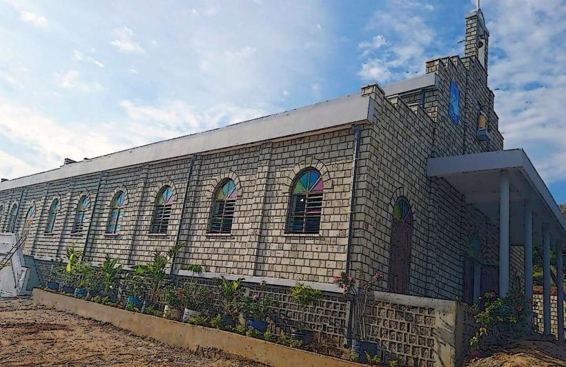
Historically, Morondava was the center of the Menabe Sakalava Kingdom. In the 17th and 18th centuries, it functioned as a major port for trade with European and Arab merchants. During the French colonial period, the region was developed for large-scale industrial agriculture. The city has recently faced significant environmental challenges, including coastal erosion that has reclaimed several blocks of the historic beachfront.
Demographics & Population
The population is approximately 60,000. The dominant ethnic group is the Sakalava, specifically the Menabe sub-group. The demographic also includes Vezo fishermen along the coast and a significant community of Indo-Pakistani and Chinese merchants who manage the city's commercial infrastructure.
Urban Layout & Key Districts
The Center: A concentrated area of administrative buildings, banks, and the main market.
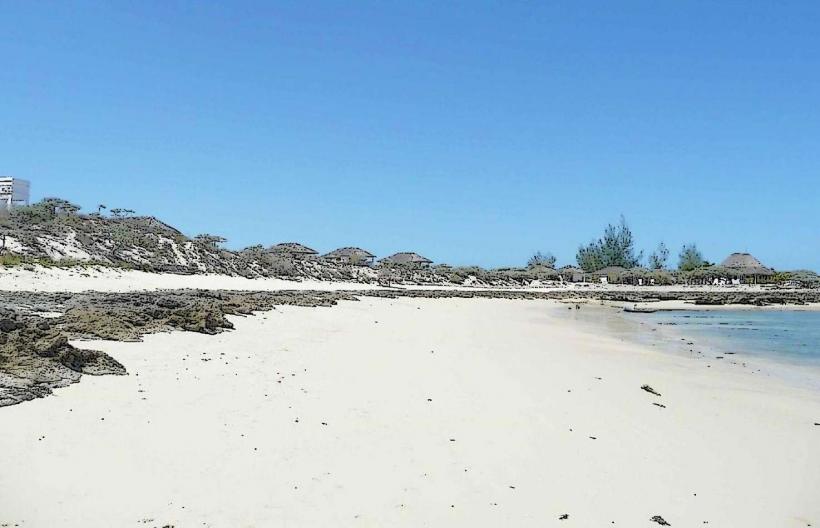
Nosy Kely: A sandy peninsula and the primary tourist district, containing the majority of hotels and restaurants. This area is most vulnerable to rising sea levels.
The Port: A high-activity zone for traditional dhows and pirogues transporting goods along the coast.
Betania: A traditional Vezo fishing village located across the lagoon from the main city.
Top Landmarks
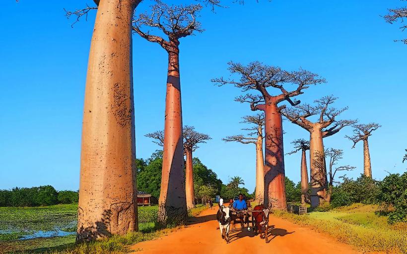
Avenue of the Baobabs: Located 15 km north, this is Madagascar’s most photographed site. It features a cluster of ~25 massive Adansonia grandidieri trees lining a dirt road.
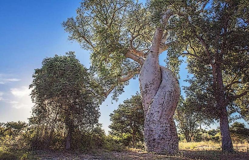
Baobab Amoureux (Baobabs in Love): Two baobabs twisted together in a permanent embrace, located a few kilometers from the main Avenue.
Kirindy Forest: A private reserve 60 km north, one of the best places to see the Fossa (Madagascar’s apex predator) and the Giant Jumping Rat.
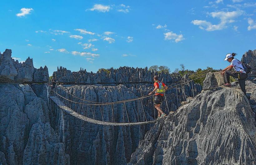
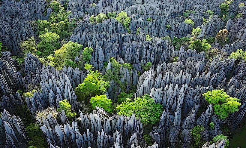
Tsingy de Bemaraha: A UNESCO World Heritage site featuring jagged limestone needles. While technically 200 km north, Morondava is the essential staging point for expeditions there.
Sakalava Tombs: Distinctive funerary structures featuring erotic wooden carvings (piles) representing life and fertility.
Transportation Network
Air: Morondava Airport (MOQ) connects to Antananarivo via regular Tsaradia flights.
Roads: Reached via the RN35 from Antsirabe or the RN34 from Miandrivazo. The journey from the capital takes approximately 12–14 hours.
Local Transit: Tuk-tuks and Pousse-pousses are the primary modes of transport.
Sea: Traditional outrigger pirogues are used to ferry people between the city center and Betania.
Safety & "Red Zones"
Risks: Petty theft is common in the market and along the beachfront at Nosy Kely.
Night Safety: Avoid walking on the beach or unlit roads after dark.
Road Safety: The road between Morondava and the Tsingy (RN8) is prone to seasonal flooding and historically has been a zone of concern for dahalo (bandit) activity; travel in convoys or with reputable operators is advised.
Digital & Financial Infrastructure
4G mobile coverage is reliable in the city center and at the Avenue of the Baobabs. Fiber-optic internet is restricted to high-end resorts. Several banks (BNI, BMOI, Société Générale) provide ATMs. The currency is the Malagasy Ariary (MGA).
Climate & Air Quality
Climate: Tropical savanna. It is hot and semi-arid. The dry season (May–October) is the peak travel period.
Air Quality: Excellent, except for localized dust on unpaved roads and smoke from seasonal "tavy" (slash-and-burn) agriculture in the hinterlands.
Culture & Social Norms
Sakalava Royalty: The Fitampoha (bathing of the relics of ancestors) is a major sacred festival held every few years.
Cuisine: Specialized in Camarons (giant freshwater prawns) and fresh seafood from the Mozambique Channel.
Fady: Respect local taboos regarding tombs and sacred trees; for example, pointing with a straight finger at a tomb is often considered offensive (use a folded knuckle instead).
Local Cost Index
1 Espresso: ~5,000 MGA ($1.10)
1 Tuk-tuk Ride: ~2,000 MGA ($0.45)
1 4x4 Rental to Tsingy (Daily): ~250,000–400,000 MGA ($55–$90)
Nearby Day Trips
Betania: A 10-minute pirogue trip to observe traditional Vezo life and boat building.
Kimony Beach: A wide, pristine beach located between the city and the airport, popular for sunsets.
Facts & Legends
A verified historical oddity is that the baobabs are often called "upside-down trees" because their branches resemble roots reaching into the sky. Local legend says that the baobabs were once so vain that God uprooted them and replanted them upside down to keep them quiet.