Information
City: Ponta GrossaCountry: Brazil
Continent: South America
Ponta Grossa, Brazil, South America
Ponta Grossa serves as the "Princess of the Fields" (Princesa dos Campos) and is the primary logistical and industrial hub of the Campos Gerais region in Paraná. It is situated on the Second Plateau of Paraná, a strategic junction for road and rail transport connecting the interior of Brazil to the Port of Paranaguá.
Historical Timeline
The city originated in the early 18th century as a mandatory stop for tropeiros (cattle herders) traveling between Viamão and Sorocaba. It was officially established as a municipality in 1823. The arrival of the railroad in 1894 and massive waves of German, Polish, and Ukrainian immigrants transformed it into a regional commercial center. In the 2010s and 2020s, Ponta Grossa experienced a massive industrial boom, becoming one of the largest food-processing and brewing hubs in Latin America.
Demographics & Population
The population is approximately 360,000. The demographic is characterized by strong European roots, specifically German, Polish, Italian, and Russian (Volga Germans). The city is a major educational center, home to the State University of Ponta Grossa (UEPG). The median age is 32.8 years.
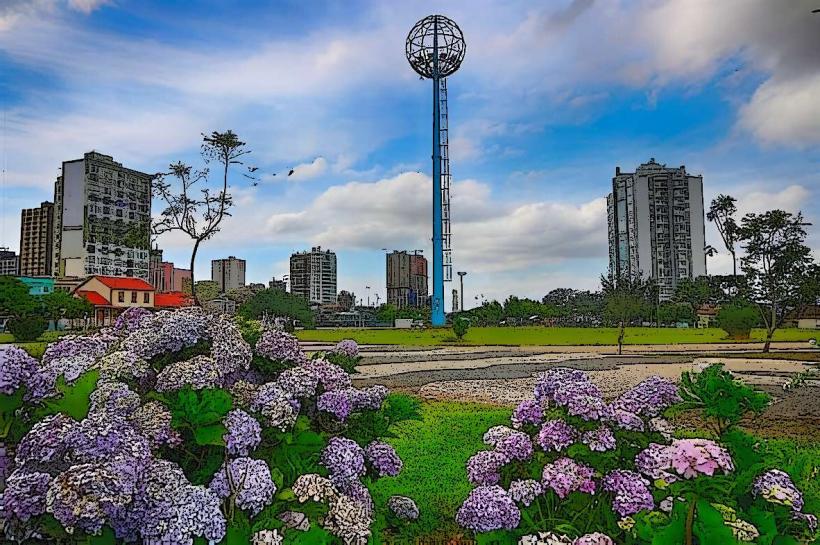
Urban Layout & Key Districts
The city is built on undulating terrain, creating a hilly urban landscape.
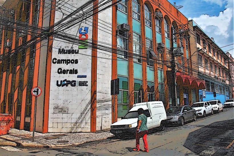
Centro: The commercial core and site of the historic cathedral and railway stations.
Vila Estrela / Olarias: The most affluent residential districts, featuring high-end apartments and the recently revitalized Olarias Lake Park.
Uvaranas: A sprawling district housing the university campus and significant commercial development.
Distrito Industrial: A massive specialized zone on the city's outskirts housing multinational factories (e.g., Heineken, Tetra Pak, Mars).
Top City Landmarks
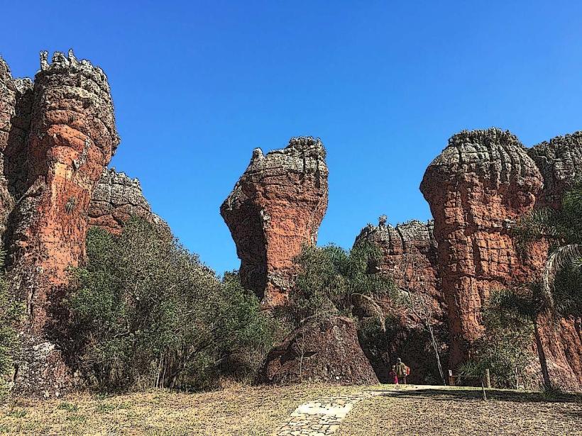
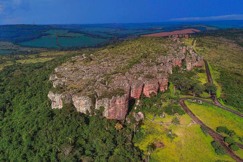
Vila Velha State Park: Featuring 300-million-year-old sandstone formations, "furnas" (deep craters), and the Golden Lagoon.
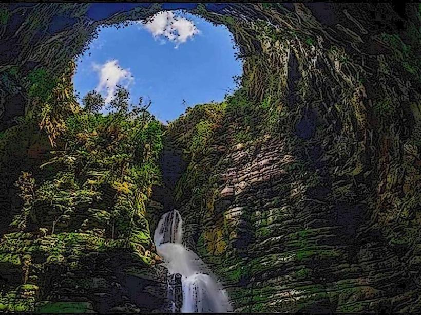
Buraco do Padre: A 30-meter waterfall inside a subterranean cave, creating a natural amphitheater.
Canyon Rio São Jorge: A scenic area featuring waterfalls and rocky cliffs popular for trekking.
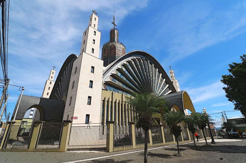
Sant’Ana Cathedral: A modernist landmark situated at the highest point of the city center.
Olarias Lake (Parque Lago de Olarias): The city's premier urban leisure space.
Transportation Network
Ponta Grossa is one of the most important highway junctions in Southern Brazil, where the BR-376, BR-277, and BR-153 converge.
Road: The city is the gateway for all cargo moving from the Midwest toward the Port of Paranaguá.
Air: Sant'Ana Airport (PGZ) offers commercial flights to São Paulo and regional hubs.
Urban Bus: The city operates an integrated terminal system (Central, Uvaranas, Nova Rússia, and Oficinas).
Ride-sharing: Uber and 99 are the standard.
Safety & "Red Zones"
Safety Profile: Generally safer than the state capital, Curitiba, but property crime occurs.
Red Zones: Avoid isolated areas of the Santa Paula and Contorno districts at night.
Precautions: The city center can be deserted and unsafe after 8:00 PM. High-speed traffic on the perimeter highways requires caution when driving.
Digital & Financial Infrastructure
Average internet speed is 105 Mbps. 5G is available in the Centro, Vila Estrela, and Olarias districts. The Pix system is universal. Card acceptance is 100% in formal businesses. ATMs are concentrated in the Shopping Palladium and Shopping Total.
Climate & Air Quality
Humid subtropical climate. It is one of the windiest cities in Paraná. Temperatures range from 6°C to 18°C in winter (with frequent frosts) and 18°C to 28°C in summer. Air quality is moderate to high, though occasionally affected by industrial emissions in the south.
Culture & Social Norms
The local culture is a blend of tropeiro tradition and European heritage. Tipping is a 10% service charge. A unique social norm is the Munchenfest, a major German-themed beer festival held annually. The regional diet is famous for Alcatra no Espeto and Pirogi (Polish dumplings).
Accommodation Zones
Centro / Vila Estrela: Recommended for 90% of visitors due to proximity to services, dining, and hotels.
Local Cost Index
1 Espresso: 7.50 BRL ($1.35)
1 Standard Lunch (Executive): 35.00 BRL ($6.35)
1 Entry to Vila Velha Park: 110.00 BRL ($20.00)
1 Taxi/Uber (5km): 18.00 BRL ($3.25)
Nearby Day Trips
Carambeí: A Dutch colony featuring the largest open-air historical museum in Brazil (20 km).
Castrolanda: A Dutch colony in Castro featuring one of the largest windmills in the world (45 km).
Witmarsum Colony: A German Mennonite colony (60 km).
Facts & Legends
A prominent legend involves the "Ghost Train of the 24th," a spectral locomotive said to appear on abandoned tracks near the old railway station. A verified historical oddity is that Ponta Grossa was the temporary capital of the Republic of Brazil for three days during the Revolution of 1930. Another fact: the city is known as the "World Capital of Soy" due to the massive volume of grain processed in its industrial district.