Information
City: SnaefellsnesCountry: Iceland
Continent: Europe
Snaefellsnes, Iceland, Europe
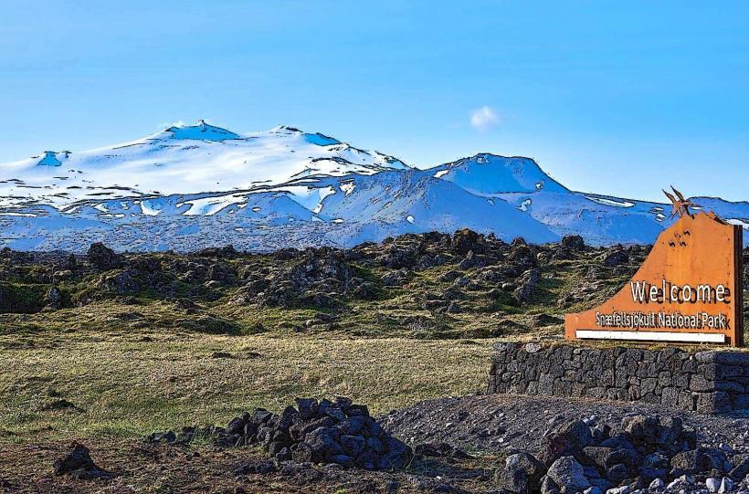
Snæfellsnes serves as "Iceland in Miniature," containing nearly all of the country’s distinct geological features-volcanoes, glaciers, lava fields, fjords, and basalt cliffs-within a 90-kilometer peninsula. It functions as a National Park and a primary site for literary and cinematic tourism, dominated by the Snæfellsjökull glacier-capped volcano.
Historical Timeline
Settled in the 9th century, the peninsula is the backdrop for the Laxdæla Saga and Eyrbyggja Saga. Its global cultural significance was established in 1864 by Jules Verne’s Journey to the Center of the Earth, which identified the local glacier as the entry point to the subterranean world. The primary event shaping its modern status was the 2001 establishment of the Snæfellsjökull National Park, the first in Iceland to protect coastal areas and marine life alongside terrestrial features.
Demographics & Population
The total population is approximately 3,900 (2026 estimate). The residents are distributed among several small coastal towns: Stykkishólmur (the largest), Grundarfjörður, Ólafsvík, and Hellissandur. The demographic is a mix of traditional fishing families and an increasing number of tourism entrepreneurs and artists.
Urban Layout & Key Districts
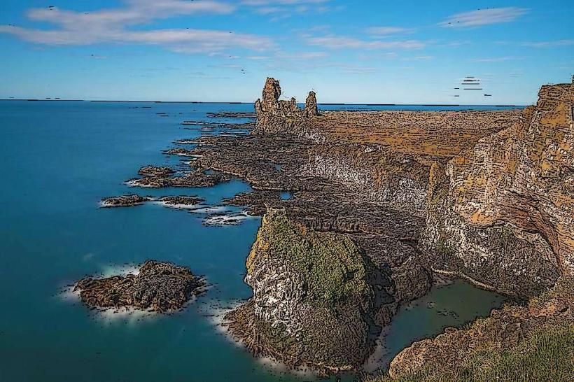
The peninsula is organized by a coastal loop road. The North is characterized by sheltered fjords and historic fishing villages; The West (The Tip) is the National Park wilderness; and The South features dramatic sea cliffs, golden beaches, and the vast Snæfellsnes lava fields.
Top Landmarks
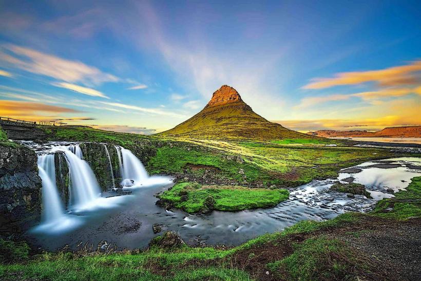
Kirkjufell: The most photographed mountain in Iceland, known for its distinctive arrowhead shape.
Snæfellsjökull: A 1,446m glacier-capped stratovolcano.
Arnarstapi & Hellnar: Twin coastal hamlets connected by a scenic basalt cliff walk.
Djúpalónssandur: A black pebble beach featuring historic "lifting stones" and shipwreck remains.
Búðakirkja: A lonely, iconic black wooden church set in a lava field.
Transportation Network
Movement is facilitated by Route 54 and Route 574. There is no rail transit. Public transport is limited to Strætó Route 58, which connects Stykkishólmur to Borgarnes. Most visitors arrive via private vehicle. The Baldur Ferry operates from Stykkishólmur, connecting the peninsula to the Westfjords. Roads are mostly paved, but the mountain pass Fróðárheiði can be hazardous in winter.
Safety & "Red Zones"
The safety level is high. The primary "red zones" are environmental.
Snæfellsjökull: Do not attempt to climb or drive on the glacier without a certified guide and specialized equipment due to hidden crevasses.
Djúpalónssandur: Like Reynisfjara, this beach is prone to dangerous sneaker waves.
Londrangar Cliffs: Soil stability at the cliff edges is inconsistent; remain on marked paths.
Digital & Financial Infrastructure
Average internet speed is 50–100 Mbps in villages. The region is 100% cashless. Every gas station, museum, and remote cafe accepts international credit cards and mobile payments. ATMs are available only in the larger towns like Stykkishólmur and Ólafsvík.
Climate & Air Quality
Temperatures range from -4°C in winter to 13°C in summer. The peninsula is highly exposed to Atlantic weather systems, resulting in frequent, heavy rain and wind. Air quality is exceptional.
Culture & Social Norms
Tipping is not required. The culture is deeply connected to maritime history and the supernatural; the area is considered one of the world's "power centers" by New Age practitioners. Respect for the environment is paramount; off-road driving is a serious criminal offense.
Accommodation Zones
Stykkishólmur: Stay here for boutique hotels, refined dining, and ferry access.
Grundarfjörður: Stay here for immediate access to Kirkjufell and whale watching.
Arnarstapi/Hellnar: Stay here for remote, high-end guesthouses and coastal hiking.
Local Cost Index
1 Espresso: 650 – 850 ISK
1 Standard Lunch (Fish & Chips/Soup): 2,900 – 4,200 ISK
1 Guided Glacier Tour: 18,000 – 25,000 ISK
Nearby Day Trips
Flatey Island: Accessible via ferry from Stykkishólmur.
Borgarnes: 1 hour from the southern start of the peninsula.
Gerðuberg Basalt Columns: Located at the eastern entrance of the peninsula.
Facts & Legends
The village of Hellissandur was once the most important fishing hub in Iceland; today, it is known for having the tallest structure in the country, the Longwave radio transmitter Gufuskálar (412m). Local legend claims the spirit of Bárður Snæfellsás, a half-troll/half-human, protects the peninsula from his home within the glacier. A verified historical fact is that the stones at Djúpalónssandur were used for centuries to test the strength of aspiring fishermen; to qualify for a ship, a man had to lift the "Hálfdrættingur" stone (54kg) onto a waist-high ledge.