Information
Landmark: Djúpalónssandur BeachCity: Snaefellsnes
Country: Iceland
Continent: Europe
Djúpalónssandur Beach, Snaefellsnes, Iceland, Europe
Djúpalónssandur Beach is a black pebble beach situated on the Snæfellsnes Peninsula in western Iceland. It is characterized by its distinctive rock formations and historical association with fishing.
Visual Characteristics
The beach consists of black volcanic pebbles, smoothed by ocean action, varying in size. Prominent basalt and lava formations include the arch-shaped Gatklettur. The two large basalt pillars of Lóndrangar are visible to the east. Vegetation is sparse, limited to hardy coastal grasses on the surrounding cliffs. The North Atlantic Ocean water is typically dark blue-grey. Scattered across the beach are the rusted remains of the British trawler Epine GY7, which was wrecked in 1968.
Location & Access Logistics
Access to Djúpalónssandur Beach is via Road 574 (Útnesvegur). A marked turn-off leads to a gravel road, Djúpalónssandurvegur, which terminates at a designated parking area. The beach is approximately 10 km west of Arnarstapi and 20 km west of Hellnar. There is no public transport directly serving the beach; access is primarily by private vehicle or organized tour.
Historical & Ecological Origin
Djúpalónssandur is a volcanic black pebble beach, formed by ancient volcanic activity and subsequent erosion by the Atlantic Ocean. Historically, it functioned as one of the largest fishing stations on the Snæfellsnes Peninsula, supporting numerous fishing boats. The beach retains four ancient lifting stones, used by fishermen to test their strength.
Key Highlights & Activities
Specific activities include observing the scattered remains of the Epine GY7 shipwreck. Visitors can attempt to lift the historic strength-testing stones. Photography of the unique basalt rock formations and the coastal landscape is a common activity. Walking along the pebble beach and viewing the Lóndrangar basalt cliffs from a distance are also possible.
Infrastructure & Amenities
There are no public restrooms directly on Djúpalónssandur Beach. Restroom facilities may be available at nearby visitor centers or cafes in Hellnar or Arnarstapi. Natural shade is limited, as the area is exposed. Cell phone signal, typically 4G/5G, is generally available. There are no food vendors directly on the beach; the nearest options are in Hellnar or Arnarstapi.
Best Time to Visit
The months of June to August offer the mildest weather and longest daylight hours for visiting. For photography, early morning or late afternoon provides softer light on the rock formations. The beach is accessible at all tides, but caution is advised regarding strong waves, particularly at high tide.
Facts & Legends
The four strength-testing stones on the beach are named Amlóði (23 kg), Hálfdrættingur (54 kg), Hálfsterkur (100 kg), and Fullsterkur (154 kg). Fishermen were required to lift Hálfdrættingur to qualify for work on fishing boats. Local folklore suggests the beach is a gateway to the underworld, guarded by mythical creatures.
Nearby Landmarks
- Dritvík Beach: 1.5 km North
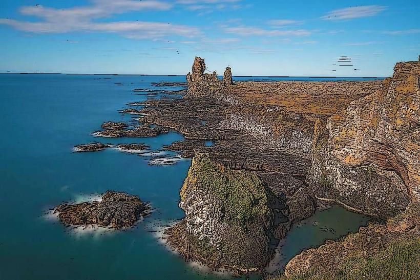
- Lóndrangar Viewpoint: 2 km East
- Vatnshellir Cave: 3 km East
- Malarrif Lighthouse: 2.5 km East
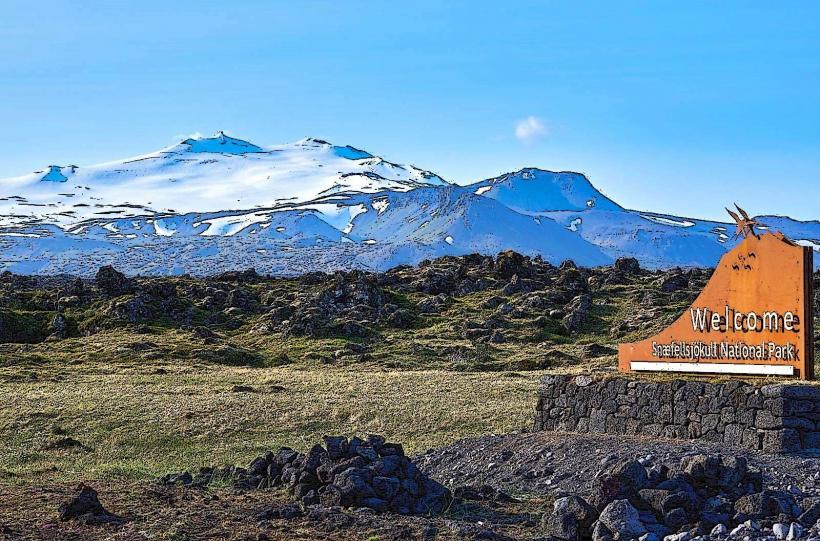
- Snaefellsjökull National Park Visitor Center: 5 km East