Information
City: Southwest AntiguaCountry: Antigua and Barbuda
Continent: North America
Southwest Antigua, Antigua and Barbuda, North America
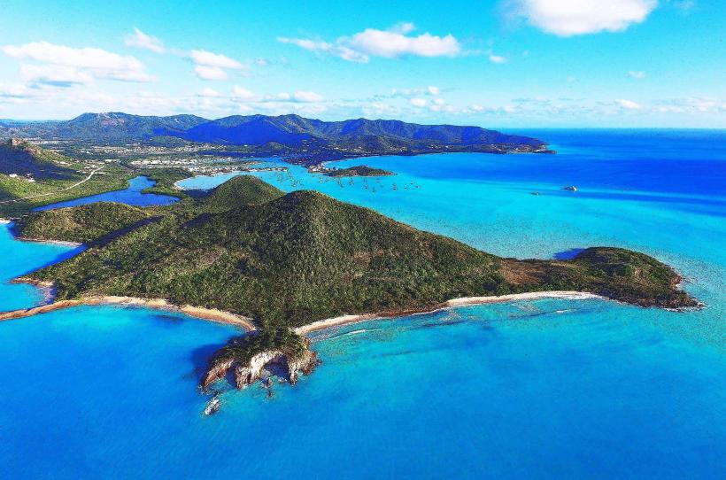
Southwest Antigua is a primary ecological and high-end residential zone, characterized by the island’s most mountainous terrain and significant rainforest coverage. It extends from the village of Bolans and Jolly Harbour southward to the Old Road and Curtain Bluff areas.
Historical Timeline
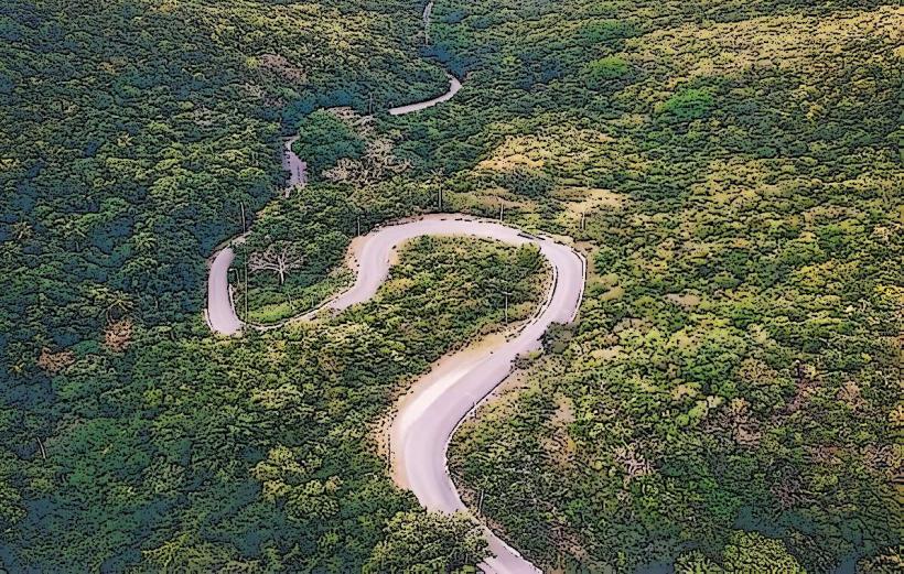
The region was historically dominated by pineapple and sugar plantations throughout the 18th and 19th centuries. Governance transitioned from British colonial administration to national independence in 1981. Significant architectural development occurred in the 1990s with the construction of the Jolly Harbour marina complex and the expansion of luxury boutique hotels along the coastal cliffs. The primary event shaping the current urban form was the mid-20th-century construction of Fig Tree Drive, which provided the first reliable vehicular access through the mountainous interior to the southern coast.
Demographics & Population
The total population of the southwest corridor is approximately 3,500 residents. The demographics are predominantly Afro-Antiguan, with significant residential clusters of British and North American expatriates in the gated communities and hillsides. The median age is approximately 38.5 years.
Urban Layout & Key Districts
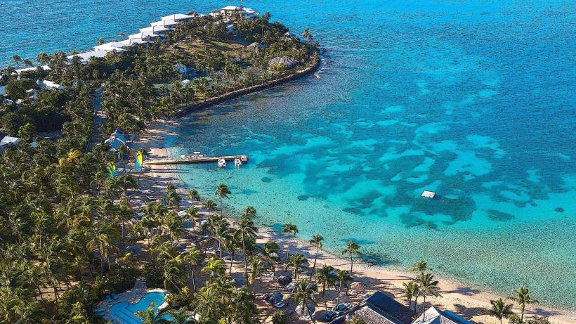
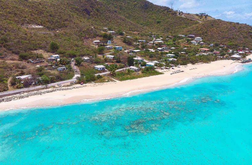
The area is organized linearly along the Valley Road and the southern coastal road. The 2 most important districts are Bolans/Jolly Harbour (the primary commercial and maritime hub, located North-West) and Old Road (the traditional agricultural and luxury resort village, located South). The layout is constrained by the Shekerley Mountains, forcing development into narrow coastal strips.
Top City Landmarks
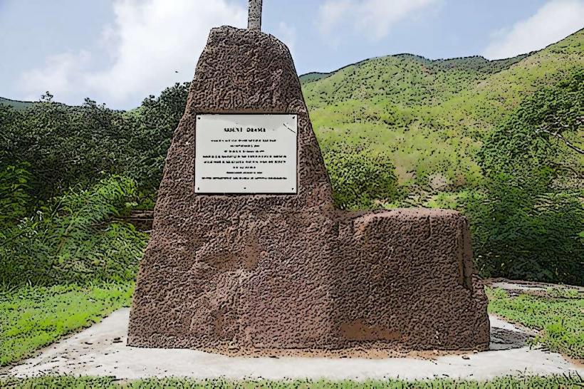
Mount Obama (Boggy Peak) - The highest point in Antigua
Fig Tree Drive (Rainforest)
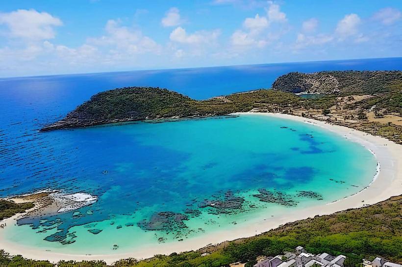
Valley Church Beach
Darkwood Beach
Cades Reef
Transportation Network
Movement is dependent on private vehicles or the national bus system. There is no metro or tram network. Public transportation is served by Route 22 mini-vans, which run frequently between St. John’s and Old Road via the Valley Road. Ride-sharing apps are not operational; transport relies on official "TX" taxis stationed at Jolly Harbour and major resorts. Traffic density is low, though Fig Tree Drive is narrow and prone to blockages from heavy rain or slow-moving tourist vehicles.
Safety & "Red Zones"
The general safety level is high. There are no specific "red zones" or neighborhoods to avoid. Risks are primarily limited to opportunistic theft from rental cars parked at isolated beaches and petty theft in the Bolans area. Nighttime driving requires caution due to unlit, winding mountain roads and stray livestock.
Digital & Financial Infrastructure
Internet speeds average 30–60 Mbps, with fiber-optic availability concentrated in the Jolly Harbour and luxury resort enclaves. Main mobile carriers are Flow and Digicel. Card acceptance is high in the Jolly Harbour commercial zone and resorts, but cash (XCD) is required for local bus fares and roadside produce stands. ATMs are located within the Jolly Harbour complex.
Climate & Air Quality
Temperatures range from 22°C to 28°C in winter and 24°C to 31°C in summer. Air quality is the highest on the island due to dense forest cover and lack of industrial activity. The region receives higher rainfall than the rest of the island, leading to occasional landslides on Fig Tree Drive during the hurricane season (June–November).
Culture & Social Norms
Tipping is standard at 10–15%. Social greetings are a mandatory cultural requirement. Dress codes are conservative in the villages; beachwear must be restricted to the shoreline. Camouflage clothing is strictly illegal for civilians. The region maintains a strong agricultural tradition, particularly the cultivation of the "Antigua Black" pineapple.
Accommodation Zones
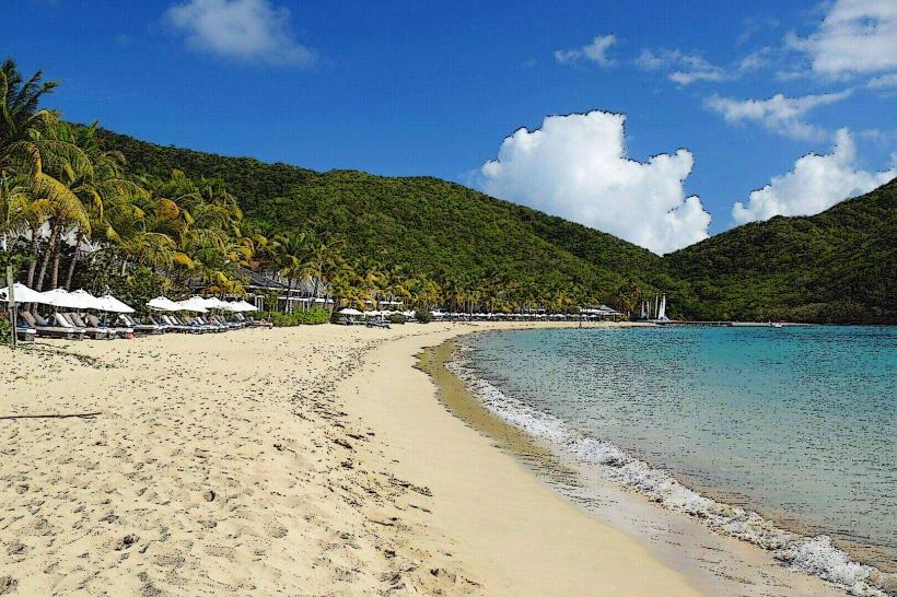
Jolly Harbour: Stay here for logistical ease, supermarkets, and a wide range of villa rentals.
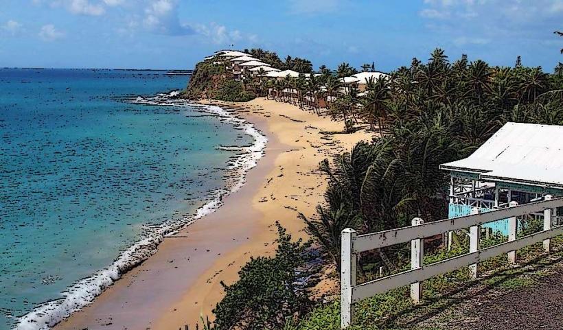
Old Road/Johnson's Point: Stay here for secluded luxury resorts and proximity to the rainforest.
Local Cost Index
1 Espresso: 12.00 XCD ($4.45 USD)
1 Standard Lunch: 55.00 XCD ($20.35 USD)
1 Bus Ticket (to St. John's): 2.75 XCD ($1.05 USD)
Nearby Day Trips
Cades Reef: 2 km offshore (15-minute boat ride)
Wallings Nature Reserve: 5 km (10 minutes by car)
St. John’s (Capital): 11 km (20–25 minutes by car)
Nelson’s Dockyard: 15 km (30 minutes by car via Fig Tree Drive)
Facts & Legends
A local historical oddity is the renaming of the island's highest point from Boggy Peak to Mount Obama in 2009 to honor the 44th US President, before its partial revert to "Mount Obama National Park." Local legend tells of the "Old Road Spirit," a guardian figure said to protect the ancient silk cotton trees in the rainforest; cutting these trees is still avoided by many locals to avoid bad luck.