Information
City: TacuaremboCountry: Uruguay
Continent: South America
Tacuarembo, Uruguay, South America
Tacuarembó is a department located in the northern region of Uruguay. It is known for its rich gaucho (cowboy) culture, rural landscapes, and significant role in the country’s agriculture and livestock industries. The department is one of Uruguay’s largest by area and serves as an important hub for both cultural and economic activities in the central part of the country.
Here's a detailed look at Tacuarembó:
1. Geography and Location:
- Location: Tacuarembó is located in the northern part of Uruguay, bordered by the departments of Rivera to the north, Salto to the west, Durazno to the south, and Cerro Largo to the east. It also borders Brazil to the north, with the Jagüel River and Cuareim River marking part of the natural border.
- Area: The department covers an area of approximately 15,000 square kilometers (around 5,800 square miles), making it one of the largest departments in Uruguay.
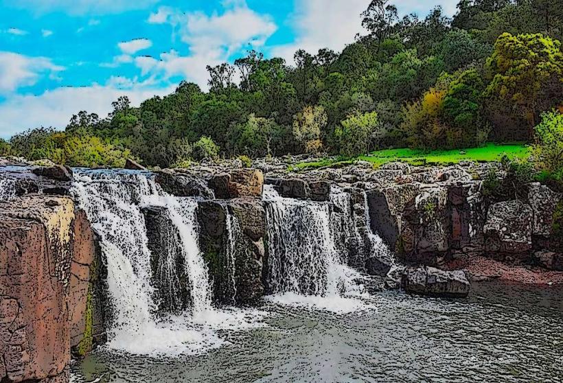
- Rivers and Waterways: Tacuarembó is home to several rivers, including the Tacuarembó River, the Yi River, and the Queguay River, which play an important role in the local agriculture and livestock industries.
- Climate: Tacuarembó experiences a humid subtropical climate, with hot summers and mild winters. It is ideal for agriculture, and the department’s climate allows for year-round farming.
2. History:
- Early Settlement: Originally inhabited by the Charrúa people, Tacuarembó was later settled by Spanish colonizers in the 18th century. The area became a significant part of the Río de la Plata colonial region.
- Post-Independence: After Uruguay gained independence from Spain and Brazil in the 19th century, Tacuarembó began to grow as a center for cattle ranching and agriculture, which would later form the backbone of its economy.
- The Birth of José Gervasio Artigas: Tacuarembó is historically significant because it is the birthplace of José Gervasio Artigas, one of Uruguay’s national heroes and the leader of the country’s fight for independence.
3. Economy:
- Agriculture and Livestock: Tacuarembó is known for its livestock farming, particularly cattle. It is one of Uruguay’s most important areas for beef production, with vast stretches of land dedicated to cattle ranching. In addition to livestock, the region also grows soybeans, corn, and wheat.
- Forestry and Agriculture: The department also has a strong presence in forestry, with the cultivation of pine and eucalyptus trees. These are important for the local economy, especially in paper production.
- Dairy Farming: Along with cattle ranching, dairy farming is also an essential part of the economy in Tacuarembó, contributing to the milk and cheese industry in Uruguay.
- Small-Scale Industry: Tacuarembó has a smaller, but growing, presence in manufacturing, particularly in industries related to agriculture, such as food processing, leather production, and textiles.
4. Attractions and Tourism:
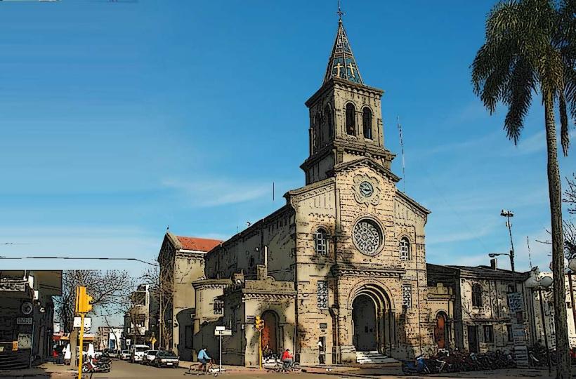
- Artigas Mausoleum: One of the most significant landmarks in Tacuarembó is the Artigas Mausoleum, where Uruguay’s national hero José Gervasio Artigas is buried. The mausoleum is located in the Plaza Artigas, and the area is a key historical site, attracting both national and international visitors interested in the history of Uruguay’s independence.
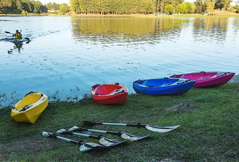
- San Gregorio Lake (Laguna de San Gregorio): A beautiful lake located in the southern part of the department, offering a peaceful natural environment for activities like birdwatching, boating, and camping.
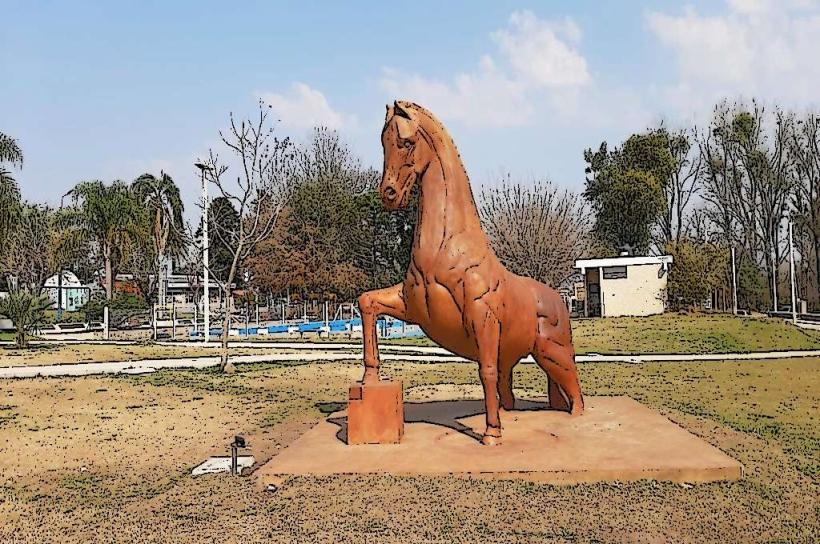
- Gaucho Culture: Tacuarembó is strongly associated with gaucho (cowboy) traditions, and the region hosts festivals that celebrate Uruguayan cowboy culture, including rodeos, traditional music, and folk dancing. The Fiesta Nacional del Caballo (National Horse Festival) is one of the department's most important annual events, drawing visitors for horseback riding competitions, parades, and other cultural displays.
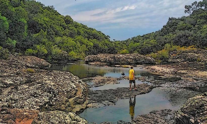
- Isla del Sauce (Island of the Sauce): An island on the Tacuarembó River, known for its serene landscapes, ideal for camping, hiking, and fishing. It's a perfect getaway for nature lovers and those seeking a peaceful retreat.
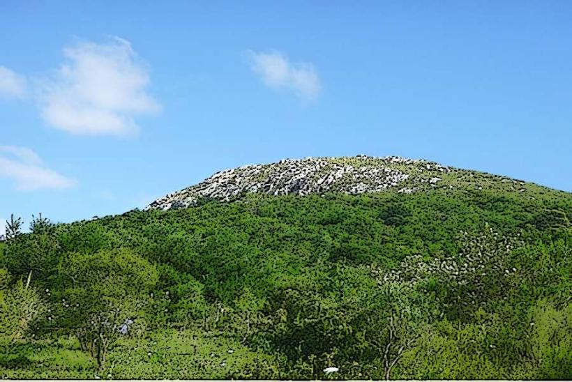
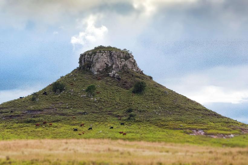
- Cerro Batoví: A hill in the department that provides scenic views of the surrounding countryside, ideal for hiking and exploring nature. It is a popular spot for eco-tourism and outdoor activities.
5. Culture and Lifestyle:
- Gaucho Heritage: Tacuarembó is often considered the heart of gaucho culture, with its vast rural lands, traditional rodeo events, and a strong connection to Uruguayan folklore. The guitar and accordion are staples of gaucho music, and the candombe rhythm also has a presence here, adding to the region’s cultural richness.
- Festivals: In addition to the National Horse Festival, Tacuarembó hosts numerous other events that celebrate its rich cultural heritage, including local fairs, music festivals, and traditional celebrations that showcase Uruguay’s folk traditions.
- Cuisine: The Uruguayan barbecue (asado) is a key part of the culture in Tacuarembó, where beef is a central element of the local diet. The department is also known for producing cheese, dairy products, and traditional Uruguayan pastries.
6. Transportation and Accessibility:
- By Road: Tacuarembó is well-connected to the rest of Uruguay by a network of highways. The Ruta 5 runs through the department, connecting it to Montevideo in the south and Salto to the north. The department is also served by other regional roads, making it accessible for both locals and tourists.
- By Bus: The bus system in Tacuarembó connects the department with other major cities in Uruguay, including Montevideo, Salto, and Rivera. Long-distance buses are a common form of transportation for both intercity travel and tourism.
- By Train: While Uruguay has a limited rail network, Tacuarembó has a train station offering services to other parts of the country, but buses are often preferred for longer journeys.
- By Air: The Tacuarembó Airport offers limited services, mainly domestic flights, and is located near the city center. For international travel, Montevideo is the nearest airport with international connections, about 400 kilometers (about 250 miles) south of Tacuarembó.
7. Environmental Issues:
- Deforestation and Land Use: While Tacuarembó’s large cattle ranching and agricultural industries drive much of the local economy, there is a growing awareness of the need to manage land use in a sustainable manner. Issues related to deforestation and the need for responsible farming practices are increasingly on the local agenda.
- Water Resources: With the vast agricultural activities and livestock farming, water management is essential. The region faces challenges related to preserving water quality and ensuring enough resources for the growing agricultural activities while protecting natural water sources.
- Conservation Efforts: Tacuarembó has begun to make strides in promoting eco-tourism and wildlife conservation, especially with its natural parks and reserves. Sustainable tourism is being encouraged to protect the region’s natural beauty while supporting the local economy.
8. Demographics:
- Population: Tacuarembó has a population of around 100,000 people, with most of the population living in the city of Tacuarembó, the department’s capital. The rest of the population is spread across smaller towns and rural communities.
- Rural and Urban Divide: Tacuarembó is known for its rural nature, and the economy is heavily based on agriculture and livestock. The city of Tacuarembó serves as the department's administrative and commercial center, but much of the region remains sparsely populated, with farming families spread out across vast estates.
9. Summary:
Tacuarembó is a department that captures the essence of Uruguayan rural life and gaucho culture. Known for its vast farmlands, cattle ranching, and gaucho traditions, Tacuarembó also has historical significance as the birthplace of José Artigas, a key figure in Uruguay’s fight for independence. The department’s natural landscapes, including rivers, lakes, and forests, along with its cultural festivals, make it a unique and important region in Uruguay. Whether you're interested in eco-tourism, agriculture, or exploring the heart of Uruguay’s gaucho heritage, Tacuarembó offers something for everyone.