Information
City: ToamasinaCountry: Madagascar
Continent: Africa
Toamasina, Madagascar, Africa
Toamasina, also known as Tamatave, is the largest port city in Madagascar and the capital of the Atsinanana region. Located on the east coast, it serves as the nation’s economic lungs, handling approximately 90% of the country’s international container traffic.
Historical Timeline
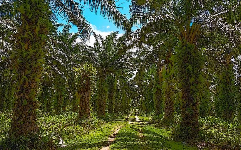
The city's name traditionally stems from the Malagasy "Tao masina" (It is holy). It grew from a small fishing village into a major colonial administrative center under the French in the late 19th century. In 1927, the city was almost entirely leveled by a devastating cyclone, leading to a reconstruction characterized by a more modern, organized grid and wide boulevards. Today, it is the center of Madagascar’s petroleum, nickel, and cobalt export industries.
Demographics & Population
The population is approximately 350,000. The dominant ethnic group is the Betsimisaraka ("The many inseparables"), the second-largest group in Madagascar. The city is highly cosmopolitan due to its port status, hosting large communities of Chinese-Malagasy (Sinoa) and French residents.
Urban Layout & Key Districts
Toamasina is flat, built on a sandy peninsula between the Indian Ocean and the Pangalanes Canal.
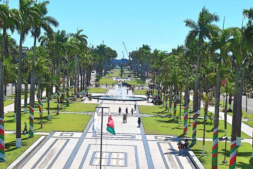
The Boulevard Maritime: A wide, palm-lined seafront promenade and the city's social epicenter.
Bazar Be: The "Great Market," the primary commercial hub for spices, textiles, and vanilla.
The Port: A restricted, high-activity zone on the southern edge of the city.
Cité Canada: A residential district rebuilt with international aid following past natural disasters.
Top Landmarks
Bazar Be: A historic market famous for the scent of high-quality vanilla, cloves, and cinnamon.
The Place de la Colonne: A central plaza featuring a colonial-era monument and the city’s administrative heart.
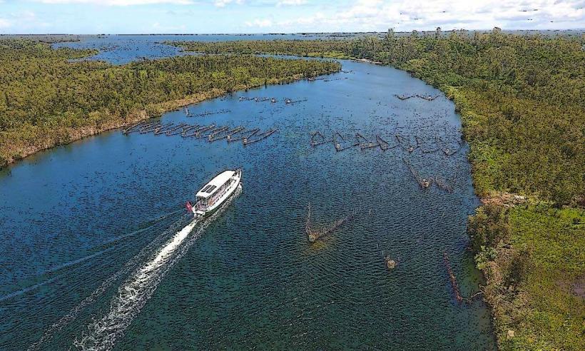
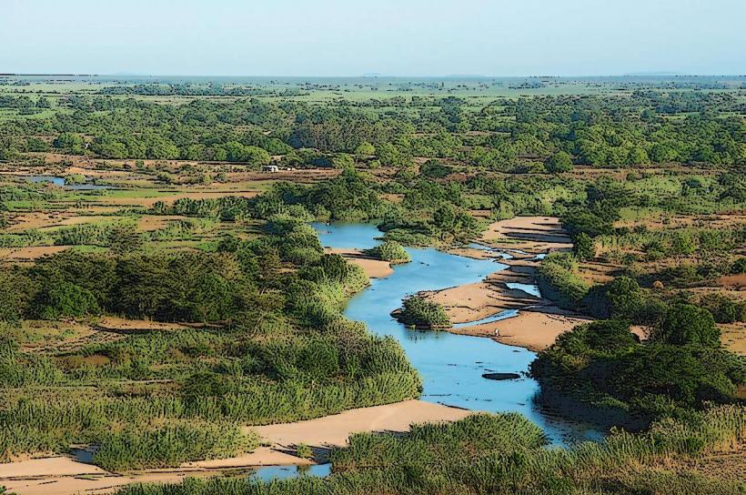
Pangalanes Canal: An artificial 650 km waterway running parallel to the coast; the city serves as its northern terminus.
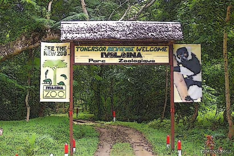
Ivoloina Parc: Located 12 km north, this botanical garden and zoo houses rescued lemurs, radiated tortoises, and rare plant species.
Minitiere Point: A popular local beach area, though swimming in the open ocean here is often restricted.
Transportation Network
Air: Ambalamanasy Airport (TMM) offers regular domestic flights to Antananarivo and Maroantsetra.
Roads: Connected to the capital via the RN2 (approx. 370 km), a winding, high-traffic highway dominated by heavy fuel and cargo trucks.
Local Transit: Pousse-pousses and Tuk-tuks are the standard transit modes. Toamasina has more rickshaws per capita than any other city in Madagascar.
Railway: The Madarail line connects to Antananarivo, but currently operates primarily for freight.
Safety & "Red Zones"
Toamasina requires high vigilance due to its industrial and port-driven nature.
Risks: Petty theft and pickpocketing are rampant in market areas and along the Boulevard Maritime.
Night Safety: Walking at night is strictly discouraged. The seafront area, while beautiful, becomes unsafe after dark.
Marine Safety: Do not swim in the open sea at Toamasina; the waters are infested with sharks attracted by the port’s activity and the deep-water drop-off.
Digital & Financial Infrastructure
4G/5G mobile coverage is consistent throughout the city. As the economic hub, it features numerous banks (BNI, BMOI, Société Générale) with reliable ATMs. Fiber-optic internet is common in business-grade hotels. The currency is the Malagasy Ariary (MGA).
Climate & Air Quality
Climate: Tropical rainforest climate. It is one of the wettest cities in Madagascar, with rain falling nearly 250 days a year. Cyclones are a recurring threat from December to March.
Air Quality: Moderate to poor. Heavy truck exhaust from the RN2 and industrial emissions from the nearby Ambatovy refinery impact the atmosphere.
Culture & Social Norms
The Betsimisaraka culture is defined by its maritime history and agricultural exports.
Cuisine: Toamasina is the center of the "Spiced East." Lychees, vanilla, and cloves are omnipresent. The city is the primary source of the national lychee export during the November harvest.
Dress: Due to the heat and humidity, light clothing is standard, but modest attire is expected in business and religious settings.
Local Cost Index
1 Espresso: ~5,000 MGA ($1.10)
1 Tuk-tuk Ride: ~2,000 MGA ($0.45)
1 kg of Export-grade Vanilla: Market Price (Highly variable)
Nearby Day Trips
Ile aux Prunes (Plum Island): Located offshore, featuring a historic lighthouse and excellent snorkeling in a protected reef.
Foulpointe (Mahavelona): 1.5 hours north; a popular resort town with a shallow, reef-protected lagoon safe for swimming.
Manambato: 2.5 hours south; a gateway to the Pangalanes Canal and white-sand lake beaches.
Facts & Legends
A verified historical oddity is that the 1927 cyclone was so powerful it permanently altered the coastline of the city, creating the current shape of the harbor. Local legend tells of the "Zazavavindrano" (Mermaids) who live in the Pangalanes Canal and are said to lure fishermen who do not respect the water's traditional taboos.