Information
Landmark: Canal des PangalanesCity: Toamasina
Country: Madagascar
Continent: Africa
Canal des Pangalanes, Toamasina, Madagascar, Africa
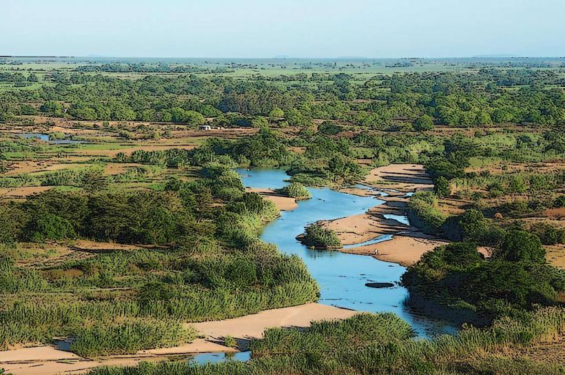
The Canal des Pangalanes is an extensive network of natural rivers, lakes, and man-made channels running parallel to the east coast of Madagascar, with significant access points from the city of Toamasina. This waterway serves as a crucial transportation route and a natural barrier.
Visual Characteristics
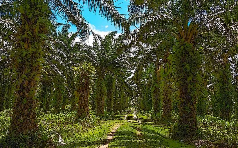
The canal consists of a narrow, calm waterway, often bordered by dense tropical vegetation including palm trees, mangroves, and pandanus. The water color is typically brownish-green due to sediment and organic matter. Its width varies, generally ranging from 20 to 100 meters, with some sections opening into wider lakes. The banks are often low-lying, featuring sandy or muddy shores.Location & Access Logistics
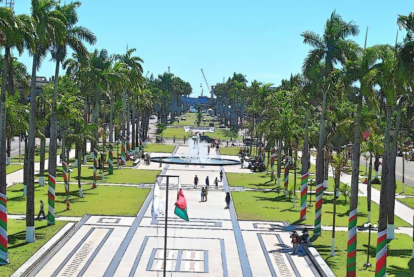
Access to the Canal des Pangalanes from Toamasina is primarily via the city's port area or specific embarkation points along the eastern edge, such as near the central market. Many organized tours depart from hotels or designated boat docks within 1-2km of the city center. Parking is generally available at tour operator offices or public boat launches. Public transport within Toamasina can reach these points, but direct bus lines to specific canal access points are not standardized; taxi or tuk-tuk services are common for short distances.Historical & Ecological Origin
Construction of the Canal des Pangalanes began in the late 19th century under French colonial rule, with significant work continuing into the early 20th century. Its primary purpose was to create a safe inland waterway for transporting goods, particularly timber, spices, and other agricultural products, avoiding the treacherous coastal waters of the Indian Ocean. It connects several natural lakes and lagoons through man-made channels, forming a continuous navigable route. Ecologically, it traverses diverse ecosystems, including coastal forests, wetlands, and freshwater lakes.Key Highlights & Activities
Key activities include multi-day boat excursions along the canal, visiting local fishing villages, and observing endemic wildlife such as lemurs, chameleons, and various bird species in the surrounding forests. Fishing is a common activity for local communities and visitors. Specific sections offer opportunities for cultural immersion in traditional Malagasy life.Infrastructure & Amenities
Infrastructure along the canal is minimal outside of major towns. Restrooms are typically available at tour operator offices in Toamasina and at some larger villages along the canal. Shade is provided by the dense vegetation along the banks and by boat canopies. Cell phone signal (4G) can be intermittent along remote sections of the canal but is generally available near Toamasina and larger settlements. Food vendors are scarce along the canal itself, but local meals are often provided as part of organized tours in villages.Best Time to Visit
The best time to visit is during the dry season, from April to November, when rainfall is lower and temperatures are more moderate. Early morning or late afternoon boat trips offer optimal lighting for photography and increased chances of wildlife sightings. There are no specific high/low tide requirements for canal navigation, as it is an inland waterway.Facts & Legends
The Canal des Pangalanes is a vital transportation artery for local communities, with pirogues and small cargo boats constantly traversing its length, serving as a lifeline for remote villages. A practical tip for visitors is to bring insect repellent, especially during dawn and dusk, due to the presence of mosquitoes.Nearby Landmarks
- Toamasina Port: 1km West
- Bazar Be (Toamasina Central Market): 0.5km West
- Toamasina Beach: 0.2km East
- Avenue de l'Indépendance: 0.7km West
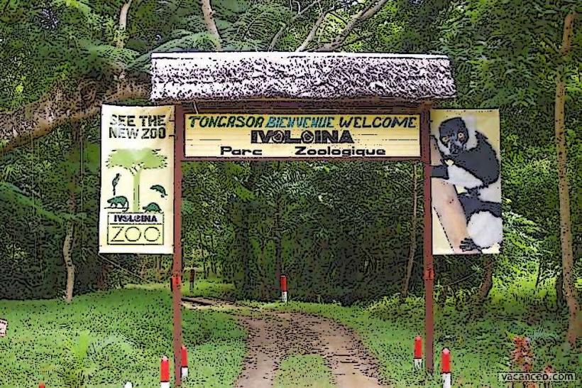
- Parc Zoologique Ivoloina: 12km North-West