Information
City: TumbesCountry: Peru
Continent: South America
Tumbes, Peru, South America
Tumbes is the capital of the Tumbes Region in the far northwest of Peru, bordering Ecuador. Located along the Tumbes River, it is a tropical coastal city serving as the main northern gateway for cross-border trade and ecotourism. It is known for its unique mangrove ecosystems and consistently warm, "eternal summer" climate.
Historical Timeline
Inhabited by the Tumpis culture (noted for navigation and shell carving) and later the Tallanes, Tumbes was the first point of contact between Francisco Pizarro and the Inca Empire in 1528. It was the first Peruvian city to proclaim independence from Spanish rule on January 7, 1821. Historically, it has been a flashpoint for territorial disputes with Ecuador, most notably during the 1941 Peruvian–Ecuadorian War.
Demographics & Population
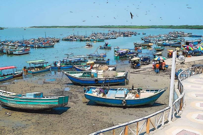
The metropolitan population is approximately 115,000, while the region exceeds 260,000. The demographic is predominantly Mestizo, with cultural influences from pre-Inca tribes, Spanish settlers, and Afro-descendant communities. The economy is driven by cross-border commerce, petroleum, and the extraction of aquatic resources like shrimp and black shells (conchas negras).
Urban Layout & Key Districts
City Center (Cercado): The commercial core centered around the Plaza de Armas.
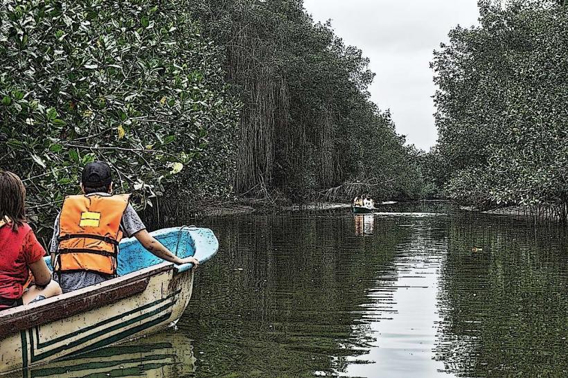
Puerto Pizarro: A fishing village 13 km north of the city; the primary departure point for boat tours into the mangroves.
Corrales: A historic district housing the Cabeza de Vaca archaeological complex.
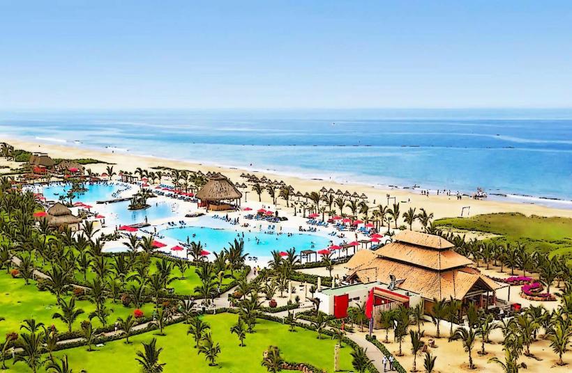
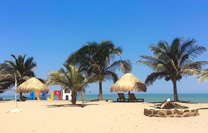
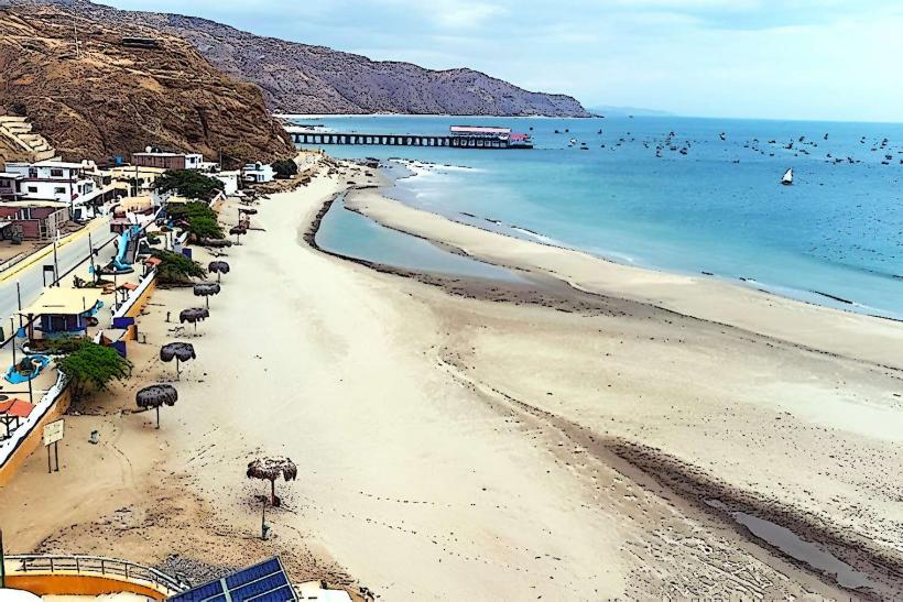
Zorritos: Located 28 km south; a tranquil beach town known for its thermal baths and modern resort infrastructure.
Top Landmarks
Plaza de Armas: Features the "Meeting of Two Worlds" mosaic, depicting the arrival of the Spanish and the resistance of Chief Chilimasa.
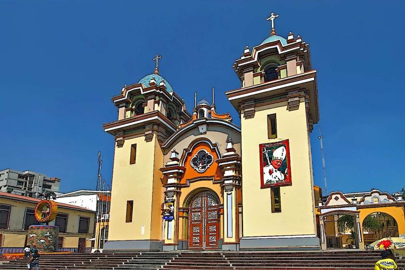
San Nicolás de Tolentino Cathedral: A 17th-century Baroque church located on the main square.
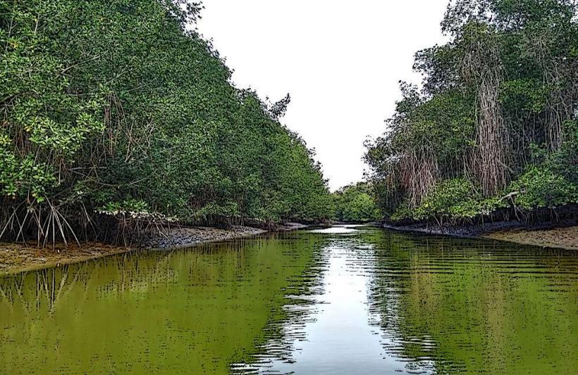
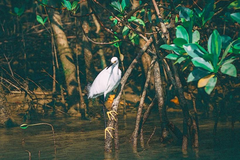
Los Manglares de Tumbes National Sanctuary: A 2,900-hectare protected area protecting Peru's only mangrove forests, home to American crocodiles and rare bird species.
Cabeza de Vaca (Fortaleza de Tumpis): A massive adobe and stone archaeological complex that served as a major administrative center on the Inca coastal road.
Paseo Jerusalén: A pedestrian walkway featuring a 15-meter sculpture of Christ and intricate mosaics depicting biblical scenes.
Transportation Network
Air: Capitán FAP Pedro Canga Rodríguez Airport (TBP) offers daily flights to Lima.
Road: Located on the Pan-American Highway. It is the primary transit point for buses traveling between Peru and Ecuador (Guayaquil/Quito).
Border Logistics: The international bridge at Aguas Verdes connects Tumbes to the Ecuadorian city of Huaquillas.
Local: Relies on mototaxis and standard taxis. Most ecotourism sites require "colectivos" or private tour vans.
Safety & Health
Border Security: The border region can be chaotic. Travelers are advised to use direct international buses (e.g., Cruz del Sur) to minimize exposure to scams at the crossing.
Epidemiological Risk: Significant risk of Dengue and Zika due to the tropical climate; high-DEET repellent is mandatory.
Water: High risk of waterborne illness; consume only bottled or treated water.
Street Crime: Use caution in crowded markets and avoid poorly lit areas near the river at night.
Digital & Financial Infrastructure
4G/LTE is stable in the city center and major beach resorts. The currency is the Peruvian Sol (PEN), though US Dollars are often accepted for cross-border transit. ATMs are available around the Plaza de Armas. Cash is mandatory for port fees and local markets.
Climate & Air Quality
Tropical savanna climate. It is hot and humid year-round ($24^\circ\text{C}$ to $34^\circ\text{C}$). The Wet Season (January–March) can bring torrential rains and flooding, which may disrupt road travel. Air quality is generally high, though localized pollution exists near the border crossing.
Culture & Social Norms
Binational Culture: Strong social and economic ties with Ecuador; many residents move freely between the two countries daily.
Folklore: Famous for Cumananas (improvised poetic songs) and the Danza de la Pava (Turkey Dance).
Cuisine: Specialized in Ceviche de Conchas Negras (black shell ceviche), Chilcano de Pescado, and Majarisco (mashed plantains with seafood sauce).
Local Cost Index (PEN)
1 Plate of Ceviche de Conchas Negras: S/ 30.00–S/ 50.00
1 Boat Tour of Mangroves (per person): S/ 40.00–S/ 70.00
1 Mototaxi (City Center): S/ 3.00–S/ 6.00
Nearby Day Trips
Crocodile Farm (Puerto Pizarro): A breeding center for the endangered American Crocodile (Crocodylus acutus).
Punta Sal: One of Peru's most exclusive beaches, located 1.5 hours south.
Cerros de Amotape National Park: A dry tropical forest ecosystem housing howler monkeys and jaguars.
Facts & Legends
Legend says the "Water of Succor" (Agua del Socorro)-a ritualized emergency baptism-protects unbaptized children from mountain spirits. A geographic fact: Tumbes is the only region in Peru with a significant mangrove ecosystem, created by the meeting of the Tumbes River's freshwater and the Pacific's saltwater. Historically, Tumbes was the site of the first "Western" religious act in South America: the planting of a cross at Caleta La Cruz by Pizarro's men.