Information
Landmark: Zorritos BeachCity: Tumbes
Country: Peru
Continent: South America
Zorritos Beach, Tumbes, Peru, South America
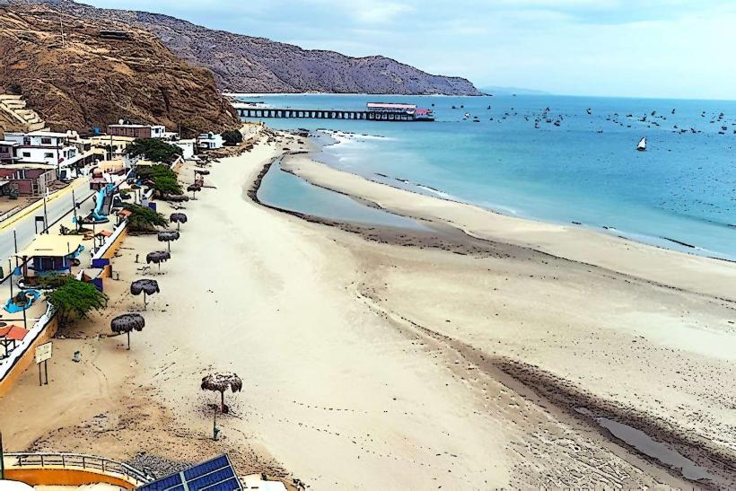
Zorritos Beach is a coastal area located in the Tumbes region of northern Peru. It is known for its long stretch of sand and warm waters.
Visual Characteristics
The beach features light brown, fine-grained sand. The water is typically a clear turquoise color, with moderate wave action. Palm trees line the shore, providing natural shade in some areas. The coastline extends for several kilometers.
Location & Access Logistics
Zorritos Beach is situated approximately 28 kilometers north of the city of Tumbes, accessible via the Pan-American Highway (Carretera Panamericana Norte). Travel time from Tumbes is about 30-40 minutes by car. Public transportation options include local buses that run frequently along the highway. Parking is available along the main road adjacent to the beach, with some informal areas designated for vehicles.
Historical & Ecological Origin
Zorritos Beach is part of the coastal plain of northwestern Peru, formed by alluvial deposits and marine erosion over millennia. Ecologically, it is situated within a tropical dry forest ecosystem, characterized by arid conditions and specific plant and animal adaptations. Historically, the area has been a fishing and agricultural zone for local communities.
Key Highlights & Activities
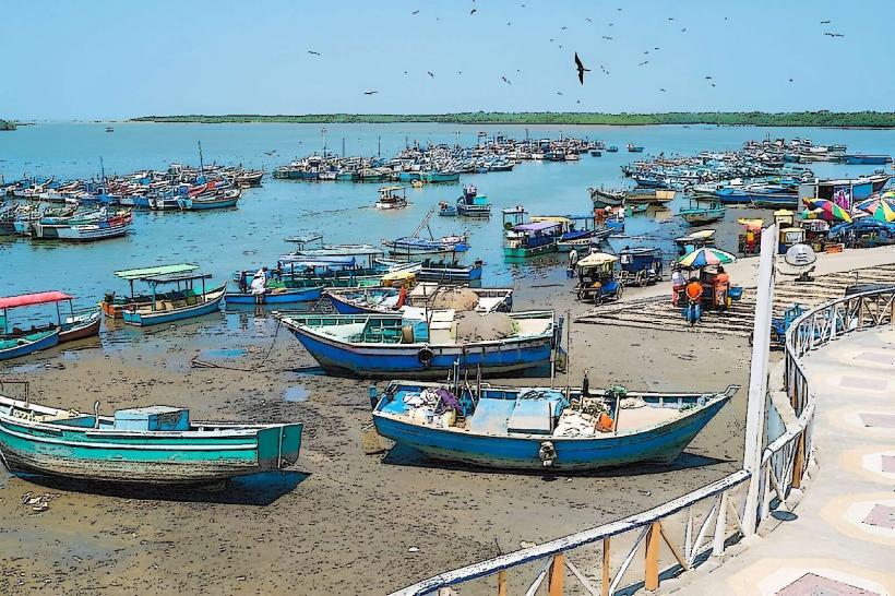
Swimming is a primary activity due to the warm water temperatures. Sunbathing on the sand is common. Local vendors offer boat trips for dolphin watching, particularly during the months of July to September. Fishing from the shore or by boat is also practiced.
Infrastructure & Amenities
Basic infrastructure includes several beachfront restaurants and small shops selling snacks and drinks. Restrooms are available at some of these establishments. Shade is provided by palm trees and palapas at some restaurants. Cell phone signal (4G) is generally available.
Best Time to Visit
The best time for visiting Zorritos Beach is during the dry season, from April to November, when temperatures are warm and rainfall is minimal. The sun is strongest between 10:00 AM and 3:00 PM. High tide can affect the width of the sandy area.
Facts & Legends
A local legend speaks of ancient mariners who used the distinctive rock formations at the southern end of the beach as navigational markers. These formations are locally known as "Los Órganos" due to their layered, pipe-like appearance.
Nearby Landmarks
- 0.5km South: Los Órganos rock formations
- 5km North: Puerto Pizarro (fishing port)
- 15km South: Mancora (beach town)
- 20km South: Los Órganos (town)