Information
City: Vanua LevuCountry: Fiji
Continent: Australia
Vanua Levu, Fiji, Australia
Vanua Levu serves as the second-largest island in the Fiji archipelago and the primary engine for the nation's Northern Division economy. It is situated 64 km north of Viti Levu, separated by the Bligh Water and the Koro Sea.
Historical Timeline
The island was first sighted by Abel Tasman in 1643, but European settlement only solidified in the early 19th century through the sandalwood trade in Bua Bay. The primary era of governance shifted from independent chiefly confederacies to a centralized colonial administration following the 1874 Cession. A significant economic reconstruction occurred in 1894 with the establishment of the Labasa Sugar Mill. The primary event shaping the current urban and logistical form was the 2011 completion of the Nabouwalu-to-Labasa highway sealing project, which integrated the island’s western port with its northern industrial center.
Demographics & Population
The total population of Vanua Levu is approximately 140,000. The demographics consist of approximately 56% iTaukei (Indigenous Fijian), 41% Indo-Fijian, and 3% representing Chinese, European, and other Pacific Islander minorities. The median age is 28.2 years.
Urban Layout & Key Districts
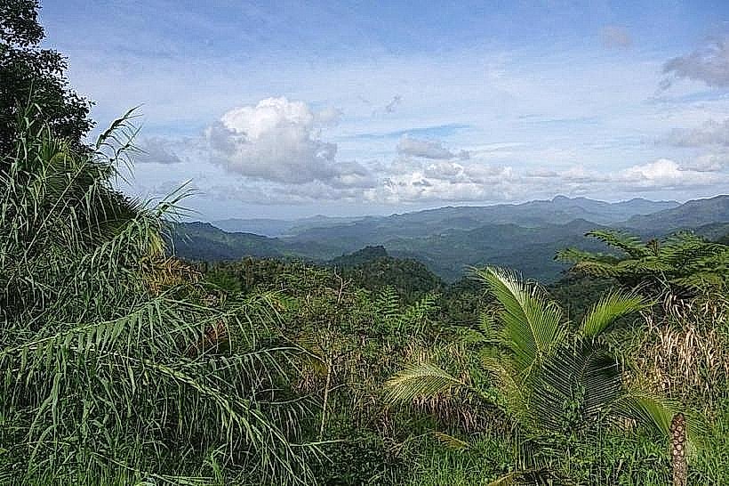
The island is organized around two primary urban nodes connected by the Hibiscus Highway and the Cross-Island Road. Labasa, in the north, is the industrial and administrative hub. Savusavu, in the south, is the maritime and tourism hub. The Bua District in the west serves as the primary gateway for Roll-on/Roll-off (Ro-Ro) ferry traffic from Viti Levu. The interior is dominated by a rugged volcanic mountain range that divides the island into a "wet" southern windward side and a "dry" northern leeward side.
Top City Landmarks
Labasa Sugar Mill: The dominant industrial structure of the Northern Division.
Savusavu Hot Springs: Active geothermal vents used for traditional cooking on the southern waterfront.
Naag Mandir: A sacred Hindu site in the north housing a growing stone monolith.
Wasavula Ceremonial Site: An ancient megalithic site near Labasa featuring upright stones.
Copra Shed Marina: The logistical and social center for the island’s maritime community in Savusavu.
Transportation Network
Movement between districts is facilitated by a network of public buses and "carriers" (modified trucks). Inter-island transit relies on the Nabouwalu and Savusavu wharves for ferry connections and airports at Labasa and Savusavu for domestic flights. Taxis are white and unmetered outside of Labasa town, requiring negotiated rates. Traffic density is low, but the Cross-Island Road remains hazardous due to steep gradients and frequent heavy rainfall.
Safety & "Red Zones"
The general safety level is higher than on Viti Levu. Risks are primarily environmental, including flash flooding and poorly lit rural roads. There are no designated urban "red zones," though caution is advised in the Labasa market area during peak transit hours. Night travel is discouraged due to the high frequency of wandering livestock and lack of road reflectors.
Digital & Financial Infrastructure
Internet speeds average 15–30 Mbps in urban centers. Vodafone and Digicel provide 4G coverage, though the mountainous interior and parts of the Natewa Peninsula have no signal. Card acceptance is moderate in Savusavu and Labasa supermarkets but non-existent in rural villages. ATMs are concentrated in the two main towns (BSP, ANZ, Westpac).
Climate & Air Quality
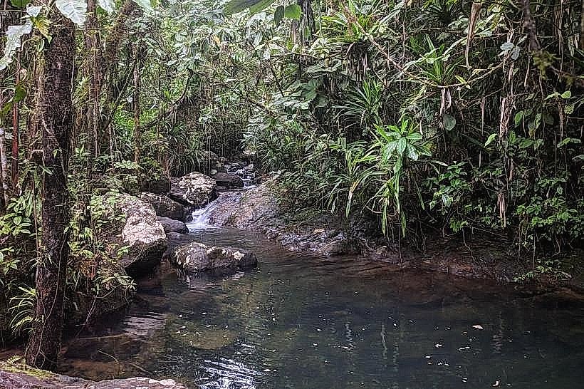
The island features two distinct microclimates: the tropical rainforest south (high rainfall) and the tropical savanna north (distinct dry season). Daytime temperatures range from 22°C to 32°C. Air quality is exceptional, with localized soot pollution in Labasa during the June–December sugar crushing season. The primary risk is tropical cyclones, which frequently impact the northern coast.
Culture & Social Norms
Tipping is not traditional. Cultural norms are deeply conservative. Presentation of a "Sevusevu" (kava root) is mandatory when entering a village for non-commercial purposes. In the north, Indo-Fijian social customs are prevalent, requiring the removal of shoes at temples and homes. Public displays of affection are culturally inappropriate in both urban and rural settings.
Accommodation Zones
Savusavu/Lesiaceva: Recommended for tourism, yachting, and proximity to high-end dining.
Labasa CBD: Recommended for logistical access to government offices and northern industrial sites.
Local Cost Index
1 Espresso: 7.00 FJD ($3.13 USD)
1 Standard Lunch: 10.00–18.00 FJD ($4.47–$8.04 USD)
1 Bus Ticket (Inter-town): 15.00 FJD ($6.70 USD)
Nearby Day Trips
Natewa Bay: The largest deep-water bay in the South Pacific (1-hour drive from Savusavu).
Snake Temple (Labasa): 10 km from Labasa town center.
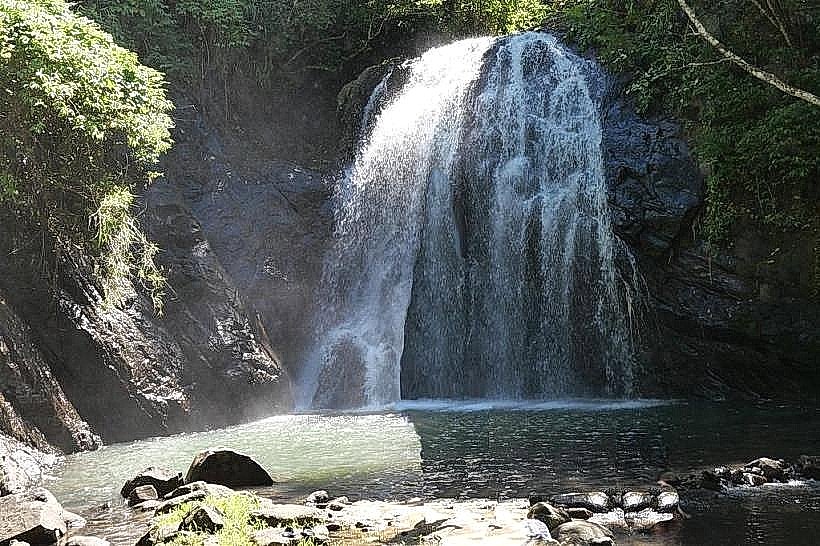
Vuadomo Village Waterfall: 15 km from Savusavu.
Korovatu Beach: 15 km from Labasa.
Facts & Legends
Vanua Levu is the site of the "Floating Island" legend of Lake Tagimoucia, where localized peat and vegetation masses move across the water surface. Historically, the island was the location of a significant American military presence during WWII, with an auxiliary airbase established at Labasa. A unique historical oddity is the "Copra Currency"; for much of the late 19th century, dried coconut meat was used as the primary medium of exchange in the absence of formal colonial coinage.