Information
Landmark: Achill IslandCity: Mayo
Country: Ireland
Continent: Europe
Achill Island, Mayo, Ireland, Europe
Achill Island is the largest island off the coast of Ireland, situated in County Mayo. It is connected to the mainland by the Michael Davitt Bridge. The island is characterized by mountainous terrain, sheer sea cliffs, and Blue Flag beaches.
Topography & Geology
Acaill Head: Home to the Croaghaun cliffs, which are among the highest sea cliffs in Europe, rising $688$ meters vertically from the Atlantic.
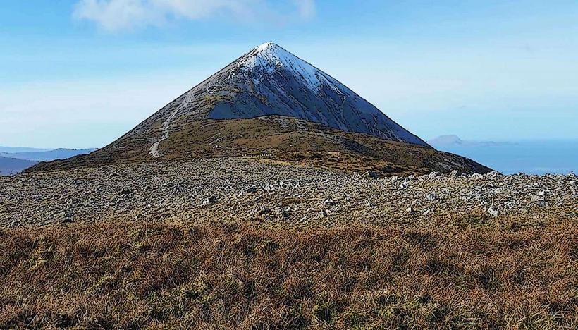
Mountain Ranges: Dominated by Slievemore ($671$ m) and Croaghaun.
The Atlantic Drive: A coastal route along the southern and western edges of the island, noted for its high-elevation views and narrow cliffside roads.
Location & Access Logistics
Access: Via the R319 road. The Michael Davitt Bridge (a swing bridge) connects the Curraun Peninsula to the island at Achill Sound.
Transit: Private vehicle is the primary mode. The Great Western Greenway is a $42$ km dedicated cycling path ending at Achill Sound.
Internal Transport: Local bus services (Route 440) connect the island to Westport and Castlebar.
Accessibility: Most beaches (Keel, Dugort) are accessible. High-altitude viewpoints and the Deserted Village require traversing uneven or steep terrain.
Historical & Cultural Context
The Deserted Village: Located at the foot of Slievemore, it consists of approximately $100$ ruined stone cottages. It was abandoned during the 19th-century Famine and later used as a "booley" (seasonal grazing) settlement.
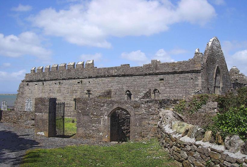
Kildamhnait Castle: A 15th-century tower house associated with the pirate queen Grace O'Malley (Granuaile).
Language: Parts of the island are within the Gaeltacht (Irish-speaking region).
Key Highlights
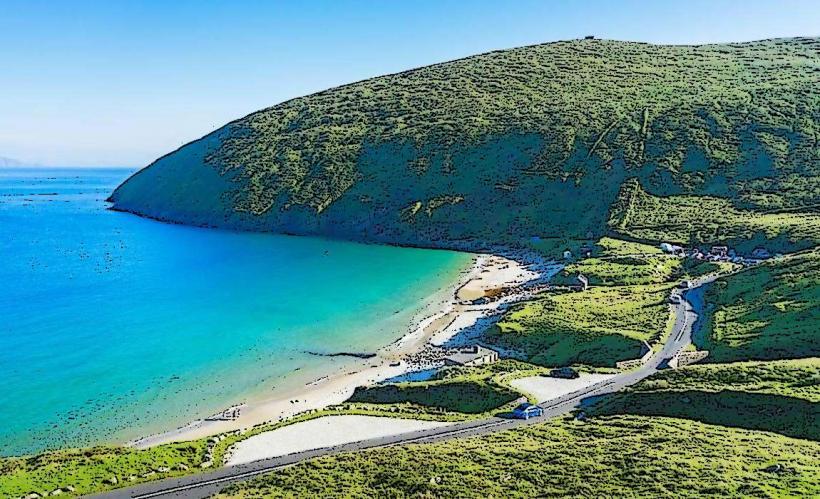
Keem Bay: A secluded horseshoe-shaped bay at the westernmost tip. Historically used as a site for basking shark fisheries.
Keel Beach: A $4$ km sandy beach popular for surfing and kite-boarding.
Slievemore Dugort: Features Megalithic tombs dating back $5,000$ years.
Infrastructure & Amenities
Hubs: Achill Sound (entry point), Keel (tourism hub), and Dugort.
Services: Contains supermarkets, pharmacies, and post offices at Achill Sound and Keel.
Activities: Surfing schools, hill walking, and deep-sea angling are the primary commercial activities.
Connectivity: 4G signal is stable in villages but lost in mountainous areas and deep bays like Keem.
Technical Details
Achill Island is an "island" by definition but functions as a peninsula due to the permanent bridge. The climate is hyper-oceanic, with extremely high wind speeds and rainfall exceeding $2,000$ mm annually in the mountainous sections.
Nearby Landmarks
Clare Island – Visible to the South
The Mullet Peninsula – To the North
Ballycroy National Park – 30 km East
Croagh Patrick – Visible across Clew Bay