Information
Landmark: Clare IslandCity: Mayo
Country: Ireland
Continent: Europe
Clare Island, Mayo, Ireland, Europe
Clare Island is a mountainous landmass situated at the entrance of Clew Bay in County Mayo, Ireland. It serves as a geological barrier protecting the inner bay and is located approximately 5.1km from the mainland at Roonagh Quay.
Visual Characteristics
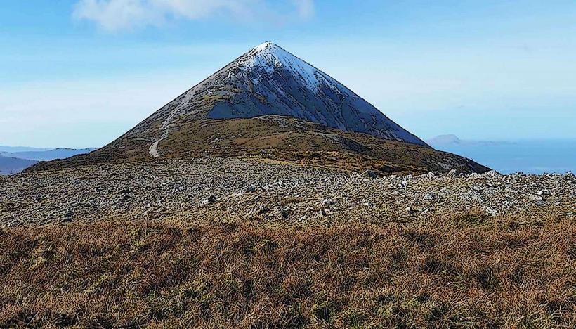
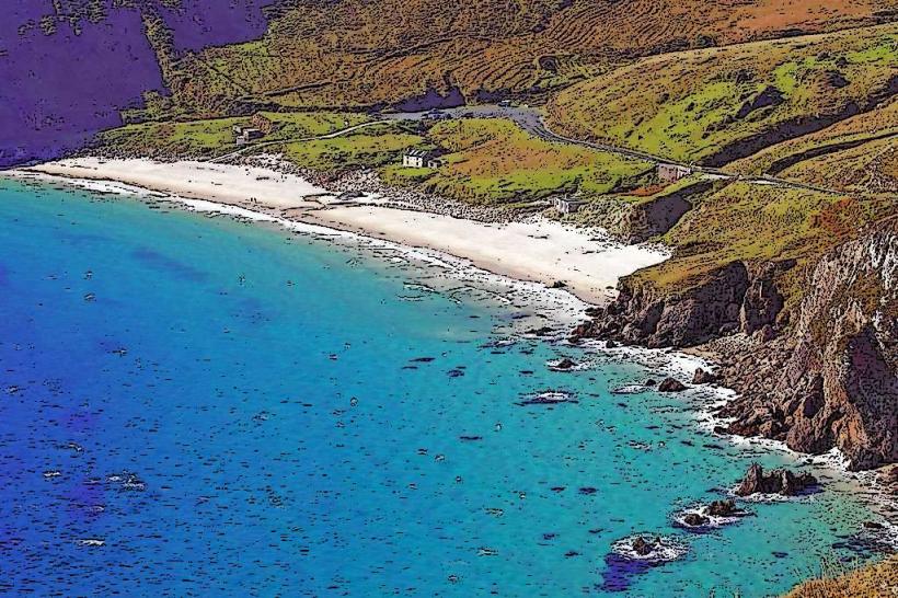
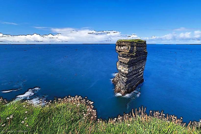
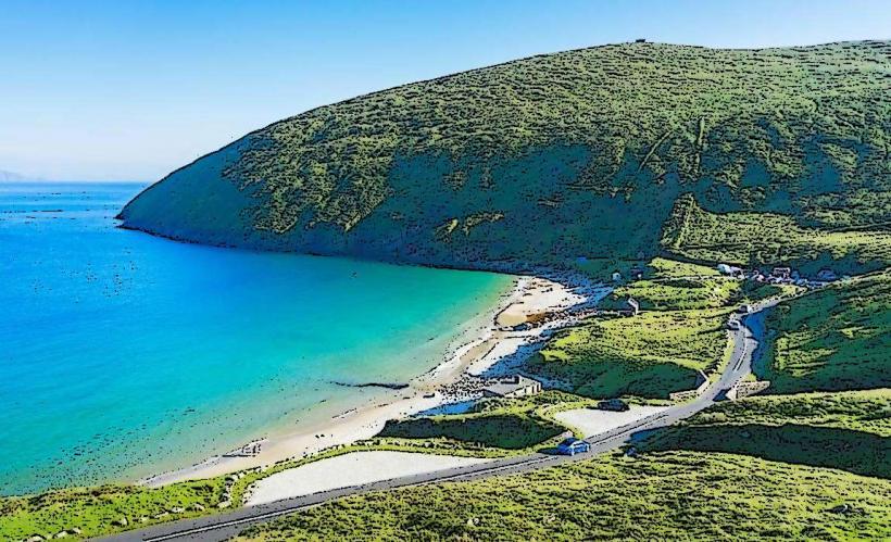
The terrain is dominated by the 487-meter peak of Mt. Knockmore, featuring steep sea cliffs on the northern and western perimeters. The geological composition consists of Silurian and Ordovician sedimentary rocks, characterized by thin soil cover and Atlantic blanket bog. Vegetation is primarily composed of wind-swept grasses, heather, and moss, with a notable absence of commercial forestry. The eastern coastline features a sandy beach near the harbor and a 16th-century square stone tower.
Location & Access Logistics
Access is restricted to maritime transport via ferries departing from Roonagh Quay, which is 28km west of Westport via the R335 road. Two ferry operators, Clare Island Ferry Co. and O'Grady's Clare Island Ferries, provide daily service; crossing time is approximately 20 minutes. There is no vehicle ferry; visitors arrive as pedestrians. On-island transport is limited to a local taxi service, bicycle rentals at the pier, or transit by foot along the single-track paved roads.
Historical & Ecological Origin
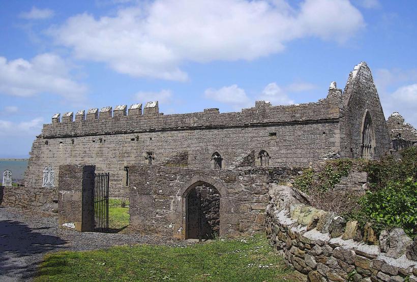
The island is a continental fragment formed by tectonic shifts along the Clew Bay Fault. Historically, it was the 16th-century stronghold of the O'Malley clan, specifically the base for the pirate queen Grace O'Malley (Granuaile). Between 1909 and 1911, the island was the site of the "Clare Island Survey," a pioneering biological study led by Robert Lloyd Praeger that documented every species on the island to establish a baseline for island biogeography.
Key Highlights & Activities
Hiking is the primary activity, specifically the ascent of Mt. Knockmore and the coastal loop toward the lighthouse. The 12th-century Cistercian Abbey contains rare medieval wall paintings and the O'Malley tomb. Sea kayaking and snorkeling are conducted around the sheltered eastern harbor. Birdwatching is focused on the western cliffs, which house colonies of fulmars, guillemots, and puffins during breeding season.
Infrastructure & Amenities
Public restrooms are located at the harbor near the community center. Shade is non-existent due to the lack of trees; waterproof gear is required. Cell signal is intermittent, with 4G available near the harbor but lost in the mountainous interior. Food is limited to one pub/restaurant and a small community shop near the pier; these operate on seasonal schedules and may close during winter months.
Best Time to Visit
The peak period is between June and August for maximum daylight and ferry frequency. Photography of the cliffs is best in late afternoon (golden hour) as the western face catches the direct Atlantic light. Low tide is necessary to access certain sea caves and the full extent of the harbor beach.
Facts & Legends
Local tradition holds that Grace O'Malley is buried in the canopy tomb at the Abbey; the tomb is marked by the O'Malley crest and the Latin motto "Terra Marique Putens" (Valiant by Sea and Land). A specific logistical tip: ferry sailings are highly dependent on swell height and wind direction from the west, often resulting in short-notice cancellations.
Nearby Landmarks
Inishturk Island – 12.0km Southwest
Croagh Patrick – 14.5km East
Roonagh Quay – 5.1km Southeast
Achill Island (southern tip) – 6.8km North
Caher Island – 8.2km South