Information
Landmark: Keem BayCity: Mayo
Country: Ireland
Continent: Europe
Keem Bay, Mayo, Ireland, Europe
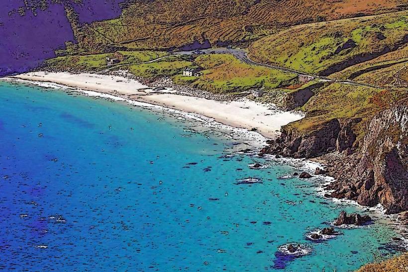
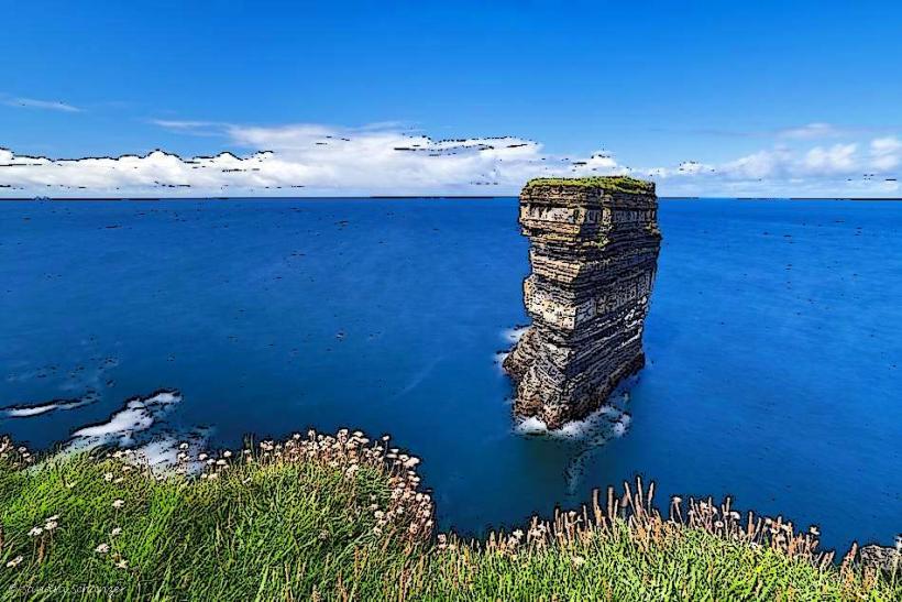
Keem Bay is a secluded horseshoe-shaped bay located at the westernmost tip of Achill Island, County Mayo. It is consistently ranked as one of the highest-quality beaches in Ireland and Europe.
Visual Characteristics
The bay is sheltered by steep cliffs on three sides, creating a micro-environment with calm waters relative to the open Atlantic.
Topography: Flanked by the slopes of Croaghaun mountain to the north and Moyteoge Head to the south.
Seascape: Noted for its turquoise water and white sand, a result of the high quartz content in the surrounding rock.
Wildlife: A primary sighting location for Basking Sharks, which feed in the bay during late spring and early summer.
Location & Access Logistics
Address: Keem, Achill, Co. Mayo, Ireland.
Position: At the terminus of the R319 road.
Transit: Reached via a narrow, winding cliffside road with steep drops and no safety barriers in several sections. Private vehicle or bicycle is the standard mode of access.
Parking: A tiered car park is located at the base of the valley. Capacity is frequently exceeded during summer months, leading to traffic congestion on the access road.
Accessibility: The car park is adjacent to the beach, but the transition to the sand involves a steep incline/steps. The surrounding cliff walks are unsuitable for mobility devices.
Historical & Economic Origin
Basking Shark Fishery: In the mid-20th century, Keem was a major center for the commercial hunting of Basking Sharks for their liver oil. The remains of the lookout hut used by fishermen are still visible on Moyteoge Head.
Deserted Village: The valley was once home to a seasonal "booley" settlement where islanders lived while grazing cattle on the mountain slopes.
Cinematic History: Served as a primary filming location for the 2022 film The Banshees of Inisherin (Colm Doherty’s house was situated on the cliffs overlooking the bay).
Key Highlights & Activities
Snorkeling: Features a designated Blueway snorkeling trail due to high water clarity and diverse marine life.
Hiking: The trailhead for the Croaghaun Cliffs (highest in Ireland) begins here. The hike is strenuous and requires navigation skills.
Swimming: The bay is a designated Blue Flag beach with seasonal lifeguard services.
Infrastructure & Amenities
Facilities: Minimal to preserve the natural landscape. No permanent buildings or shops are located at the bay.
Sanitation: Seasonal public restrooms are provided in the car park area.
Connectivity: Zero Signal. The high surrounding mountains cause a total shadow for cellular and GPS signals at the beach level.
Facts & Technical Details
Keem Bay is a "Valley of the Sun" geologically, formed by glacial erosion that hollowed out the quartzite basin. The water depth drops significantly just offshore, which allows large marine megafauna like sharks and dolphins to enter very close to the beach.
Nearby Landmarks
Croaghaun Cliffs – Directly North
Achill Sound – 25 km East
Keel Beach – 10 km East
Deserted Village (Slievemore) – 12 km Northeast