Information
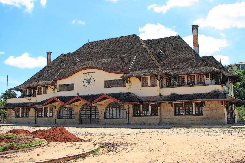
Landmark: Anja Community ReserveCity: Fianarantsoa
Country: Madagascar
Continent: Africa
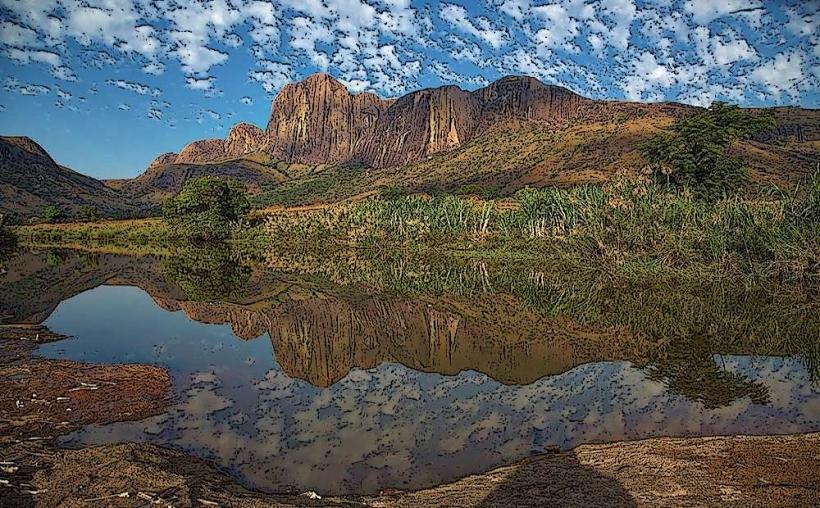
Anja Community Reserve, Fianarantsoa, Madagascar, Africa
The Anja Community Reserve is a protected area managed by a local community, located in the rural commune of Anja, approximately 13 kilometers south of Ambalavao, near Fianarantsoa, Madagascar.
This reserve is primarily characterized by large granite inselbergs and a dry forest ecosystem. The landscape features massive, smooth grey rock formations, some reaching significant heights, interspersed with dense, low-lying vegetation. The dominant tree species are adapted to dry conditions, and the undergrowth is thick. The reserve is known for its population of Ring-tailed Lemurs (Lemur catta), which have grey fur, white undersides, and distinctive black and white striped tails.
Location & Access Logistics
The reserve is situated along National Route 7 (RN7), approximately 13 kilometers south of Ambalavao and 78 kilometers south of Fianarantsoa. Access is directly from RN7, with a clearly marked entrance. Parking is available at the reserve's entrance, typically an unpaved area suitable for cars and tour buses. Public transport options include taxi-brousses (shared taxis) traveling along RN7 between Fianarantsoa and Ambalavao or further south, which can drop visitors at the reserve entrance.
Historical & Ecological Origin
The Anja Community Reserve was established in 1999 by the local community of Anja. Its original purpose was to protect the local wildlife, particularly the Ring-tailed Lemur population, and to generate income for community development through ecotourism. Ecologically, it represents a unique dry forest habitat nestled among granite inselbergs, providing a critical refuge for endemic flora and fauna in a region facing deforestation pressures.
Key Highlights & Activities
Guided walking tours are available, focusing on observing Ring-tailed Lemurs in their natural habitat. Hiking trails vary in length and difficulty, ranging from a 1-hour loop to a 3-hour circuit that ascends the granite formations for panoramic views. Visitors can also observe chameleons, various bird species, and unique dry forest plants. A small craft market at the entrance offers locally made souvenirs.
Infrastructure & Amenities
Basic restrooms are available near the entrance and information center. Shade is provided by the forest canopy along the trails and by designated rest areas. Cell phone signal (4G) is generally available at the entrance and in some elevated areas within the reserve. Local food vendors and a small restaurant serving traditional Malagasy meals are located near the entrance.
Best Time to Visit
The best time to visit is during the dry season, from April to October, when trails are less muddy and weather is cooler and drier. Lemur activity is generally high throughout the day, but early mornings (8:00 AM - 10:00 AM) and late afternoons (3:00 PM - 5:00 PM) often offer optimal viewing opportunities as lemurs sunbathe or forage. Photography is best during these times due to softer light.
Facts & Legends
The reserve is entirely managed by the local community, making it a successful model for community-based conservation in Madagascar. Local folklore suggests that the granite caves and crevices within the reserve were historically used as burial sites by the Bara people, adding a cultural layer to the natural landscape.
Nearby Landmarks
- Ambalavao Zebu Market: 13km North
- Soa Zara Silk Workshop: 12km North
- Pic Boby (Andringitra National Park): Approximately 50km East (access point)
- Tsaranoro Valley: Approximately 40km East