Information
Landmark: Cabo Rojo BeachCity: Pedernales
Country: Dominican Republic
Continent: North America
Cabo Rojo Beach, Pedernales, Dominican Republic, North America
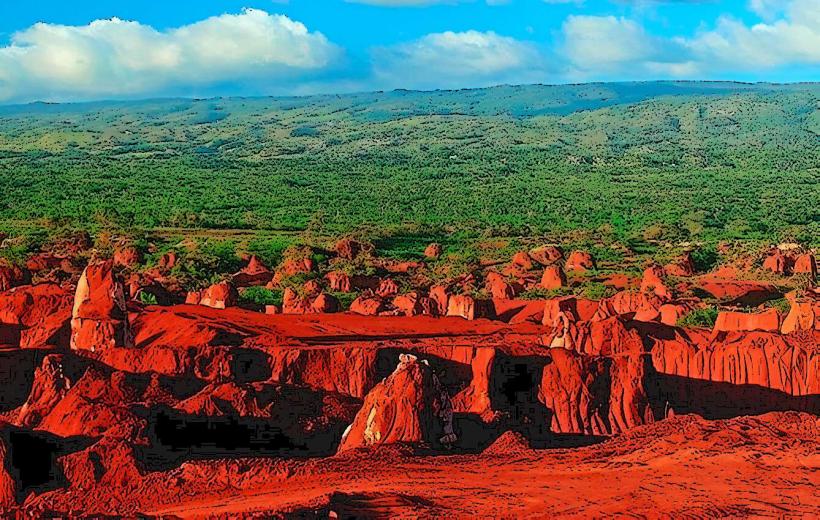
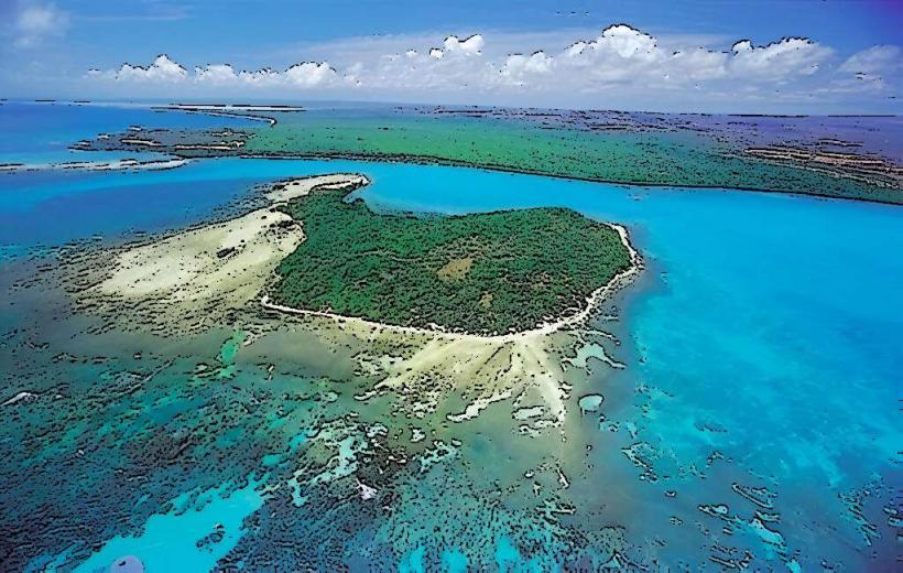
Cabo Rojo Beach is a coastal area characterized by its reddish sand and clear, shallow waters. It is situated on the southwestern coast of the Dominican Republic, approximately 15 kilometers north of the city of Pedernales.
Visual Characteristics
The beach features fine, reddish-orange sand, a result of iron oxide deposits in the local geology. The water is typically calm and transparent, exhibiting shades of turquoise and light blue. The bay is crescent-shaped, bordered by low-lying, arid vegetation and limestone cliffs.
Location & Access Logistics
Cabo Rojo Beach is located approximately 15 kilometers north of Pedernales. Access is primarily via the Carretera Pedernales-Barahona (DR-44), a paved road that runs along the coast. A turn-off, marked for the port and beach, leads directly to the area. Ample unpaved parking is available directly behind the beach area. Public transport options are limited; local taxis or motoconchos from Pedernales are the most common means of access for those without private vehicles.
Historical & Ecological Origin
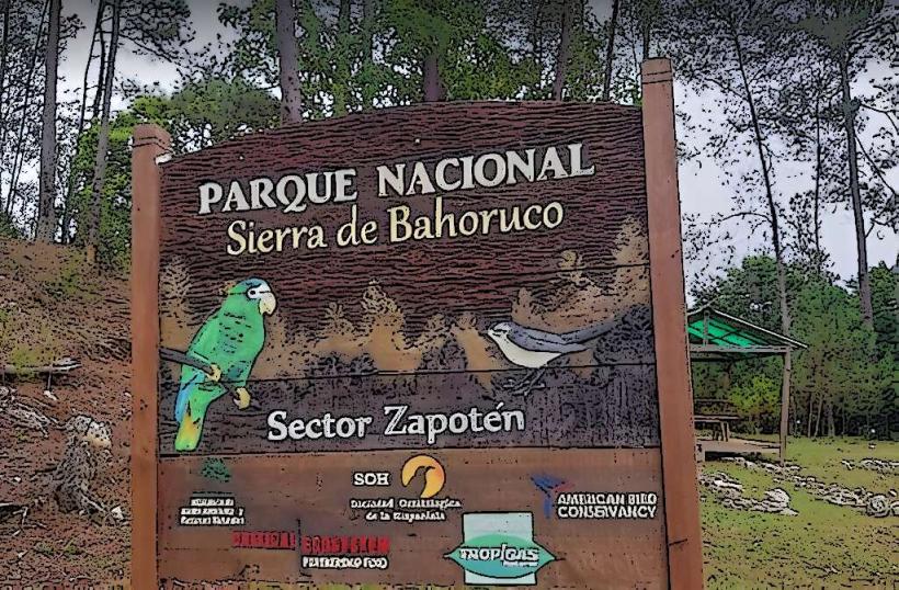
Cabo Rojo's distinctive reddish sand is a result of geological processes involving the erosion of iron-rich sedimentary rocks and lateritic soils from the nearby Sierra de Bahoruco mountain range. The bay itself is a natural formation, providing a sheltered environment. The surrounding ecosystem is characterized as a dry forest, adapted to arid conditions.
Key Highlights & Activities
Primary activities include swimming in the calm, shallow waters and sunbathing on the reddish sand. The clear water is suitable for snorkeling, particularly near the rocky outcrops at either end of the bay. Boat tours to nearby islands, such as Isla Beata and Isla Alto Velo, often depart from the adjacent port.
Infrastructure & Amenities
Basic infrastructure is present due to the nearby port. Restrooms are available near the port facilities, though they may not be directly on the beach. Natural shade is limited, primarily provided by sparse trees at the back of the beach. Cell phone signal (4G) is generally available. Small, informal food vendors occasionally operate, offering local snacks and drinks. There are no formal restaurants directly on the beach.
Best Time to Visit
The best time to visit is during the dry season, from December to April, when rainfall is minimal and temperatures are moderate. Mornings offer calmer conditions and softer light for photography. The beach is accessible at all tides, as the water remains relatively shallow.
Facts & Legends
The name Cabo Rojo translates to "Red Cape," directly referencing the distinctive color of its sand and surrounding cliffs. A local tip suggests exploring the small coves just beyond the main beach for more secluded swimming spots, accessible by walking along the coastline.
Nearby Landmarks
- Pedernales City Center: 15km South
- Parque Nacional Jaragua (entrance): 20km East
- Bahía de las Águilas: 30km East (requires specific off-road access or boat)
- Port of Cabo Rojo: 0.5km North