Information
Landmark: Cerro Verde National ParkCity: Santa Ana
Country: El Salvador
Continent: North America
Cerro Verde National Park, Santa Ana, El Salvador, North America
Cerro Verde National Park is a protected area located in the Santa Ana department of El Salvador. It is situated within the Santa Ana mountain range.
Visual Characteristics
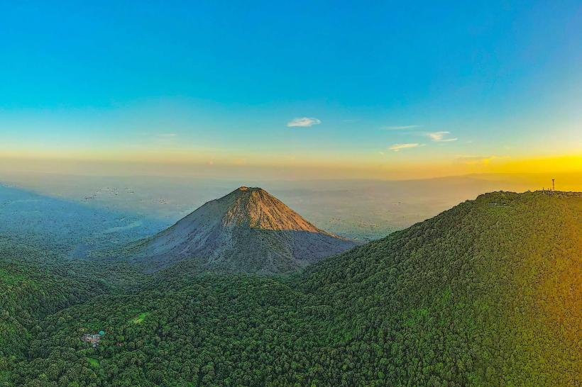
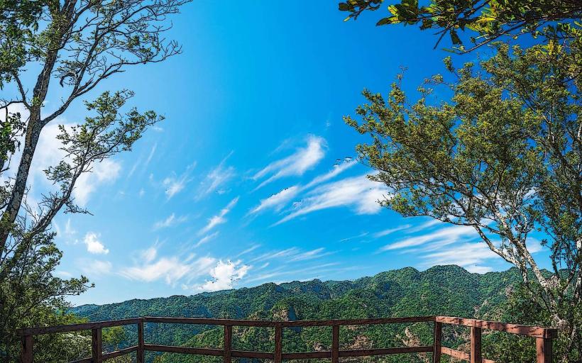
The park features a temperate forest ecosystem characterized by dense vegetation, primarily pine and cypress trees. The terrain is mountainous, with elevations reaching approximately 2,000 meters (6,560 feet) above sea level. Volcanic cones, including Santa Ana Volcano (also known as Ilamatepec) and Cerro Verde itself, are prominent features within the landscape. The climate is generally cool and humid.
Location & Access Logistics
Cerro Verde National Park is located approximately 70 kilometers (43 miles) west of San Salvador. Access is via Carretera de los Planes de Renderos (CA-12) and then branching onto Carretera al Cerro Verde (RN-13). The drive from Santa Ana city center is about 20 kilometers (12 miles). Ample parking is available at designated areas within the park. Public transportation options include local buses that run from Santa Ana to the park entrance; specific bus line numbers may vary.
Historical & Ecological Origin
Cerro Verde National Park was established as a protected area to conserve its unique cloud forest ecosystem and the surrounding volcanic landscape. The park's ecological origin is tied to the volcanic activity of the region, with the dormant Cerro Verde volcano forming a significant part of its topography. The surrounding forests are a result of natural regeneration and conservation efforts over decades.
Key Highlights & Activities
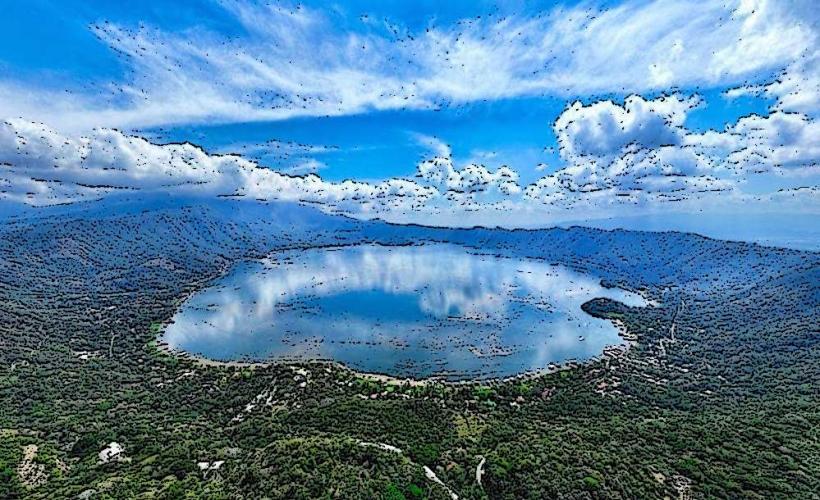
Activities include hiking on marked trails, such as the trail to the summit of Cerro Verde for panoramic views. Observation points offer vistas of the Izalco Volcano and Coatepeque Lake. Birdwatching is a common activity due to the diverse avian population. Picnicking is permitted in designated areas.
Infrastructure & Amenities
Restrooms are available at the main visitor center. Limited shade is provided by the forest canopy. Cell phone signal (4G/5G) is generally available in most areas of the park. Food vendors are typically present near the park entrance and visitor center, offering local snacks and beverages.
Best Time to Visit
The best time of day for photography is generally in the morning when lighting is softer and mist may be present, enhancing the atmospheric quality of the volcanic landscape. The dry season, from November to April, offers more predictable weather. The park is accessible year-round, but rain is more frequent during the wet season (May to October).
Facts & Legends
A local legend suggests that the dormant Cerro Verde volcano is actually a sleeping giant, guarding the surrounding lands. Historically, the area was a significant agricultural region before its designation as a national park.
Nearby Landmarks
- Santa Ana Volcano (Ilamatepec) - 2km Northwest
- Coatepeque Lake - 5km Southwest
- El Tunal National Recreation Area - 4km South
- Los Ausoles Geothermal Area - 6km Southwest