Information
Landmark: Coolangatta BeachCity: Gold Coast
Country: Australia
Continent: Australia
Coolangatta Beach, Gold Coast, Australia, Australia
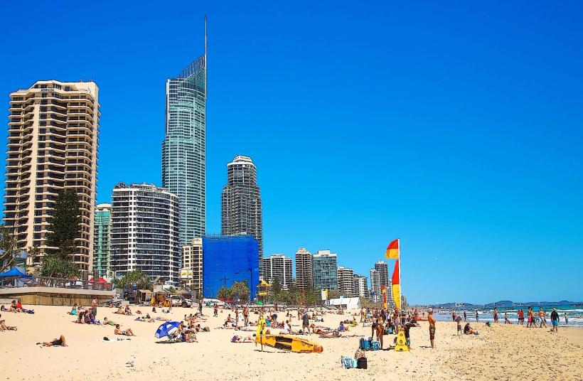
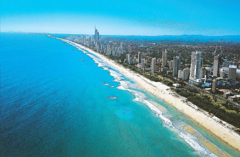
Coolangatta Beach is a coastal stretch located in the suburb of Coolangatta on the Gold Coast, Queensland, Australia.
It is a popular destination for surfing and swimming, situated at the southern end of the Gold Coast.
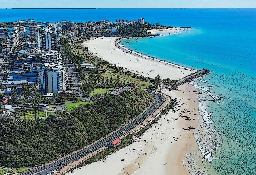
Visual Characteristics
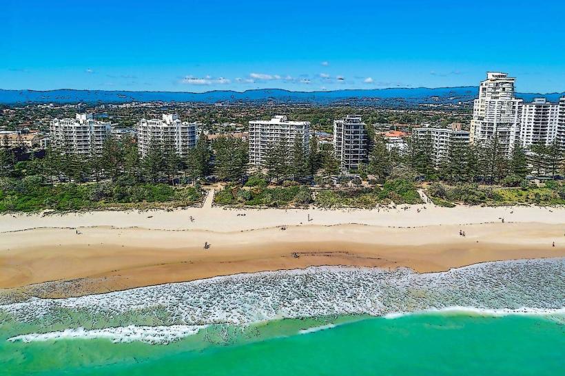
The beach features a crescent-shaped shoreline with fine, pale golden sand. The water color varies from clear turquoise near the shore to deeper blue further out, influenced by ocean currents and sunlight. The coastline is backed by low dunes and vegetation, with a paved promenade running along its length. Surfing breaks are present, particularly at the southern end near the headland.
Location & Access Logistics
Coolangatta Beach is approximately 100 kilometers south of Brisbane and 25 kilometers south of Surfers Paradise. Access is via the Gold Coast Highway (State Route 20). Parking is available in designated street parking areas and a multi-level car park located at the intersection of Marine Parade and Griffith Street. Public transport options include numerous bus routes that service the Gold Coast Highway, with stops directly adjacent to the beach. The nearest major airport is Gold Coast Airport (OOL), located approximately 4 kilometers inland.
Historical & Ecological Origin
The beach is part of the larger coastal system of the Gold Coast, formed by natural sand deposition and erosion processes over millennia. The area's indigenous history is tied to the Yugambeh people. The modern development of Coolangatta as a beachside town began in the early 20th century, with its popularity growing significantly in the latter half of the century due to its surf conditions and accessibility.
Key Highlights & Activities
Surfing is a primary activity, with breaks suitable for various skill levels. Swimming is permitted in designated areas. Walking along the promenade offers views of the coastline. The southern end of the beach, near Point Danger, is known for its consistent waves. Lifeguard services are operational during daylight hours.
Infrastructure & Amenities
Public restrooms and shower facilities are located along the promenade. Shade is provided by natural vegetation and some strategically placed shade structures. Cell phone signal (4G/5G) is generally strong throughout the area. Food vendors and cafes are situated along Marine Parade and Griffith Street, immediately adjacent to the beach.
Best Time to Visit
For photography, early morning light provides soft illumination on the sand and water. Mid-morning to late afternoon offers good visibility for swimming and surfing. The best months for consistent weather and moderate temperatures are typically March to May and September to November. Wave conditions are often favorable during the autumn and winter months (April to August).
Facts & Legends
Coolangatta is named after the SS Kooringal, a ship that ran aground on the nearby reef in 1904. The wreck is now submerged but contributes to the local marine environment. The area is also adjacent to Point Danger, a significant geographical and historical marker.
Nearby Landmarks
- Greenmount Beach (0.3km South)
- Rainbow Bay Beach (0.8km Southwest)
- Point Danger (1.2km South)
- Tweed Heads (1.5km South)
- Kirra Beach (2.0km Northwest)