Information
Landmark: Galovac LakeCity: Plitvice Lakes
Country: Croatia
Continent: Europe
Galovac Lake, Plitvice Lakes, Croatia, Europe
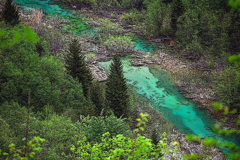
Galovac Lake (Jezero Galovac) is the third-largest lake in Plitvice Lakes National Park and a centerpiece of the Upper Lakes (Gornja jezera) system. It is situated at an elevation of 582 meters.
Visual Characteristics
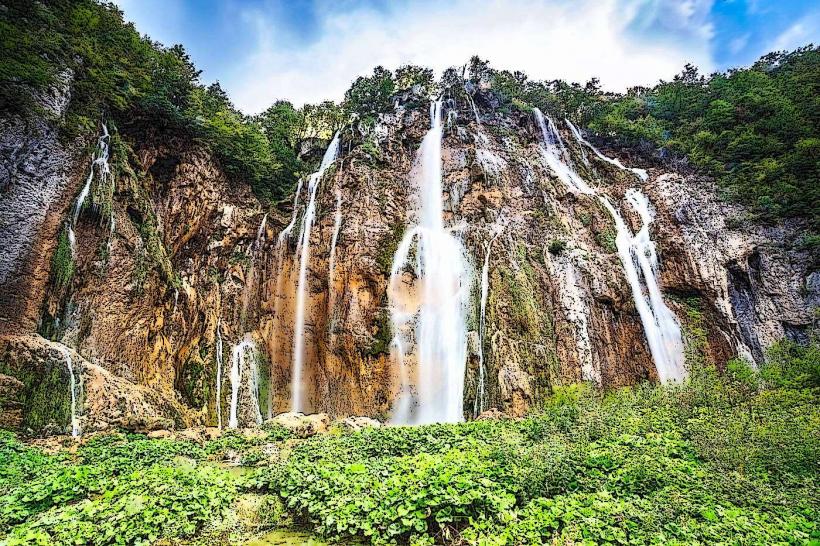
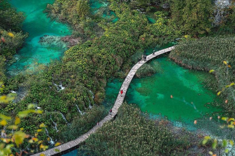
The lake covers an area of approximately 12.5 hectares with a maximum depth of 28 meters. Its northern shore is defined by a massive, 200-meter-wide travertine barrier. The water is deep emerald green, fed by numerous cascades entering from the higher Lake Batinovac and Lake Vir. The most distinctive feature is the "Galovački buk," a 28-meter-high waterfall that plunges from the lake's northern edge toward the Gradinsko Lake basin.
Location & Access Logistics
Galovac is located in the heart of the Upper Lakes.
Access: Primarily via Entrance 2 (South Entrance).
Transit: Visitors typically take the panorama train to Station 3 (ST3) and walk down, or take the boat to P2 and hike upward.
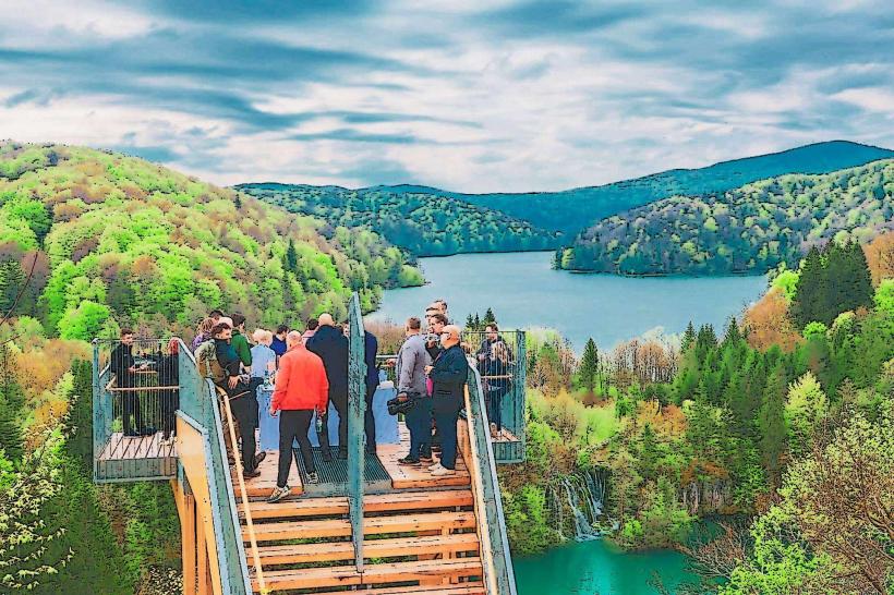
Pathways: It is a central junction for Programs C, H, and K. The lake is circumnavigated by wooden boardwalks on the lower side and forest trails on the elevated ridges.
Historical & Ecological Origin
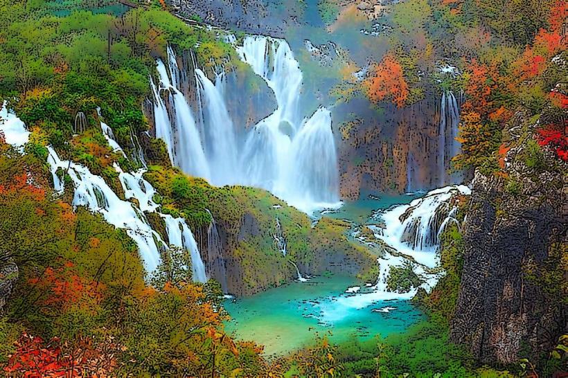
Geologically, Galovac sits on a bed of impermeable dolomite. The lake is notable for the "Prštavci" waterfalls (Veliki and Mali), which are formed by the rapid accumulation of tufa. These barriers are among the most active in the park, constantly changing the shape of the lake's outflow. The lake is named after Captain Gal, who allegedly defeated Ottoman invaders on its shores in the 15th century.
Key Highlights & Activities
Veliki Prštavac Waterfall: One of the park's most aesthetic waterfalls, located on the barrier of Galovac.
Mali Prštavac Waterfall: A smaller, delicate cascade that often creates a mist over the boardwalks.
Galovački Buk: The largest waterfall on the northern rim, visible from the lower trails heading toward Gradinsko Lake.
Walking the Barrier: The boardwalk directly traverses the top of the travertine barriers, allowing visitors to stand inches away from the falling water.
Infrastructure & Amenities
Rest Areas: There are no food or restroom facilities directly at Galovac. The nearest hub is the ST3 train station (uphill) or the P2 boat station (downhill).
Signage: The area is well-marked with educational plaques describing the tufa-forming process.
Connectivity: 4G signal is generally stable, though 5G may be intermittent due to the dense forest canopy.
Best Time to Visit
Early Morning: To experience the mist rising from the multiple cascades before the arrival of the panorama trains.
Spring: When the volume of the "Prštavci" waterfalls is at its peak.
Winter: The northern barrier often transforms into a wall of ice, though boardwalks may be closed if ice accumulation becomes hazardous.
Facts & Legends
According to local folklore, the depth of Galovac hides the remains of a sunken village, though geological surveys confirm it is a natural karst formation. A verified historical fact is that the lake's barrier has grown significantly in height over the last millennium, a process that continues at a rate of approximately 1 to 3 centimeters per year.
Nearby Landmarks
Lake Batinovac – 0.1km South
Lake Gradinsko – 0.2km North
Veliki Prštavac Waterfall – 0.05km North
ST3 Train Station – 0.6km West
Lake Milino – 0.15km Southwest