Information
Landmark: Giant's CausewayCity: Antrim
Country: Ireland
Continent: Europe
Giant's Causeway, Antrim, Ireland, Europe
The Giant's Causeway is a geological area of approximately 40,000 interlocking basalt columns located on the north coast of County Antrim, Northern Ireland. It is a UNESCO World Heritage site situated about 4.8km northeast of the town of Bushmills.
Visual Characteristics
The site is defined by hexagonal, pentagonal, and heptagonal basalt pillars made of dense, dark grey volcanic rock. The columns vary in height, with some reaching 12 meters, forming a stepped pavement that disappears into the Atlantic Ocean. The surrounding cliffs are composed of distinct reddish ochre beds and thick layers of dark basalt, with vegetation consisting of salt-tolerant grasses and sea fescue.
Location & Access Logistics
The site is located on the B147 Causeway Road. It is accessible from Belfast via the M2 and A26 roads (approximately 100km). The Translink Causeway Rambler bus (Service 402) operates seasonally, and the Service 170/221 provides year-round links from Coleraine and Bushmills. A large paid parking facility is managed by the National Trust at the Visitor Centre. A shuttle bus runs from the Visitor Centre down the steep access road to the columns for a fee.
Historical & Ecological Origin
The formation resulted from an intense period of volcanic activity 50 to 60 million years ago during the Paleogene Period. Molten basalt intruded through chalk beds to form a lava plateau; as the lava cooled rapidly, contraction cracked the rock into regular pillars. Ecologically, the site is a National Nature Reserve and home to rare plants such as Frog Orchid and Sea Fescue.
Key Highlights & Activities
Visitors can walk across the "Grand Causeway," the largest of the three rock outcrops. Specific formations include the "Giant’s Boot," the "Wishing Chair," and the "Honeycomb." Hiking trails range from the accessible "Blue Trail" to the "Red Trail" along the cliff tops, which provides aerial views of the formations.
Infrastructure & Amenities
The Visitor Centre contains a cafe, restrooms, and a gift shop. The center provides audio guides in multiple languages. There is no shade or shelter once visitors leave the center and descend to the shoreline. 4G/5G cellular reception is generally strong, though it may drop near the base of the highest cliffs.
Best Time to Visit
The site is open dawn to dusk. Sunset is the optimal time for photography as the low light emphasizes the geometric textures of the columns. To avoid large tour groups, visit before 10:00 or after 16:00. Winter visits offer dramatic wave action but require caution due to slippery wet rocks and high winds.
Facts & Legends
Gaelic mythology attributes the causeway to the giant Finn MacCool, who supposedly built it as a bridge to Scotland to challenge the Scottish giant Benandonner. Geologically, the same basalt formations are visible at Fingal’s Cave on the Scottish island of Staffa, lending a physical basis to the legend of a connecting bridge.
Nearby Landmarks
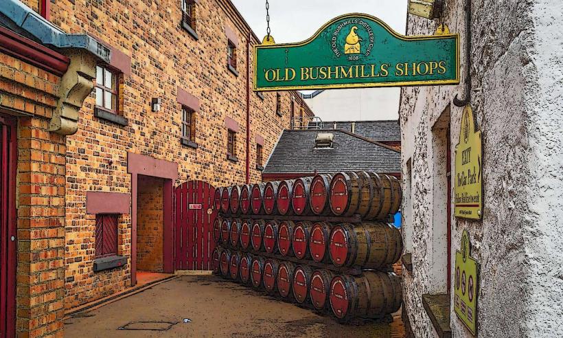
Old Bushmills Distillery – 4.1km Southwest
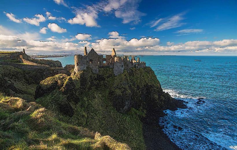
Dunluce Castle – 6.5km West
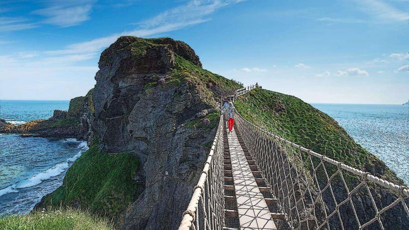
Carrick-a-Rede Rope Bridge – 12km East
Portballintrae Harbour – 3.2km West
Whitepark Bay – 7.5km East