Information
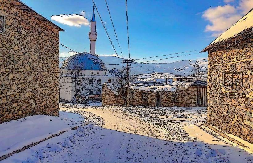
Landmark: Gjallica MountainCity: Kukes
Country: Albania
Continent: Europe
Gjallica Mountain, Kukes, Albania, Europe
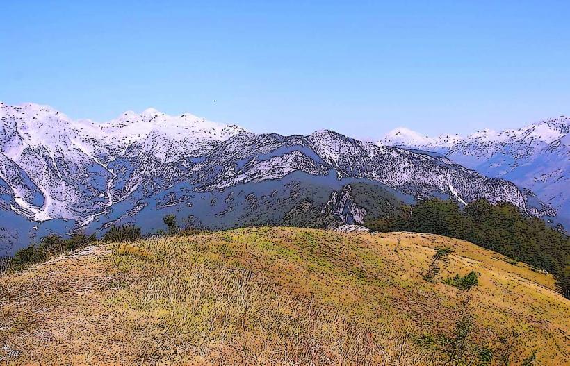
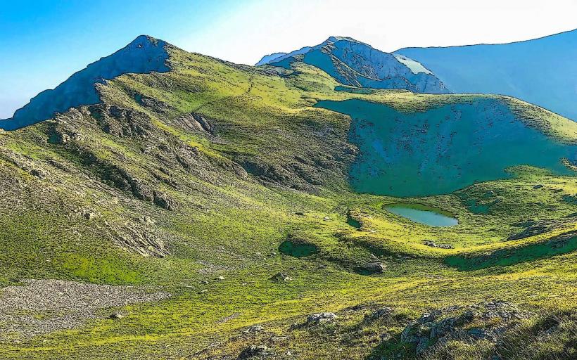
Gjallica Mountain (Mali i Gjallicës) is the highest peak in the Kukës District, reaching an elevation of 2,487 meters. It forms part of the Korab-Koritnik Nature Park and is the most prominent massif in the northeastern Albanian Alps, situated at the confluence of the Black Drin and White Drin rivers.
Visual Characteristics
Gjallica is a massive limestone pyramid with steep, jagged slopes and a sharp, rocky summit. The mountain exhibits distinct altitudinal zonation: the lower slopes are covered in oak and beech forests, transitioning to dense Bosnian pine (Pinus heldreichii) and eventually to alpine meadows and bare karst rock near the peak. Its northern face is particularly sheer, dropping precipitously toward the Drin valley.
Location & Access Logistics
The mountain is located directly east of the city of Kukës. Access is primarily through the village of Brekijë or Shtiqën. To reach the trailheads from Kukës, a 4x4 vehicle is recommended to navigate the unpaved mountain roads. There is no public transport to the higher elevations; hikers typically hire local transport or depart on foot from the lower villages. Informal parking is available in the village centers of Brekijë or Bicaj.
Historical & Ecological Origin
Gjallica is part of the Dinaric Alps, formed by tectonic uplift and composed mainly of Triassic limestone. Historically, it has served as a natural border and a strategic lookout point for the region. Ecologically, it is a high-biodiversity zone, home to the golden eagle, brown bear, and several endemic Balkan plant species that survive in the high-altitude karst environment.
Key Highlights & Activities
Hiking to the summit is the primary activity, typically starting from the village of Brekijë; the ascent takes approximately 4–6 hours. Mountaineering and rock climbing are possible on the more technical northern and eastern faces. During the winter, backcountry skiing is practiced by experienced professionals. The mountain also hosts the "Gjallica Trophy," a local paragliding event, due to its significant thermal currents.
Infrastructure & Amenities
Infrastructure on the mountain is nearly non-existent. There are no marked mountain huts, restrooms, or permanent shelters at high altitudes. Visitors must be self-sufficient for water and food. Cellular signal is generally available (4G) on the western slopes facing Kukës but becomes unreliable on the eastern side and in deep gullies. Natural shade is found only in the forested lower sections.
Best Time to Visit
The optimal window for summiting is from June to September. During these months, the trails are clear of snow and the weather is stable. For photography, the late afternoon provides dramatic lighting on the limestone faces and a clear view of the Fierza Lake below. Winter visits require specialized alpine equipment due to heavy snow accumulation and the risk of avalanches.
Facts & Legends
Local tradition holds that Gjallica is a sacred site, and every August, pilgrims climb to the summit for a ritual known as "The Day of the Mountain." A verified geographical oddity is the mountain's "verticality"; it rises nearly 2,200 meters directly from the lake level, creating one of the highest base-to-peak ratios in the Balkans.
Nearby Landmarks
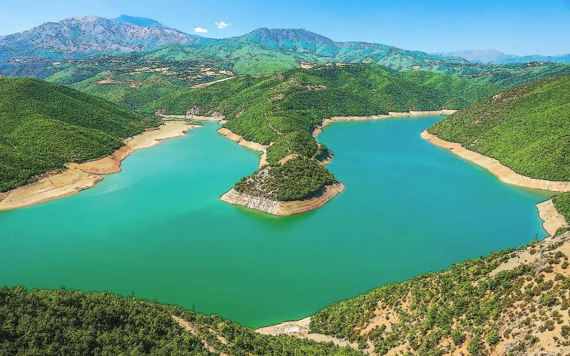
Fierza Lake: 12.0km Northwest
Kukes City Center: 10.0km West
Koritnik Mountain: 15.0km Northeast
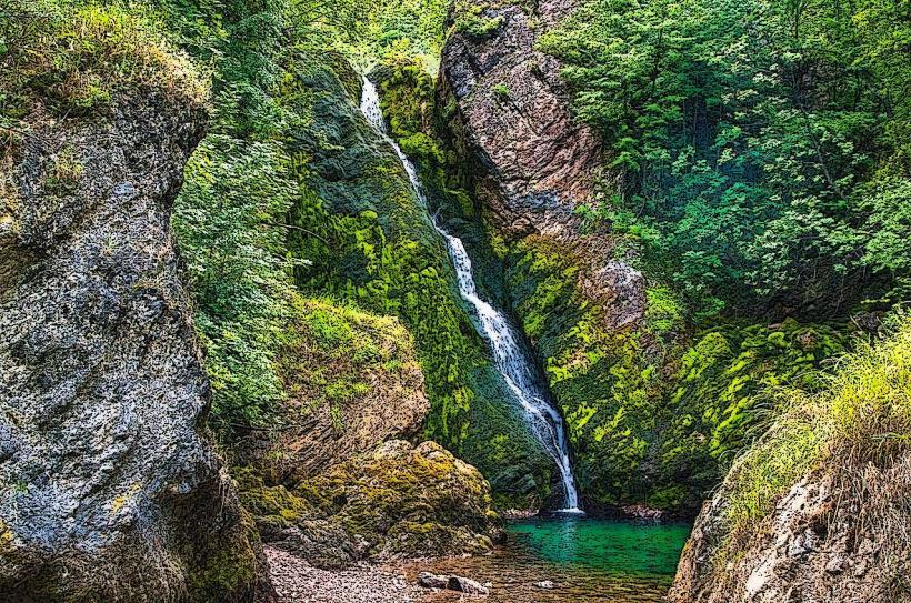
Bicaj Canyon: 6.0km Southwest
Mali i Pashtrikut: 20.0km North