Information
Landmark: Hurricane Creek ParkCity: Tuscaloosa
Country: USA Alabama
Continent: North America
Hurricane Creek Park, Tuscaloosa, USA Alabama, North America
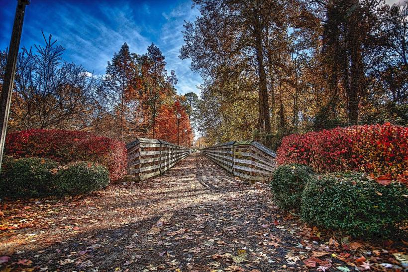
Hurricane Creek Park is a 150-acre public park located in Tuscaloosa, Alabama, USA. It features a network of trails and natural formations along Hurricane Creek.
Visual Characteristics
The park's terrain consists of steep ravines and bluffs formed from sandstone and shale. The creek bed is characterized by exposed rock formations and gravel. Vegetation is dense, primarily composed of deciduous trees such as oak and hickory, with undergrowth of ferns and vines. The creek water color varies from clear to brown depending on recent rainfall.
Location & Access Logistics
Hurricane Creek Park is situated approximately 10 miles north of downtown Tuscaloosa. Access is via Highway 69 North. Turn east onto County Road 24 (also known as Hurricane Creek Road). The park entrance is approximately 1.5 miles from Highway 69. Parking is available at the main trailhead near the park entrance. No public transport services directly reach the park.
Historical & Ecological Origin
The park's geological formations are the result of erosion over millennia, carving out the distinct ravines and bluffs. The area was historically used for timber harvesting before being designated as a public park. Ecologically, it represents a mixed mesophytic forest ecosystem.
Key Highlights & Activities
Hiking is the primary activity, with trails ranging from easy to moderate difficulty. The main trail follows the creek through the ravines. Rock scrambling is possible in designated areas. Birdwatching is also a common activity due to the diverse flora and fauna.
Infrastructure & Amenities
Restrooms are available at the main trailhead. Limited shade is provided by the tree canopy. Cell phone signal is inconsistent within the park, particularly in the deeper ravines. No food vendors are located within the park; visitors should bring their own supplies.
Best Time to Visit
The best time for hiking is during spring (March-May) and fall (September-November) when temperatures are moderate and foliage is at its peak. Early morning or late afternoon offers the best natural light for photography. The park is accessible year-round, but trails can become muddy after heavy rain.
Facts & Legends
Local lore suggests that the deep ravines were once used as hiding places during periods of conflict. A specific point of interest is a large, unusually shaped sandstone formation known locally as "The Sentinel."
Nearby Landmarks
- University of Alabama Arboretum (8.2km South)
- Tuscaloosa Riverwalk (11.5km South)
- Capitol Park (12.1km South)
- Alabama Museum of Natural History (12.5km South)