Information
Landmark: Iron Gates Gorge (Donji Milanovac)City: Belgrade
Country: Serbia
Continent: Europe
Iron Gates Gorge (Donji Milanovac), Belgrade, Serbia, Europe
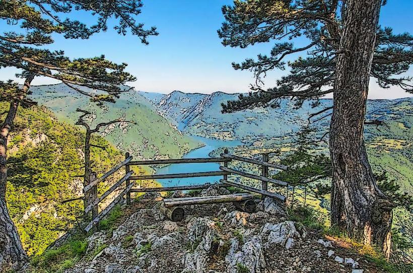
The Iron Gates Gorge is a series of four narrow gorges and three wide basins on the Danube River, forming a natural border between Serbia and Romania. The Serbian town of Donji Milanovac is situated within the wider Milanovac basin of this geological formation.
Visual Characteristics
The gorge features steep limestone and granite cliffs rising directly from the Danube, reaching heights of up to 500 meters. The river itself is deep, with water appearing dark blue-green in color. Vegetation consists primarily of dense deciduous and coniferous forests clinging to the slopes, interspersed with exposed rock faces.
Location & Access Logistics
The Iron Gates Gorge, specifically the area around Donji Milanovac, is located approximately 200 kilometers east of Belgrade. Access from Belgrade is primarily via the E75 highway south to Požarevac, then east on the Đerdap Highway (Route 34) which follows the Danube. The drive typically takes 3 to 3.5 hours. Parking is available in designated areas within Donji Milanovac and at various viewpoints along Route 34. Public transport options include intercity bus lines from Belgrade's main bus station to Donji Milanovac; direct boat transfers are not a primary mode of access from Belgrade but local boat tours operate within the gorge.
Historical & Ecological Origin
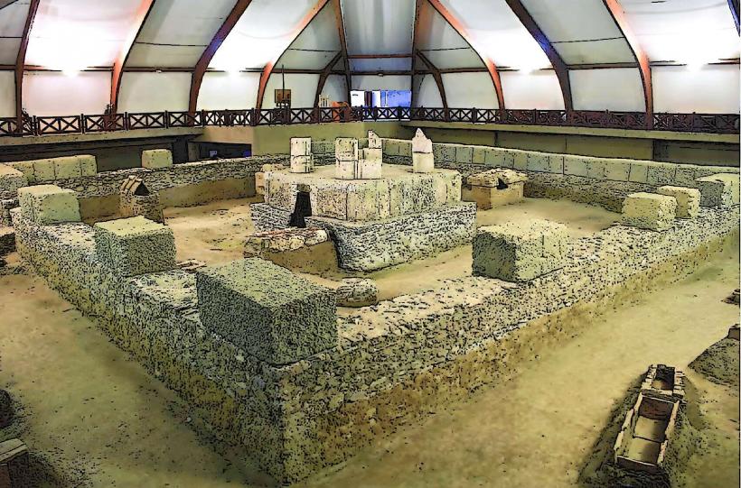
The Iron Gates Gorge is a geological formation resulting from the Danube River's incision through the southern Carpathian Mountains over millions of years. It is classified as a compound antecedent gorge. The area is part of the Đerdap National Park, established in 1974, which protects its unique geomorphology, flora, and fauna. Evidence of human habitation dates back to the Mesolithic period, notably the Lepenski Vir archaeological site.
Key Highlights & Activities
Boat tours are available from Donji Milanovac, offering views of the gorge's narrowest sections and historical markers like Trajan's Tablet. Hiking trails are accessible from various points within Đerdap National Park, including routes near Donji Milanovac that provide elevated perspectives of the Danube. Fishing is permitted with a valid license.
Infrastructure & Amenities
Restrooms are available in Donji Milanovac town and at key visitor centers within Đerdap National Park. Shade is provided by natural tree cover along hiking trails and in designated picnic areas. Cell phone signal (4G/5G) is generally reliable in Donji Milanovac and along the main Đerdap Highway, but can be intermittent in deeper parts of the gorge. Food vendors and restaurants are present in Donji Milanovac.
Best Time to Visit
The best months for visiting are May, June, September, and October, when temperatures are moderate and vegetation is lush. Early morning or late afternoon provides optimal lighting for photography, particularly for capturing the river and cliff faces. There are no specific high/low tide requirements as it is a river system.
Facts & Legends
A notable historical oddity is Trajan's Tablet (Tabula Traiana), a Roman memorial plaque carved into the rock face on the Romanian side of the gorge, commemorating Emperor Trajan's construction of a road and bridge across the Danube in 105 AD. It is best viewed from a boat on the Serbian side.
Nearby Landmarks
- Lepenski Vir Archaeological Site: 15km East
- Veliki Štrbac Peak: 20km West (hiking access point)
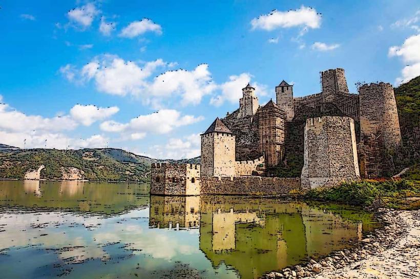
- Golubac Fortress: 70km West
- Mali Kazan Gorge: 30km East (narrowest section of the Iron Gates)