Information
Landmark: Le Morne Brabant MountainCity: Le Morne
Country: Mauritius
Continent: Africa
Le Morne Brabant Mountain, Le Morne, Mauritius, Africa
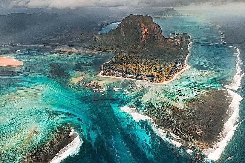
Le Morne Brabant is a basaltic monolith and UNESCO World Heritage site located on a peninsula at the southwestern tip of Mauritius. It stands 556 meters (1,824 feet) above sea level and is the island’s most significant cultural and historical landmark.
Visual Characteristics
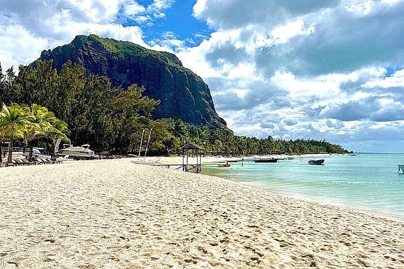
The mountain is defined by its steep, rugged cliffs and flat-topped summit. It is surrounded by a vast turquoise lagoon and white sandy beaches. The vegetation ranges from endemic tropical forests on its lower slopes to sparse, hardy shrubs near the peak. A notable geological phenomenon, the "Underwater Waterfall"-an optical illusion created by sand and silt deposits on the ocean floor-is visible from the air off the mountain's coast.
Location & Access Logistics
The site is located in the Black River district.
Driving: Accessible via the B9 coastal road. There is a designated parking area at the trailhead entrance near the Le Morne Public Beach.
Hiking Access: The trail is approximately 7 km (round trip). The first half is a gentle slope on a wide path, while the second half involves steep, technical scrambling on rocky terrain.
Regulations: Access to the summit section is typically restricted and requires passing through a gated area. Opening hours are generally 07:00 to 14:30.
Historical & Cultural Significance
Le Morne Brabant is a symbol of resistance to slavery. During the 18th and early 19th centuries, the mountain’s isolated and inaccessible cliffs served as a refuge for "maroons"-enslaved people who escaped their captors. It became a "maroon republic" where escapees established settlements. In 2008, it was inscribed as a UNESCO World Heritage site to commemorate the struggle for freedom and the cultural legacy of the African diaspora in Mauritius.
Key Highlights & Activities
Hiking: Reaching the cross at the summit viewpoint offers a 360-degree panorama of the coastline, the lagoon, and the Black River Gorges.
Kiteboarding: The "One Eye" and "Manawa" spots at the base of the mountain are globally renowned for professional kiteboarding and windsurfing.
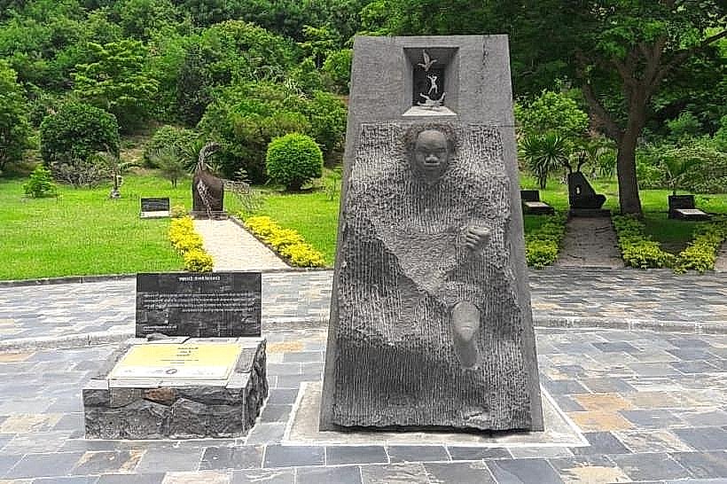
Memorial: The International Slave Route Monument at the foot of the mountain features sculptures and plaques detailing the history of the site.
Infrastructure & Amenities
The mountain itself is a natural site with no infrastructure on the upper slopes.
Visitor Centre: A small office at the trailhead provides information and registers hikers.
Facilities: Restrooms and snack vendors are located at the Le Morne Public Beach, approximately 1 km from the trailhead.
Safety: Sturdy footwear is mandatory for the rocky ascent. Hiring a professional guide is highly recommended for the technical upper sections.
Best Time to Visit
The best time to start the hike is at 07:00 to avoid midday heat and afternoon cloud cover that can obscure the views. The winter months (May to September) offer cooler temperatures and clearer skies. Hiking is prohibited during heavy rain or cyclonic conditions due to the risk of slippery rocks and landslides.
Facts & Legends
The most prominent legend associated with the mountain claims that upon the abolition of slavery in 1835, a police expedition was sent to tell the maroons they were free. Mistaking the authorities for those coming to recapture them, many maroons reportedly jumped to their deaths from the cliffs. While historical records are sparse, the site remains a sacred place of memory.
Nearby Landmarks
Slave Route Monument: 0.5 km South
Le Morne Public Beach: 1.2 km West
Maconde Viewpoint: 6.5 km East
Black River Gorges National Park: 12 km East
Chamarel Seven Coloured Earth: 14 km Northeast